

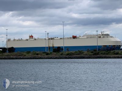
EUPHONY ACE
Vehicles Carrier

Current Trip
ARZAE
| Time Travelled | 7 days |
|---|---|
| Remaining Time | --- |
| Distance Travelled | 2949.41 nm |
| Remaining Distance | --- |
| AVG Speed | 16.6 Noeuds |
| MAX Speed | 20.5 Noeuds |
| AVG Wind | 10.8 knots |
| MAX Wind | 25 knots |
| MIN Temp | 7.2°C / 44.96°F |
| MAX Temp | 32.8°C / 91.04°F |
| Tirant d eau | 8.5 m |
| Position reçue | 13 d depuis |
Current Position
| Longitude | --- |
|---|---|
| Latitude | --- |
| Etat | Under way using engine |
| Vitesse | 16.4 Noeuds |
| Parcours | 215° |
| Zone | South Atlantic Ocean |
| Station | T-AIS |
| Position reçue | 13 d depuis |
Information
The current position of EUPHONY ACE is in South Atlantic Ocean with coordinates -29.74780° / -49.26345° as reported on 2025-03-16 10:44 by AIS to our vessel tracker app. The vessel's current speed is 16.4 Noeuds
The vessel EUPHONY ACE (IMO: 9293595, MMSI: 371618000) is a Vehicles Carrier that was built in 2005 ( 20 Age ). It's sailing under the flag of [PA] Panama.
In this page you can find informations about the vessels current position, last detected port calls, and current voyage information. If the vessels is not in coverage by AIS you will find the latest position.
The current position of EUPHONY ACE is detected by our AIS receivers and we are not responsible for the reliability of the data. The last position was recorded while the vessel was in Coverage by the Ais receivers of our vessel tracking app.
The current draught of EUPHONY ACE as reported by AIS is 8.5 meters
Weather
| Temperature | 16.6°C / 61.88°F |
|---|---|
| Wind Speed | 8 knots |
| Direction | 290° WNW |
| Pressure | 1014.6 hPa |
| Humidity | 79.6 % |
| Cloud Coverage | 58 % |


Featured Company
Last Port Calls
| Port | Arrival | Departure | Time In Port |
|---|---|---|---|
| 2025-03-18 09:47 | 2025-03-21 15:27 | 3 d | |
| 2025-03-14 01:51 | 2025-03-15 08:38 | 1 d | |
| 2025-03-10 08:37 | 2025-03-11 01:37 | 17 h | |
| 2025-02-28 09:09 | 2025-02-28 23:59 | 14 h | |
| 2025-02-18 08:06 | 2025-02-19 01:35 | 17 h | |
| 2025-02-14 02:24 | 2025-02-14 15:05 | 12 h | |
| 2025-02-07 09:58 | 2025-02-08 16:15 | 1 d | |
| 2025-01-01 13:01 |
Last Trips
| Origin | Departure | Destination | Arrival | Distance | |
|---|---|---|---|---|---|
| 2025-03-15 08:38 | 2025-03-18 09:47 | 1051.46 nm | |||
| 2025-03-11 01:37 | 2025-03-14 01:51 | 1313.77 nm | |||
| 2025-02-28 23:59 | 2025-03-10 08:37 | 4170.07 nm | |||
| 2025-02-19 01:35 | 2025-02-28 09:09 | 3218.88 nm | |||
| 2025-02-14 15:05 | 2025-02-18 08:06 | 1252.65 nm | |||
| 2025-02-08 16:15 | 2025-02-14 02:24 | 2008.98 nm | |||
| 2025-01-01 13:01 | 2025-02-07 09:58 | 14419.07 nm |
Events
| Heure | Evenement | Détails | Position/ Destination | Info |
|---|---|---|---|---|
| 2025-03-29 01:18 | Arret | 1.78 nm, West of SAN ANTONIO |
-33.59428 / -71.65453
ARZAE
|
Vitesse: 0.3 kn Parcours: 156° |
| 2025-03-21 18:27 | PORT DE DEPART |
|
-34.08975 / -59.01150
ARZAE
|
Vitesse: 8.3 kn Parcours: 140° |
| 2025-03-21 18:15 | Démarrage |
-34.06985 / -59.02889
[AR] ZARATE
|
Vitesse: 3.6 kn Parcours: 139° |