
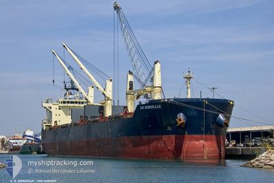
E.R.BORDEAUX
Bulk Carrier
Current Trip
| Time Travelled | 10 days |
|---|---|
| Remaining Time | --- |
| Distance Travelled | 516.79 nm |
| Remaining Distance | --- |
| AVG Speed | 15.3 Noeuds |
| MAX Speed | 15.3 Noeuds |
| AVG Wind | 11.6 knots |
| MAX Wind | 22.9 knots |
| MIN Temp | 18.7°C / 65.66°F |
| MAX Temp | 24.4°C / 75.92°F |
| Tirant d eau | 6.4 m |
| Position reçue | 2 d depuis |
Current Position
| Longitude | 31.73265° |
|---|---|
| Latitude | 31.63162° |
| Etat | At anchor |
| Vitesse | 102.2 Noeuds |
| Parcours | 148.5° |
| Zone | Mediterranean Sea - Eastern Basin |
| Station | T-AIS |
| Position reçue | 2 d depuis |
Info
Information
The current position of E.R.BORDEAUX is in Mediterranean Sea - Eastern Basin with coordinates 31.63162° / 31.73265° as reported on 2024-05-04 03:11 by AIS to our vessel tracker app. The vessel's current speed is 102.2 Noeuds
The vessel E.R.BORDEAUX (IMO: 9483229, MMSI: 636092152) is a Bulk Carrier that was built in 2011 ( 13 Age ). It's sailing under the flag of [LR] Liberia.
In this page you can find informations about the vessels current position, last detected port calls, and current voyage information. If the vessels is not in coverage by AIS you will find the latest position.
The current position of E.R.BORDEAUX is detected by our AIS receivers and we are not responsible for the reliability of the data. The last position was recorded while the vessel was in Coverage by the Ais receivers of our vessel tracking app.
The current draught of E.R.BORDEAUX as reported by AIS is 6.4 meters
Weather
| Temperature | 19.7°C / 67.46°F |
|---|---|
| Wind Speed | 17 knots |
| Direction | 303° WNW |
| Pressure | 1013.5 hPa |
| Humidity | 72 % |
| Cloud Coverage | --- |
Featured Company
Last Port Calls
| Port | Arrival | Departure | Time In Port |
|---|---|---|---|
| 2024-04-21 08:52 | 2024-04-25 22:49 | 4 d | |
| 2024-03-18 01:48 | |||
| 2024-03-07 11:33 | 2024-03-14 04:33 | 6 d |
Last Trips
| Origin | Departure | Destination | Arrival | Distance | |
|---|---|---|---|---|---|
| 2024-03-17 20:48 | 2024-04-21 11:52 | 7264.29 nm | |||
| 2023-12-25 10:55 | 2024-03-07 05:33 | 9833.78 nm |
Events
| Heure | Evenement | Détails | Position/ Destination | Info |
|---|---|---|---|---|
| 2024-05-04 03:48 | Arret | 10.21 nm, North of DAMIETTA |
31.63608 / 31.72912
EG DAM
|
Vitesse: 0.1 kn Parcours: 299° |
| 2024-05-04 03:24 | Etat Changé | Default At anchor |
31.63671 / 31.72875
EG DAM
|
Vitesse: 102.2 kn Parcours: 148.5° |
| 2024-05-04 03:11 | Démarrage | 9.92 nm, North of DAMIETTA |
31.63162 / 31.73265
EG DAM
|
Vitesse: 102.2 kn Parcours: 148.5° |
| 2024-05-04 03:11 | Hors de la zone couverte |
31.63162 / 31.73265
Mediterranean Sea - Eastern Basin
|
Vitesse: 102.2 kn Parcours: 148.5° |
|
| 2024-05-04 02:59 | Etat Changé | At anchor Default |
31.63631 / 31.72932
EG DAM
|
Vitesse: 0.1 kn Parcours: 299° |
| 2024-05-04 02:54 | Arret | 10.21 nm, North of DAMIETTA |
31.63601 / 31.72913
EG DAM
|
Vitesse: 0.1 kn Parcours: 299° |
| 2024-05-04 02:51 | Dans la zone couverte |
31.63611 / 31.72965
Mediterranean Sea - Eastern Basin
|
Vitesse: 28.7 kn Parcours: 146.4° |
|
| 2024-05-03 12:30 | Etat Changé | Default At anchor |
31.63594 / 31.72756
EG DAM
|
Vitesse: 0.4 kn Parcours: 274° |
| 2024-05-03 12:24 | Hors de la zone couverte |
31.63684 / 31.72802
Mediterranean Sea - Eastern Basin
|
Vitesse: 0.4 kn Parcours: 263.3° |
|
| 2024-05-03 12:07 | Etat Changé | At anchor Default |
31.63661 / 31.72800
EG DAM
|
Vitesse: Parcours: -1° |