

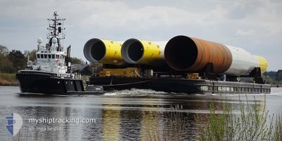
EN AVANT 20
Tug

Current Trip
| Time Travelled | 2 days |
|---|---|
| Remaining Time | --- |
| Distance Travelled | 203.75 nm |
| Remaining Distance | --- |
| AVG Speed | 4.4 Noeuds |
| MAX Speed | 6.2 Noeuds |
| AVG Wind | 12.1 knots |
| MAX Wind | 16.5 knots |
| MIN Temp | 5.1°C / 41.18°F |
| MAX Temp | 8.1°C / 46.58°F |
| Tirant d eau | 5.2 m |
| Position reçue | 1 m depuis |
Current Position
| Longitude | --- |
|---|---|
| Latitude | --- |
| Etat | Restricted manoeuverability |
| Vitesse | 3.6 Noeuds |
| Parcours | 342° |
| Zone | Kattegat |
| Station | T-AIS |
| Position reçue | 1 m depuis |
Information
The current position of EN AVANT 20 is in Kattegat with coordinates 56.99527° / 10.86682° as reported on 2025-03-29 08:03 by AIS to our vessel tracker app. The vessel's current speed is 3.6 Noeuds and is heading at the port of NEWCASTLE. The estimated time of arrival as calculated by MyShipTracking vessel tracking app is 2025-04-02 02:00 LT
The vessel EN AVANT 20 (IMO: 9408645, MMSI: 244790685) is a Tug that was built in 2007 ( 18 Age ). It's sailing under the flag of [NL] Netherlands.
In this page you can find informations about the vessels current position, last detected port calls, and current voyage information. If the vessels is not in coverage by AIS you will find the latest position.
The current position of EN AVANT 20 is detected by our AIS receivers and we are not responsible for the reliability of the data. The last position was recorded while the vessel was in Coverage by the Ais receivers of our vessel tracking app.
The current draught of EN AVANT 20 as reported by AIS is 5.2 meters
Weather
| Temperature | 5.6°C / 42.08°F |
|---|---|
| Wind Speed | 10 knots |
| Direction | 248° WSW |
| Pressure | 1012.8 hPa |
| Humidity | 83.1 % |
| Cloud Coverage | 100 % |


Featured Company
Last Port Calls
Last Trips
| Origin | Departure | Destination | Arrival | Distance | |
|---|---|---|---|---|---|
| 2025-03-25 19:38 | 2025-03-25 21:14 | 16.65 nm | |||
| 2025-03-15 19:41 | 2025-03-20 20:55 | 693.34 nm | |||
| 2025-02-22 08:27 | 2025-03-01 12:25 | 759.91 nm | |||
| 2025-02-14 07:42 | 2025-02-19 15:46 | 698.44 nm | |||
| 2025-01-18 08:48 | 2025-01-23 09:11 | 698.48 nm |
Events
| Heure | Evenement | Détails | Position/ Destination | Info |
|---|---|---|---|---|
| 2025-03-27 18:55 | Changement de zone | Danish part of the Kattegat Danish part of the Baltic Sea |
54.74843 / 10.87916
Kattegat
NEWCASTLE UPON TYNE
|
Vitesse: 5.5 kn Parcours: 357.9° |
| 2025-03-27 17:01 | Changement de zone | Danish part of the Baltic Sea German part of the Baltic Sea |
54.63876 / 11.05547
Baltic Sea
NEWCASTLE UPON TYNE
|
Vitesse: 4.9 kn Parcours: 294.4° |
| 2025-03-27 14:40 | Detecté en mer | German part of the Baltic Sea |
54.54963 / 11.35537
Baltic Sea
NEWCASTLE UPON TYNE
|
Vitesse: 5.2 kn Parcours: 297.2° |
| 2025-03-27 09:58 | Changement de zone | Danish part of the Baltic Sea German part of the Baltic Sea |
54.36686 / 11.93028
Baltic Sea
NEWCASTLE UPON TYNE
|
Vitesse: 5.2 kn Parcours: 305.2° |
| 2025-03-27 07:34 | PORT DE DEPART |
|
54.19010 / 12.08803
NEWCASTLE UPON TYNE
|
Vitesse: 6.5 kn Parcours: 354° |
| 2025-03-27 07:08 | Démarrage |
54.15668 / 12.10772
[DE] ROSTOCK
|
Vitesse: 3.3 kn Parcours: 31° |
|
| 2025-03-27 06:34 | Changement d'ETA | 2025/04/01 15:00 2025/04/20 18:00 |
54.15478 / 12.10688
[DE] ROSTOCK
|
Vitesse: Parcours: 161° |
| 2025-03-27 06:28 | Etat Changé | Restricted manoeuverability Moored |
54.15479 / 12.10688
[DE] ROSTOCK
|
Vitesse: Parcours: 161° |
| 2025-03-27 06:28 | Changement de destination | NEWCASTLE UPON TYNE ROSTOCK |
54.15479 / 12.10688
[DE] ROSTOCK
|
Vitesse: Parcours: 161° |
| 2025-03-27 06:28 | Changement d'ETA | 2025/04/20 18:00 2025/03/20 18:00 |
54.15479 / 12.10688
[DE] ROSTOCK
|
Vitesse: Parcours: 161° |