
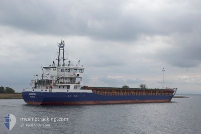
EMSTAL
General Cargo
Current Trip
| Time Travelled | 22 h, 46 mins |
|---|---|
| Remaining Time | --- |
| Distance Travelled | 146.82 nm |
| Remaining Distance | --- |
| AVG Speed | 9.9 Noeuds |
| MAX Speed | 10.7 Noeuds |
| AVG Wind | 6.2 knots |
| MAX Wind | 10 knots |
| MIN Temp | 13.8°C / 56.84°F |
| MAX Temp | 20.9°C / 69.62°F |
| Tirant d eau | 3.9 m |
| Position reçue | 17 m depuis |
Current Position
| Longitude | --- |
|---|---|
| Latitude | --- |
| Etat | At anchor |
| Vitesse | 0.2 Noeuds |
| Parcours | 10° |
| Zone | North Atlantic Ocean |
| Station | T-AIS |
| Position reçue | 17 m depuis |
Info
Information
The current position of EMSTAL is in North Atlantic Ocean with coordinates 32.29722° / -9.28971° as reported on 2024-12-24 18:42 by AIS to our vessel tracker app. The vessel's current speed is 0.2 Noeuds
The vessel EMSTAL (IMO: 9356878, MMSI: 255806438) is a General Cargo that was built in 2007 ( 17 Age ). It's sailing under the flag of [PT] Portugal.
In this page you can find informations about the vessels current position, last detected port calls, and current voyage information. If the vessels is not in coverage by AIS you will find the latest position.
The current position of EMSTAL is detected by our AIS receivers and we are not responsible for the reliability of the data. The last position was recorded while the vessel was in Coverage by the Ais receivers of our vessel tracking app.
The current draught of EMSTAL as reported by AIS is 3.9 meters
Weather
| Temperature | 18.7°C / 65.66°F |
|---|---|
| Wind Speed | 10 knots |
| Direction | 34° NE |
| Pressure | 1020.4 hPa |
| Humidity | 54.7 % |
| Cloud Coverage | 36 % |
Featured Company
Last Port Calls
| Port | Arrival | Departure | Time In Port |
|---|---|---|---|
| 2024-12-22 08:04 | 2024-12-23 20:14 | 1 d | |
| 2024-12-20 06:24 | 2024-12-20 20:22 | 13 h | |
| 2024-12-07 00:02 | 2024-12-10 15:06 | 3 d | |
| 2024-12-01 18:36 | 2024-12-05 19:56 | 4 d | |
| 2024-11-18 07:54 | 2024-11-20 00:07 | 1 d | |
| 2024-11-14 17:28 | 2024-11-15 18:24 | 1 d | |
| 2024-11-02 01:48 | 2024-11-05 13:30 | 3 d | |
| 2024-10-29 13:04 | 2024-11-01 11:06 | 2 d | |
| 2024-10-23 05:04 | 2024-10-23 16:32 | 11 h | |
| 2024-10-21 10:08 | 2024-10-22 01:03 | 14 h |
Last Trips
| Origin | Departure | Destination | Arrival | Distance | |
|---|---|---|---|---|---|
| 2024-12-20 20:22 | 2024-12-22 09:04 | 346.64 nm | |||
| 2024-12-10 16:06 | 2024-12-20 06:24 | 1470.39 nm | |||
| 2024-12-05 19:56 | 2024-12-07 01:02 | 261.96 nm | |||
| 2024-11-20 01:07 | 2024-12-01 18:36 | 2012.93 nm | |||
| 2024-11-15 19:24 | 2024-11-18 08:54 | 104.31 nm | |||
| 2024-11-05 14:30 | 2024-11-14 18:28 | 1845.65 nm | |||
| 2024-11-01 11:06 | 2024-11-02 02:48 | 133.64 nm | |||
| 2024-10-23 18:32 | 2024-10-29 13:04 | 738.94 nm | |||
| 2024-10-22 02:03 | 2024-10-23 07:04 | 208.01 nm | |||
| 2024-10-20 02:25 | 2024-10-21 11:08 | 256.82 nm |
Events
| Heure | Evenement | Détails | Position/ Destination | Info |
|---|---|---|---|---|
| 2024-12-24 18:57 | Etat Changé | Default At anchor |
32.29722 / -9.28988
MASFI
|
Vitesse: 0.2 kn Parcours: 10° |
| 2024-12-24 18:36 | Etat Changé | At anchor Default |
32.29717 / -9.28982
MASFI
|
Vitesse: 0.3 kn Parcours: 16° |
| 2024-12-24 18:36 | Dans la zone couverte |
32.29717 / -9.28982
North Atlantic Ocean
|
Vitesse: 0.2 kn Parcours: 206.1° |
|
| 2024-12-24 17:27 | Etat Changé | Default At anchor |
32.29716 / -9.28917
MASFI
|
Vitesse: 0.3 kn Parcours: 0° |
| 2024-12-24 17:24 | Hors de la zone couverte |
32.29710 / -9.28929
North Atlantic Ocean
|
Vitesse: 0.3 kn Parcours: 197° |
|
| 2024-12-24 17:18 | Etat Changé | At anchor Default |
32.29724 / -9.28885
MASFI
|
Vitesse: 0.3 kn Parcours: 2° |
| 2024-12-24 17:06 | Dans la zone couverte |
32.29724 / -9.28885
North Atlantic Ocean
|
Vitesse: 0.3 kn Parcours: 218.9° |
|
| 2024-12-24 02:56 | Tirant d'eau modifié | 3.9 3.5 |
33.43038 / -8.64239
MASFI
|
Vitesse: 10.7 kn Parcours: 215° |
| 2024-12-24 01:04 | Etat Changé | Default Under way using engine |
33.58758 / -8.37353
MASFI
|
Vitesse: 10.6 kn Parcours: 243.9° |
| 2024-12-24 00:59 | Hors de la zone couverte |
33.59471 / -8.35663
North Atlantic Ocean
MASFI
|
Vitesse: 10.6 kn Parcours: 243.9° |