

EMPEDOCLE
Motor Hopper

Current Trip
DINARD
| Time Travelled | 5 days |
|---|---|
| Remaining Time | --- |
| Distance Travelled | 228.64 nm |
| Remaining Distance | --- |
| AVG Speed | 6.6 Noeuds |
| MAX Speed | 8.8 Noeuds |
| AVG Wind | 8 knots |
| MAX Wind | 17.7 knots |
| MIN Temp | 8.1°C / 46.58°F |
| MAX Temp | 13.6°C / 56.48°F |
| Tirant d eau | 1.6 m |
| Position reçue | 1 m depuis |
Current Position
| Longitude | --- |
|---|---|
| Latitude | --- |
| Etat | Moored |
| Vitesse | |
| Parcours | 223° |
| Zone | English Channel |
| Station | T-AIS |
| Position reçue | 1 m depuis |
Information
The current position of EMPEDOCLE is in English Channel with coordinates 48.63196° / -2.04986° as reported on 2025-03-27 12:38 by AIS to our vessel tracker app. The vessel's current speed is 0 Noeuds
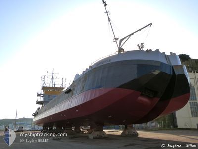
The vessel EMPEDOCLE (IMO: 8741351, MMSI: 227056460) is a Motor Hopper that was built in 1977 ( 48 Age ). It's sailing under the flag of [FR] France.
In this page you can find informations about the vessels current position, last detected port calls, and current voyage information. If the vessels is not in coverage by AIS you will find the latest position.
The current position of EMPEDOCLE is detected by our AIS receivers and we are not responsible for the reliability of the data. The last position was recorded while the vessel was in Coverage by the Ais receivers of our vessel tracking app.
The current draught of EMPEDOCLE as reported by AIS is 1.6 meters
Weather
| Temperature | 9.3°C / 48.74°F |
|---|---|
| Wind Speed | 5 knots |
| Direction | 353° N |
| Pressure | 1022 hPa |
| Humidity | 80.8 % |
| Cloud Coverage | 1 % |


Featured Company
Last Port Calls
| Port | Arrival | Departure | Time In Port |
|---|---|---|---|
| 2025-03-16 22:55 | 2025-03-21 14:11 | 4 d | |
| 2025-03-16 18:08 | 2025-03-16 19:51 | 1 h | |
| 2025-02-28 04:16 | 2025-02-28 10:51 | 6 h | |
| 2025-01-31 12:57 | 2025-01-31 15:22 | 2 h | |
| 2025-01-10 15:38 |
Most Visited Ports (Last year)
| Port | Arrivals | |
|---|---|---|
| 19 | ||
| 15 | ||
| 5 |
Last Trips
| Origin | Departure | Destination | Arrival | Distance | |
|---|---|---|---|---|---|
| 2025-03-16 19:51 | 2025-03-16 22:55 | 18.73 nm | |||
| 2025-02-28 10:51 | 2025-03-16 18:08 | 671.45 nm | |||
| 2025-01-31 15:22 | 2025-02-28 04:16 | 729.22 nm | |||
| 2025-01-10 15:38 | 2025-01-31 12:57 | 631.84 nm |
Events
| Heure | Evenement | Détails | Position/ Destination | Info |
|---|---|---|---|---|
| 2025-03-27 07:14 | Arret | 1.05 nm, South West of SAINT MALO |
48.63131 / -2.05023
DINARD
|
Vitesse: 0.1 kn Parcours: 213° |
| 2025-03-27 03:40 | Démarrage | 0.75 nm, South West of SAINT MALO |
48.63495 / -2.04491
DINARD
|
Vitesse: 3.1 kn Parcours: 54° |
| 2025-03-26 18:05 | Arret | 1.04 nm, South West of SAINT MALO |
48.63129 / -2.05000
DINARD
|
Vitesse: 0.3 kn Parcours: 211° |
| 2025-03-26 15:12 | Démarrage | 0.72 nm, North West of SAINT MALO |
48.64694 / -2.04558
DINARD
|
Vitesse: 3.5 kn Parcours: 328° |
| 2025-03-26 12:53 | Arret | 0.7 nm, West of SAINT MALO |
48.64506 / -2.04605
DINARD
|
Vitesse: 0.3 kn Parcours: 20° |
| 2025-03-26 12:40 | Démarrage | 0.95 nm, South West of SAINT MALO |
48.63311 / -2.04909
DINARD
|
Vitesse: 3.1 kn Parcours: 40° |
| 2025-03-26 06:01 | Arret | 1.04 nm, South West of SAINT MALO |
48.63110 / -2.04971
DINARD
|
Vitesse: 0.3 kn Parcours: 210° |
| 2025-03-26 03:04 | Démarrage | 0.89 nm, South West of SAINT MALO |
48.63378 / -2.04799
DINARD
|
Vitesse: 5.1 kn Parcours: 57.5° |
| 2025-03-25 17:13 | Arret | 0.99 nm, South West of SAINT MALO |
48.63198 / -2.04905
DINARD
|
Vitesse: 0.3 kn Parcours: 207° |
| 2025-03-25 14:07 | Démarrage | 0.93 nm, South West of SAINT MALO |
48.63349 / -2.04871
DINARD
|
Vitesse: 5 kn Parcours: 44.4° |