
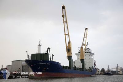
EMMA
General Cargo
Current Trip
| Trip Time | 30 days |
|---|---|
| Trip Distance | 7176.65 nm |
| AVG Speed | 11.2 Noeuds |
| MAX Speed | 15.4 Noeuds |
| Tirant d eau | 6 m |
| AVG Wind | 12.9 knots |
| MAX Wind | 38.3 knots |
| MIN Temp | 11°C / 51.8°F |
| MAX Temp | 28.6°C / 83.48°F |
| Position reçue | 4 d depuis |
Current Position
| Longitude | --- |
|---|---|
| Latitude | --- |
| Etat | Under way using engine |
| Vitesse | 10.2 Noeuds |
| Parcours | 32.2° |
| Zone | Indian Ocean |
| Station | T-AIS |
| Position reçue | 4 d depuis |
Information
The current position of EMMA is in Indian Ocean with coordinates -29.62439° / 31.71880° as reported on 2025-03-18 09:48 by AIS to our vessel tracker app. The vessel's current speed is 10.2 Noeuds and is currently inside the port of RICHARDS BAY.
The vessel EMMA (IMO: 9474371, MMSI: 305514000) is a General Cargo that was built in 2009 ( 16 Age ). It's sailing under the flag of [AG] Antigua Barbuda.
In this page you can find informations about the vessels current position, last detected port calls, and current voyage information. If the vessels is not in coverage by AIS you will find the latest position.
The current position of EMMA is detected by our AIS receivers and we are not responsible for the reliability of the data. The last position was recorded while the vessel was in Coverage by the Ais receivers of our vessel tracking app.
The current draught of EMMA as reported by AIS is 6 meters
Weather
| Temperature | 22.2°C / 71.96°F |
|---|---|
| Wind Speed | 6 knots |
| Direction | 15° NNE |
| Pressure | 1013 hPa |
| Humidity | 89.8 % |
| Cloud Coverage | 2 % |
Featured Company
Last Port Calls
| Port | Arrival | Departure | Time In Port |
|---|---|---|---|
| 2025-03-22 07:09 | |||
| 2025-02-15 10:48 | 2025-02-19 18:19 | 4 d | |
| 2025-02-09 14:09 | 2025-02-11 17:58 | 2 d | |
| 2025-02-02 23:59 | 2025-02-04 08:21 | 1 d | |
| 2025-01-28 21:00 | 2025-01-31 14:14 | 2 d | |
| 2025-01-26 17:38 |
Most Visited Ports (Last year)
| Port | Arrivals | |
|---|---|---|
| 5 | ||
| 2 | ||
| 2 | ||
| 2 | ||
| 2 | ||
| 1 |
Last Trips
| Origin | Departure | Destination | Arrival | Distance | |
|---|---|---|---|---|---|
| 2025-02-19 19:19 | 2025-03-22 09:09 | 7176.65 nm | |||
| 2025-02-11 18:58 | 2025-02-15 11:48 | 1062.12 nm | |||
| 2025-02-04 09:21 | 2025-02-09 15:09 | 163.83 nm | |||
| 2025-01-31 15:14 | 2025-02-03 00:59 | 553.83 nm | |||
| 2025-01-26 18:38 | 2025-01-28 22:00 | 602.41 nm |
Events
| Heure | Evenement | Détails | Position/ Destination | Info |
|---|---|---|---|---|
| 2025-03-22 07:45 | Arret |
-28.79062 / 32.05249
[ZA] RICHARDS BAY
|
Vitesse: 0.3 kn Parcours: 26° |
|
| 2025-03-22 07:09 | Port d'arrivée |
|
-28.81118 / 32.09587
[ZA] RICHARDS BAY
|
Vitesse: 9.9 kn Parcours: 307° |
| 2025-03-22 06:25 | Démarrage | 9.07 nm, South East of RICHARDS BAY |
-28.89762 / 32.18702
ZA RCB
|
Vitesse: 7.5 kn Parcours: 322° |
| 2025-03-18 15:07 | Arret | 9.23 nm, South East of RICHARDS BAY |
-28.90067 / 32.18802
ZA RCB
|
Vitesse: 0.3 kn Parcours: 40° |
| 2025-03-18 09:53 | Etat Changé | Default Under way using engine |
-29.61282 / 31.72769
ZA RCB
|
Vitesse: 10.2 kn Parcours: 32.2° |
| 2025-03-18 09:48 | Hors de la zone couverte |
-29.62439 / 31.71880
Indian Ocean
ZA RCB
|
Vitesse: 10.2 kn Parcours: 32.2° |
|
| 2025-03-18 05:10 | Changement de destination | ZA RCB NA WVB |
-30.30885 / 31.20817
ZA RCB
|
Vitesse: 10.5 kn Parcours: 32.1° |
| 2025-03-18 05:10 | Changement d'ETA | 2025/03/18 16:00 2025/03/10 08:00 |
-30.30885 / 31.20817
ZA RCB
|
Vitesse: 10.5 kn Parcours: 32.1° |
| 2025-03-18 04:56 | Detecté en mer | South African part of the Indian Ocean |
-30.34275 / 31.18300
Indian Ocean
|
Vitesse: 10.4 kn Parcours: 33.5° |
| 2025-03-18 04:56 | Etat Changé | Under way using engine Default |
-30.34275 / 31.18300
NA WVB
|
Vitesse: 10.4 kn Parcours: 32° |