
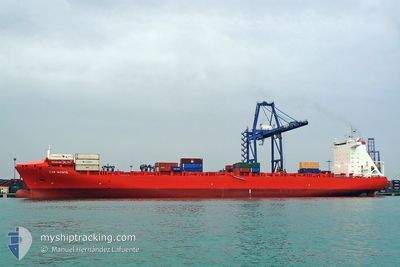
EM KEA
Container Ship
Current Trip
| Time Travelled | 4 days |
|---|---|
| Remaining Time | --- |
| Distance Travelled | 734.26 nm |
| Remaining Distance | --- |
| AVG Speed | 12.8 Noeuds |
| MAX Speed | 14.1 Noeuds |
| AVG Wind | 19.6 knots |
| MAX Wind | 30 knots |
| MIN Temp | -13.1°C / 8.42°F |
| MAX Temp | 3.7°C / 38.66°F |
| Tirant d eau | 9.4 m |
| Position reçue | 3 d depuis |
Current Position
| Longitude | --- |
|---|---|
| Latitude | --- |
| Etat | Under way using engine |
| Vitesse | 13.9 Noeuds |
| Parcours | 70.2° |
| Zone | North Atlantic Ocean |
| Station | T-AIS |
| Position reçue | 3 d depuis |
Info
Information
The current position of EM KEA is in North Atlantic Ocean with coordinates 44.43836° / -63.05667° as reported on 2025-01-02 23:11 by AIS to our vessel tracker app. The vessel's current speed is 13.9 Noeuds
The vessel EM KEA (IMO: 9334351, MMSI: 636015646) is a Container Ship that was built in 2007 ( 18 Age ). It's sailing under the flag of [LR] Liberia.
In this page you can find informations about the vessels current position, last detected port calls, and current voyage information. If the vessels is not in coverage by AIS you will find the latest position.
The current position of EM KEA is detected by our AIS receivers and we are not responsible for the reliability of the data. The last position was recorded while the vessel was in Coverage by the Ais receivers of our vessel tracking app.
The current draught of EM KEA as reported by AIS is 9.4 meters
Weather
| Temperature | -7.3°C / 18.86°F |
|---|---|
| Wind Speed | 11 knots |
| Direction | 269° W |
| Pressure | 1002 hPa |
| Humidity | 79.2 % |
| Cloud Coverage | 100 % |
Featured Company
Last Port Calls
| Port | Arrival | Departure | Time In Port |
|---|---|---|---|
| 2025-01-02 12:14 | 2025-01-02 20:59 | 8 h | |
| 2024-12-21 14:34 | 2024-12-22 09:45 | 19 h | |
| 2024-12-19 01:04 | 2024-12-20 07:46 | 1 d | |
| 2024-12-17 07:33 | 2024-12-18 04:55 | 21 h | |
| 2024-12-08 10:22 | 2024-12-09 12:03 | 1 d | |
| 2024-12-01 07:27 | 2024-12-04 08:48 | 3 d | |
| 2024-11-14 23:31 | 2024-11-15 13:20 | 13 h | |
| 2024-11-13 02:46 | 2024-11-13 21:14 | 18 h | |
| 2024-11-10 14:56 | 2024-11-11 20:44 | 1 d |
Most Visited Ports (Last year)
| Port | Arrivals | |
|---|---|---|
| 12 | ||
| 11 | ||
| 11 | ||
| 11 | ||
| 11 | ||
| 1 |
Last Trips
| Origin | Departure | Destination | Arrival | Distance | |
|---|---|---|---|---|---|
| 2024-12-22 10:45 | 2025-01-02 08:14 | 2875.84 nm | |||
| 2024-12-20 08:46 | 2024-12-21 15:34 | 138.41 nm | |||
| 2024-12-18 05:55 | 2024-12-19 02:04 | 262.63 nm | |||
| 2024-12-09 08:03 | 2024-12-17 08:33 | 2907.27 nm | |||
| 2024-12-04 03:48 | 2024-12-08 06:22 | 1008.14 nm | |||
| 2024-11-15 14:20 | 2024-12-01 02:27 | 3332.94 nm | |||
| 2024-11-13 22:14 | 2024-11-15 00:31 | 134.79 nm | |||
| 2024-11-11 21:44 | 2024-11-13 03:46 | 264.26 nm | |||
| 2024-10-30 23:24 | 2024-11-10 15:56 | 2999.57 nm |
Events
| Heure | Evenement | Détails | Position/ Destination | Info |
|---|---|---|---|---|
| 2025-01-05 06:30 | Arret | 9.14 nm, North East of TROIS-PISTOLES |
48.27374 / -69.09045
CAMTR
|
Vitesse: 0.1 kn Parcours: 263° |
| 2025-01-02 23:15 | Etat Changé | Default Under way using engine |
44.44420 / -63.03667
CAMTR
|
Vitesse: 13.9 kn Parcours: 70.2° |
| 2025-01-02 23:11 | Hors de la zone couverte |
44.43836 / -63.05667
North Atlantic Ocean
CAMTR
|
Vitesse: 13.9 kn Parcours: 70.2° |
|
| 2025-01-02 23:05 | Etat Changé | Under way using engine Default |
44.42858 / -63.09079
CAMTR
|
Vitesse: 13.9 kn Parcours: 74° |
| 2025-01-02 23:02 | Etat Changé | Default Under way using engine |
44.42520 / -63.10276
CAMTR
|
Vitesse: 13.2 kn Parcours: 66.5° |
| 2025-01-02 22:56 | Etat Changé | Under way using engine Default |
44.41745 / -63.13482
CAMTR
|
Vitesse: 13.7 kn Parcours: 73° |
| 2025-01-02 22:53 | Etat Changé | Default Under way using engine |
44.41396 / -63.15049
CAMTR
|
Vitesse: 13.3 kn Parcours: 70.2° |
| 2025-01-02 21:09 | Etat Changé | Under way using engine Moored |
44.56956 / -63.53191
CAMTR
|
Vitesse: 13.3 kn Parcours: 175.4° |
| 2025-01-02 20:59 | PORT DE DEPART |
|
44.60424 / -63.54105
CAMTR
|
Vitesse: 13.3 kn Parcours: 159° |
| 2025-01-02 20:51 | Démarrage |
44.62541 / -63.55656
[CA] HALIFAX
|
Vitesse: 5.2 kn Parcours: 135° |