

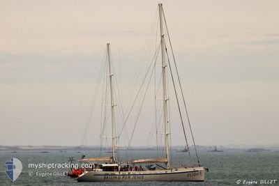
ELIDA V
Sailing Vessel

Current Trip
| Time Travelled | 1 day |
|---|---|
| Remaining Time | --- |
| Distance Travelled | 228.84 nm |
| Remaining Distance | --- |
| AVG Speed | 6.3 Noeuds |
| MAX Speed | 7.8 Noeuds |
| AVG Wind | 8 knots |
| MAX Wind | 11 knots |
| MIN Temp | 9.5°C / 49.1°F |
| MAX Temp | 14.1°C / 57.38°F |
| Tirant d eau | 4 m |
| Position reçue | 5 h, 37 m depuis |
Current Position
| Longitude | --- |
|---|---|
| Latitude | --- |
| Etat | Under way sailing |
| Vitesse | 7.1 Noeuds |
| Parcours | 332° |
| Zone | North Atlantic Ocean |
| Station | T-AIS |
| Position reçue | 5 h, 37 m depuis |
Information
The current position of ELIDA V is in North Atlantic Ocean with coordinates 42.35163° / -8.98770° as reported on 2025-03-27 07:29 by AIS to our vessel tracker app. The vessel's current speed is 7.1 Noeuds and is heading at the port of GOTEBORG. The estimated time of arrival as calculated by MyShipTracking vessel tracking app is 2025-04-04 18:00 LT
The vessel ELIDA V (IMO: 9443190, MMSI: 266263000) is a Sailing Vessel that was built in 2006 ( 19 Age ). It's sailing under the flag of [SE] Sweden.
In this page you can find informations about the vessels current position, last detected port calls, and current voyage information. If the vessels is not in coverage by AIS you will find the latest position.
The current position of ELIDA V is detected by our AIS receivers and we are not responsible for the reliability of the data. The last position was recorded while the vessel was in Coverage by the Ais receivers of our vessel tracking app.
The current draught of ELIDA V as reported by AIS is 4 meters
Weather
| Temperature | 11.4°C / 52.52°F |
|---|---|
| Wind Speed | 4 knots |
| Direction | 91° E |
| Pressure | 1018.4 hPa |
| Humidity | 78.4 % |
| Cloud Coverage | 100 % |
Featured Company
Last Port Calls
| Port | Arrival | Departure | Time In Port |
|---|---|---|---|
| 2025-03-24 18:52 | 2025-03-25 21:12 | 1 d | |
| 2025-03-23 16:44 | 2025-03-24 10:24 | 17 h | |
| 2025-03-17 22:21 | 2025-03-23 13:09 | 5 d | |
| 2025-01-19 17:23 | 2025-02-10 18:23 | 22 d | |
| 2025-01-08 22:21 | 2025-01-09 15:05 | 16 h | |
| 2025-01-06 19:24 | 2025-01-08 16:00 | 1 d | |
| 2025-01-05 19:54 | 2025-01-06 19:24 | 23 h | |
| 2025-01-04 08:44 | 2025-01-04 08:54 | 10 m | |
| 2025-01-04 08:35 |
Last Trips
| Origin | Departure | Destination | Arrival | Distance | |
|---|---|---|---|---|---|
| 2025-03-24 10:24 | 2025-03-24 18:52 | 45.77 nm | |||
| 2025-03-23 13:09 | 2025-03-23 16:44 | 8.25 nm | |||
| 2025-02-10 18:23 | 2025-03-17 22:21 | 962.61 nm | |||
| 2025-01-09 15:05 | 2025-01-19 17:23 | 101.60 nm | |||
| 2025-01-08 16:00 | 2025-01-08 22:21 | 19.51 nm | |||
| 2025-01-04 08:54 | 2025-01-06 19:24 | 123.80 nm | |||
| 2025-01-04 08:54 | 2025-01-05 19:54 | 107.60 nm | |||
| 2025-01-04 08:35 | 2025-01-04 08:44 | 1.00 nm |
Events
| Heure | Evenement | Détails | Position/ Destination | Info |
|---|---|---|---|---|
| 2025-03-27 07:29 | Hors de la zone couverte |
42.35163 / -8.98770
North Atlantic Ocean
GOTEBORG
|
Vitesse: 7.1 kn Parcours: 332° |
|
| 2025-03-27 06:00 | Detecté en mer | Spanish part of the North Atlantic Ocean |
42.18320 / -8.95735
North Atlantic Ocean
GOTEBORG
|
Vitesse: 7 kn Parcours: 342.7° |
| 2025-03-27 06:00 | Dans la zone couverte |
42.18320 / -8.95735
North Atlantic Ocean
GOTEBORG
|
Vitesse: 7 kn Parcours: 342.7° |
|
| 2025-03-26 23:58 | Hors de la zone couverte |
41.47354 / -8.89754
North Atlantic Ocean
GOTEBORG
|
Vitesse: 7.2 kn Parcours: 348.2° |
|
| 2025-03-26 15:12 | Dans la zone couverte |
40.46359 / -9.01331
North Atlantic Ocean
GOTEBORG
|
Vitesse: 7.2 kn Parcours: 15.1° |
|
| 2025-03-26 13:14 | Hors de la zone couverte |
40.25133 / -9.08814
North Atlantic Ocean
GOTEBORG
|
Vitesse: 6.1 kn Parcours: 354.9° |
|
| 2025-03-26 10:47 | Dans la zone couverte |
40.01194 / -9.18371
North Atlantic Ocean
GOTEBORG
|
Vitesse: 5.9 kn Parcours: 19.1° |
|
| 2025-03-26 08:58 | Hors de la zone couverte |
39.83006 / -9.25869
North Atlantic Ocean
GOTEBORG
|
Vitesse: 6.6 kn Parcours: 12.7° |
|
| 2025-03-26 08:58 | Dans la zone couverte |
39.83006 / -9.25869
North Atlantic Ocean
GOTEBORG
|
Vitesse: 6.6 kn Parcours: 12.7° |
|
| 2025-03-26 07:37 | Hors de la zone couverte |
39.68760 / -9.31769
North Atlantic Ocean
GOTEBORG
|
Vitesse: 6.5 kn Parcours: 5° |