
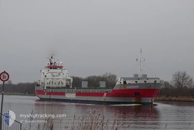
ELBEBORG
General Cargo
Current Trip
| Time Travelled | 29 days |
|---|---|
| Remaining Time | --- |
| Distance Travelled | 5066.85 nm |
| Remaining Distance | --- |
| AVG Speed | 9.4 Noeuds |
| MAX Speed | 16 Noeuds |
| AVG Wind | 13.2 knots |
| MAX Wind | 31 knots |
| MIN Temp | 10.3°C / 50.54°F |
| MAX Temp | 31.8°C / 89.24°F |
| Tirant d eau | 7 m |
| Position reçue | 9 d depuis |
Current Position
| Longitude | -79.78667° |
|---|---|
| Latitude | 26.42461° |
| Etat | Under way using engine |
| Vitesse | 11.9 Noeuds |
| Parcours | 4.5° |
| Zone | North Atlantic Ocean |
| Station | T-AIS |
| Position reçue | 9 d depuis |
Info
Information
The current position of ELBEBORG is in North Atlantic Ocean with coordinates 26.42461° / -79.78667° as reported on 2024-05-29 02:06 by AIS to our vessel tracker app. The vessel's current speed is 11.9 Noeuds and is heading at the port of MOSJOEN. The estimated time of arrival as calculated by MyShipTracking vessel tracking app is 2024-06-17 12:00 LT
The vessel ELBEBORG (IMO: 9568249, MMSI: 245297000) is a General Cargo that was built in 2011 ( 13 Age ). It's sailing under the flag of [NL] Netherlands.
In this page you can find informations about the vessels current position, last detected port calls, and current voyage information. If the vessels is not in coverage by AIS you will find the latest position.
The current position of ELBEBORG is detected by our AIS receivers and we are not responsible for the reliability of the data. The last position was recorded while the vessel was in Coverage by the Ais receivers of our vessel tracking app.
The current draught of ELBEBORG as reported by AIS is 7 meters
Weather
| Temperature | 13.4°C / 56.12°F |
|---|---|
| Wind Speed | 14 knots |
| Direction | 141° SE |
| Pressure | 1019.3 hPa |
| Humidity | 97 % |
| Cloud Coverage | 92 % |
Featured Company
Last Port Calls
| Port | Arrival | Departure | Time In Port |
|---|---|---|---|
| 2024-05-07 02:34 | 2024-05-08 14:15 | 1 d | |
| 2024-05-03 01:39 | 2024-05-04 09:55 | 1 d | |
| 2024-04-03 18:01 |
Most Visited Ports (Last year)
| Port | Arrivals | |
|---|---|---|
| 4 | ||
| 3 | ||
| 3 | ||
| 3 | ||
| 2 | ||
| 2 |
Last Trips
| Origin | Departure | Destination | Arrival | Distance | |
|---|---|---|---|---|---|
| 2024-05-04 05:55 | 2024-05-06 22:34 | 649.86 nm | |||
| 2024-03-28 17:23 | 2024-05-02 21:39 | 4379.27 nm | |||
| 2024-03-28 17:23 | 2024-04-03 20:01 | 770.44 nm |
Events
| Heure | Evenement | Détails | Position/ Destination | Info |
|---|---|---|---|---|
| 2024-05-29 02:19 | Etat Changé | Default Under way using engine |
26.46745 / -79.78230
NO MJF
|
Vitesse: 11.9 kn Parcours: 4.5° |
| 2024-05-29 02:06 | Hors de la zone couverte |
26.42461 / -79.78667
North Atlantic Ocean
NO MJF
|
Vitesse: 11.9 kn Parcours: 4.5° |
|
| 2024-05-28 19:57 | Etat Changé | Under way using engine Default |
25.16860 / -80.04823
NO MJF
|
Vitesse: 13 kn Parcours: 29° |
| 2024-05-28 19:44 | Etat Changé | Default Under way using engine |
25.12500 / -80.07333
NO MJF
|
Vitesse: 13.3 kn Parcours: 30.1° |
| 2024-05-28 19:40 | Etat Changé | Under way using engine Default |
25.11340 / -80.08331
NO MJF
|
Vitesse: 13 kn Parcours: 30° |
| 2024-05-28 18:50 | Etat Changé | Default Under way using engine |
24.95500 / -80.18833
NO MJF
|
Vitesse: 13 kn Parcours: 31.5° |
| 2024-05-28 17:43 | Etat Changé | Under way using engine Default |
24.74852 / -80.32858
NO MJF
|
Vitesse: 12 kn Parcours: 30° |
| 2024-05-28 17:38 | Etat Changé | Default Under way using engine |
24.73333 / -80.33667
NO MJF
|
Vitesse: 12.6 kn Parcours: 32.8° |
| 2024-05-28 16:45 | Etat Changé | Under way using engine Default |
24.58343 / -80.46611
NO MJF
|
Vitesse: 12 kn Parcours: 42° |
| 2024-05-28 16:41 | Etat Changé | Default Under way using engine |
24.57333 / -80.47500
NO MJF
|
Vitesse: 12.7 kn Parcours: 42.2° |