
EGY SKY
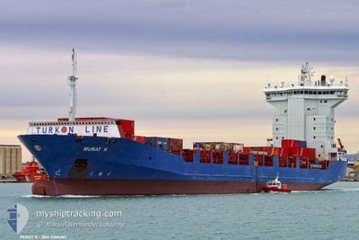
Container Ship
Current Trip
| Time Travelled | 11 h, 36 mins |
|---|---|
| Remaining Time | 1 day |
| Distance Travelled | 140.59 nm |
| Remaining Distance | 429.10 nm |
| AVG Speed | 12.2 Noeuds |
| MAX Speed | 12.4 Noeuds |
| AVG Wind | 2.5 knots |
| MAX Wind | 4.3 knots |
| MIN Temp | 20.1°C / 68.18°F |
| MAX Temp | 22°C / 71.6°F |
| Tirant d eau | 5.8 m |
| Position reçue | Maintenant |
Current Position
| Longitude | 29.85729° |
|---|---|
| Latitude | 33.14991° |
| Etat | Under way using engine |
| Vitesse | 12.3 Noeuds |
| Parcours | 310.6° |
| Zone | Mediterranean Sea - Eastern Basin |
| Station | T-AIS |
| Position reçue | Maintenant |
Info
Information
The current position of EGY SKY is in Mediterranean Sea - Eastern Basin with coordinates 33.14991° / 29.85729° as reported on 2024-05-16 14:03 by AIS to our vessel tracker app. The vessel's current speed is 12.3 Noeuds and is heading at the port of PIRAEUS. The estimated time of arrival as calculated by MyShipTracking vessel tracking app is 2024-05-18 00:47 LT
The vessel EGY SKY (IMO: 9366483, MMSI: 622113177) is a Container Ship that was built in 2007 ( 17 Age ). It's sailing under the flag of [EG] Egypt.
In this page you can find informations about the vessels current position, last detected port calls, and current voyage information. If the vessels is not in coverage by AIS you will find the latest position.
The current position of EGY SKY is detected by our AIS receivers and we are not responsible for the reliability of the data. The last position was recorded while the vessel was in Coverage by the Ais receivers of our vessel tracking app.
The current draught of EGY SKY as reported by AIS is 5.8 meters
Weather
| Temperature | 21.8°C / 71.24°F |
|---|---|
| Wind Speed | 4 knots |
| Direction | 185° S |
| Pressure | 1018.8 hPa |
| Humidity | 64 % |
| Cloud Coverage | --- |
Featured Company
Last Port Calls
| Port | Arrival | Departure | Time In Port |
|---|---|---|---|
| 2024-05-15 10:29 | 2024-05-16 02:28 | 15 h | |
| 2024-05-13 06:54 | 2024-05-13 08:44 | 1 h | |
| 2024-05-13 01:29 | 2024-05-13 06:42 | 5 h | |
| 2024-05-12 22:52 | 2024-05-13 00:07 | 1 h | |
| 2024-05-12 20:03 | 2024-05-12 22:24 | 2 h | |
| 2024-05-12 12:52 | 2024-05-12 18:42 | 5 h | |
| 2024-05-11 05:18 | 2024-05-11 16:16 | 10 h | |
| 2024-05-06 13:30 | 2024-05-07 21:03 | 1 d | |
| 2024-05-03 03:40 | 2024-05-05 01:44 | 1 d | |
| 2024-05-02 03:20 | 2024-05-02 13:10 | 9 h |
Last Trips
| Origin | Departure | Destination | Arrival | Distance | |
|---|---|---|---|---|---|
| 2024-05-13 11:44 | 2024-05-15 12:29 | 366.24 nm | |||
| 2024-05-13 09:42 | 2024-05-13 09:54 | 1.93 nm | |||
| 2024-05-13 03:07 | 2024-05-13 04:29 | 3.37 nm | |||
| 2024-05-13 01:24 | 2024-05-13 01:52 | 12.09 nm | |||
| 2024-05-12 21:42 | 2024-05-12 23:03 | 10.82 nm | |||
| 2024-05-11 19:16 | 2024-05-12 15:52 | 135.37 nm | |||
| 2024-05-07 23:03 | 2024-05-11 08:18 | 1085.54 nm | |||
| 2024-05-05 04:44 | 2024-05-06 15:30 | 361.94 nm | |||
| 2024-05-02 16:10 | 2024-05-03 06:40 | 86.88 nm | |||
| 2024-05-01 12:34 | 2024-05-02 06:20 | 207.44 nm |
Events
| Heure | Evenement | Détails | Position/ Destination | Info |
|---|---|---|---|---|
| 2024-05-16 13:29 | Etat Changé | Under way using engine Default |
33.07270 / 29.96459
GRPIR
|
Vitesse: 12.3 kn Parcours: 310° |
| 2024-05-16 13:17 | Dans la zone couverte |
33.07270 / 29.96459
Mediterranean Sea - Eastern Basin
GRPIR
|
Vitesse: 12.4 kn Parcours: 310.2° |
|
| 2024-05-16 11:27 | Etat Changé | Default Under way using engine |
32.79565 / 30.34125
GRPIR
|
Vitesse: 12.2 kn Parcours: 311.5° |
| 2024-05-16 11:19 | Hors de la zone couverte |
32.77852 / 30.36396
Mediterranean Sea - Eastern Basin
GRPIR
|
Vitesse: 12.2 kn Parcours: 311.5° |
|
| 2024-05-16 11:03 | Etat Changé | Under way using engine Default |
32.74153 / 30.41341
GRPIR
|
Vitesse: 12.3 kn Parcours: 312° |
| 2024-05-16 11:03 | Dans la zone couverte |
32.74153 / 30.41341
Mediterranean Sea - Eastern Basin
GRPIR
|
Vitesse: 12.3 kn Parcours: 311.1° |
|
| 2024-05-16 07:56 | Etat Changé | Default Under way using engine |
32.32299 / 30.97553
GRPIR
|
Vitesse: 12.1 kn Parcours: 313° |
| 2024-05-16 07:50 | Hors de la zone couverte |
32.30902 / 30.99311
Mediterranean Sea - Eastern Basin
GRPIR
|
Vitesse: 12.1 kn Parcours: 313° |
|
| 2024-05-16 06:14 | Tirant d'eau modifié | 5.8 7.6 |
32.08939 / 31.28148
GRPIR
|
Vitesse: 12.1 kn Parcours: 311.6° |
| 2024-05-16 06:14 | Changement de destination | GRPIR EGDAM |
32.08939 / 31.28148
GRPIR
|
Vitesse: 12.1 kn Parcours: 311.6° |