
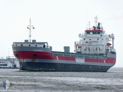
EDENBORG
General Cargo
Current Trip
| Trip Time | 11 days |
|---|---|
| Trip Distance | 2465.49 nm |
| AVG Speed | 9.8 Noeuds |
| MAX Speed | 14.1 Noeuds |
| Tirant d eau | 7.9 m |
| AVG Wind | 11.6 knots |
| MAX Wind | 28 knots |
| MIN Temp | -1.7°C / 28.94°F |
| MAX Temp | 14.7°C / 58.46°F |
| Position reçue | 4 d depuis |
Current Position
| Longitude | --- |
|---|---|
| Latitude | --- |
| Etat | Under way using engine |
| Vitesse | 11.6 Noeuds |
| Parcours | 12.8° |
| Zone | Gulf of Bothnia |
| Station | T-AIS |
| Position reçue | 4 d depuis |
Information
The current position of EDENBORG is in Gulf of Bothnia with coordinates 61.56115° / 19.53375° as reported on 2025-03-23 20:17 by AIS to our vessel tracker app. The vessel's current speed is 11.6 Noeuds and is currently inside the port of RONNSKAR.
The vessel EDENBORG (IMO: 9463449, MMSI: 246716000) is a General Cargo that was built in 2010 ( 15 Age ). It's sailing under the flag of [NL] Netherlands.
In this page you can find informations about the vessels current position, last detected port calls, and current voyage information. If the vessels is not in coverage by AIS you will find the latest position.
The current position of EDENBORG is detected by our AIS receivers and we are not responsible for the reliability of the data. The last position was recorded while the vessel was in Coverage by the Ais receivers of our vessel tracking app.
The current draught of EDENBORG as reported by AIS is 7.9 meters
Weather
| Temperature | 3.1°C / 37.58°F |
|---|---|
| Wind Speed | 10 knots |
| Direction | 235° SW |
| Pressure | 998.3 hPa |
| Humidity | 83.8 % |
| Cloud Coverage | 98 % |
Featured Company
Last Port Calls
| Port | Arrival | Departure | Time In Port |
|---|---|---|---|
| 2025-03-26 17:42 | |||
| 2025-03-13 12:39 | 2025-03-14 18:40 | 1 d | |
| 2025-03-07 07:23 | 2025-03-12 13:30 | 5 d | |
| 2025-02-23 12:59 | 2025-02-28 08:14 | 4 d | |
| 2025-02-06 07:22 | 2025-02-06 12:04 | 4 h | |
| 2025-01-30 14:55 | 2025-02-01 16:32 | 2 d | |
| 2025-01-25 05:30 | 2025-01-25 21:11 | 15 h | |
| 2025-01-18 07:28 | 2025-01-21 16:37 | 3 d | |
| 2025-01-14 19:14 | 2025-01-15 18:09 | 22 h | |
| 2025-01-08 05:38 | 2025-01-09 11:29 | 1 d |
Most Visited Ports (Last year)
| Port | Arrivals | |
|---|---|---|
| 2 | ||
| 2 | ||
| 2 | ||
| 2 | ||
| 1 | ||
| 1 |
Last Trips
| Origin | Departure | Destination | Arrival | Distance | |
|---|---|---|---|---|---|
| 2025-03-14 19:40 | 2025-03-26 18:42 | 2465.49 nm | |||
| 2025-03-12 13:30 | 2025-03-13 13:39 | 258.93 nm | |||
| 2025-02-28 09:14 | 2025-03-07 07:23 | 1827.95 nm | |||
| 2025-02-06 13:04 | 2025-02-23 13:59 | 2696.04 nm | |||
| 2025-02-01 17:32 | 2025-02-06 08:22 | 1074.87 nm | |||
| 2025-01-26 00:11 | 2025-01-30 15:55 | 1092.67 nm | |||
| 2025-01-21 19:37 | 2025-01-25 08:30 | 564.44 nm | |||
| 2025-01-15 21:09 | 2025-01-18 10:28 | 632.86 nm | |||
| 2025-01-09 13:29 | 2025-01-14 22:14 | 441.41 nm | |||
| 2024-12-16 13:17 | 2025-01-08 07:38 | 5010.05 nm |
Events
| Heure | Evenement | Détails | Position/ Destination | Info |
|---|---|---|---|---|
| 2025-03-26 17:54 | Arret |
64.67052 / 21.27775
[SE] RONNSKAR
|
Vitesse: 0.1 kn Parcours: 298° |
|
| 2025-03-26 17:42 | Port d'arrivée |
|
64.66882 / 21.28751
[SE] RONNSKAR
|
Vitesse: 5.6 kn Parcours: 305° |
| 2025-03-26 16:42 | Démarrage | 7.53 nm, East of RONNSKAR |
64.65957 / 21.54579
RONNSKAR
|
Vitesse: 3.5 kn Parcours: 183° |
| 2025-03-24 14:06 | Arret | 7.69 nm, East of RONNSKAR |
64.66183 / 21.55299
RONNSKAR
|
Vitesse: 0.3 kn Parcours: 219° |
| 2025-03-23 20:18 | Etat Changé | Default Under way using engine |
61.56278 / 19.53453
RONNSKAR
|
Vitesse: 11.6 kn Parcours: 12.8° |
| 2025-03-23 20:17 | Etat Changé | Under way using engine Default |
61.56115 / 19.53375
RONNSKAR
|
Vitesse: 11.6 kn Parcours: 12° |
| 2025-03-23 20:17 | Hors de la zone couverte |
61.56115 / 19.53375
Gulf of Bothnia
RONNSKAR
|
Vitesse: 11.6 kn Parcours: 12.8° |
|
| 2025-03-23 20:17 | Detecté en mer | Finnish part of the Gulf of Bothnia |
61.56115 / 19.53375
Gulf of Bothnia
RONNSKAR
|
Vitesse: 11.6 kn Parcours: 12.8° |
| 2025-03-23 20:06 | Dans la zone couverte |
61.56115 / 19.53375
Gulf of Bothnia
RONNSKAR
|
Vitesse: 11.6 kn Parcours: 12.8° |
|
| 2025-03-23 17:19 | Hors de la zone couverte |
60.99543 / 19.27775
Gulf of Bothnia
RONNSKAR
|
Vitesse: 11.6 kn Parcours: 13.1° |