
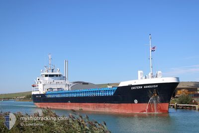
EASTERN VANQUISH
General Cargo
Current Trip
| Time Travelled | 4 days |
|---|---|
| Remaining Time | --- |
| Distance Travelled | 963.74 nm |
| Remaining Distance | --- |
| AVG Speed | 9.7 Noeuds |
| MAX Speed | 11.9 Noeuds |
| AVG Wind | 10.7 knots |
| MAX Wind | 24.9 knots |
| MIN Temp | 14.6°C / 58.28°F |
| MAX Temp | 20.2°C / 68.36°F |
| Tirant d eau | 5.6 m |
| Position reçue | 1 m depuis |
Current Position
| Longitude | 12.83568° |
|---|---|
| Latitude | 36.86214° |
| Etat | Under way using engine |
| Vitesse | 9.6 Noeuds |
| Parcours | 288° |
| Zone | Mediterranean Sea - Eastern Basin |
| Station | T-AIS |
| Position reçue | 1 m depuis |
Info
Information
The current position of EASTERN VANQUISH is in Mediterranean Sea - Eastern Basin with coordinates 36.86214° / 12.83568° as reported on 2024-04-27 16:24 by AIS to our vessel tracker app. The vessel's current speed is 9.6 Noeuds and is heading at the port of FLIXBOROUGH. The estimated time of arrival as calculated by MyShipTracking vessel tracking app is 2024-05-07 12:00 LT
The vessel EASTERN VANQUISH (IMO: 9411836, MMSI: 235113663) is a General Cargo that was built in 2012 ( 12 Age ). It's sailing under the flag of [GB] United Kingdom.
In this page you can find informations about the vessels current position, last detected port calls, and current voyage information. If the vessels is not in coverage by AIS you will find the latest position.
The current position of EASTERN VANQUISH is detected by our AIS receivers and we are not responsible for the reliability of the data. The last position was recorded while the vessel was in Coverage by the Ais receivers of our vessel tracking app.
The current draught of EASTERN VANQUISH as reported by AIS is 5.6 meters
Weather
| Temperature | 16.5°C / 61.7°F |
|---|---|
| Wind Speed | 17 knots |
| Direction | 119° ESE |
| Pressure | 1013.9 hPa |
| Humidity | 80.1 % |
| Cloud Coverage | 3 % |
Featured Company
Last Port Calls
| Port | Arrival | Departure | Time In Port |
|---|---|---|---|
| 2024-04-19 05:18 | 2024-04-23 12:21 | 4 d | |
| 2024-04-13 05:14 | 2024-04-16 11:16 | 3 d | |
| 2024-04-09 10:58 | 2024-04-10 17:36 | 1 d | |
| 2024-04-03 08:11 | 2024-04-05 11:21 | 2 d | |
| 2024-03-28 10:29 | 2024-03-29 21:20 | 1 d | |
| 2024-03-25 14:36 | 2024-03-27 21:03 | 2 d | |
| 2024-03-07 17:39 | 2024-03-11 20:48 | 4 d | |
| 2024-03-05 11:39 | 2024-03-06 15:43 | 1 d | |
| 2024-02-28 02:46 | 2024-02-28 23:47 | 21 h | |
| 2024-02-16 10:26 | 2024-02-19 18:14 | 3 d |
Most Visited Ports (Last year)
| Port | Arrivals | |
|---|---|---|
| 7 | ||
| 3 | ||
| 3 | ||
| 3 | ||
| 3 | ||
| 3 |
Last Trips
| Origin | Departure | Destination | Arrival | Distance | |
|---|---|---|---|---|---|
| 2024-04-16 14:16 | 2024-04-19 08:18 | 399.99 nm | |||
| 2024-04-10 19:36 | 2024-04-13 08:14 | 542.99 nm | |||
| 2024-04-05 13:21 | 2024-04-09 12:58 | 262.04 nm | |||
| 2024-03-29 23:20 | 2024-04-03 10:11 | 1038.56 nm | |||
| 2024-03-27 23:03 | 2024-03-28 12:29 | 130.73 nm | |||
| 2024-03-11 21:48 | 2024-03-25 16:36 | 2599.65 nm | |||
| 2024-03-06 16:43 | 2024-03-07 18:39 | 276.39 nm | |||
| 2024-02-29 00:47 | 2024-03-05 12:39 | 1147.90 nm | |||
| 2024-02-19 18:14 | 2024-02-28 03:46 | 465.82 nm | |||
| 2024-02-14 16:10 | 2024-02-16 10:26 | 427.95 nm |
Events
| Heure | Evenement | Détails | Position/ Destination | Info |
|---|---|---|---|---|
| 2024-04-27 15:35 | Etat Changé | Under way using engine Default |
36.81699 / 12.98837
GBFLW
|
Vitesse: 9.4 kn Parcours: 292° |
| 2024-04-27 14:42 | Etat Changé | Default Under way using engine |
36.76633 / 13.14809
GBFLW
|
Vitesse: 9.5 kn Parcours: 290.4° |
| 2024-04-27 14:37 | Etat Changé | Under way using engine Default |
36.76156 / 13.16396
GBFLW
|
Vitesse: 9.6 kn Parcours: 288° |
| 2024-04-27 13:57 | Etat Changé | Default Under way using engine |
36.72708 / 13.29084
GBFLW
|
Vitesse: 9.9 kn Parcours: 287° |
| 2024-04-27 13:53 | Etat Changé | Under way using engine Default |
36.72319 / 13.30491
GBFLW
|
Vitesse: 9.9 kn Parcours: 293° |
| 2024-04-27 13:30 | Etat Changé | Default Under way using engine |
36.70031 / 13.37805
GBFLW
|
Vitesse: 9.7 kn Parcours: 291.2° |
| 2024-04-27 13:26 | Etat Changé | Under way using engine Default |
36.69701 / 13.38804
GBFLW
|
Vitesse: 9.8 kn Parcours: 291° |
| 2024-04-27 13:26 | Detecté en mer | Italian part of the Mediterranean Sea - Eastern Basin |
36.69701 / 13.38804
Mediterranean Sea - Eastern Basin
GBFLW
|
Vitesse: 9.7 kn Parcours: 291.2° |
| 2024-04-27 13:23 | Dans la zone couverte |
36.69701 / 13.38804
Mediterranean Sea - Eastern Basin
GBFLW
|
Vitesse: 9.7 kn Parcours: 291.2° |
|
| 2024-04-25 07:17 | Hors de la zone couverte |
36.40929 / 23.57821
Aegean Sea
GBFLW
|
Vitesse: 9.1 kn Parcours: 219.3° |