

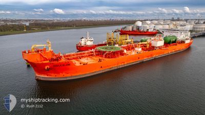
EAGLE BLANE
Tanker

Current Trip
| Time Travelled | 14 days |
|---|---|
| Remaining Time | --- |
| Distance Travelled | 1645.48 nm |
| Remaining Distance | --- |
| AVG Speed | 7.7 Noeuds |
| MAX Speed | 11.6 Noeuds |
| AVG Wind | 10.4 knots |
| MAX Wind | 28 knots |
| MIN Temp | -3.3°C / 26.06°F |
| MAX Temp | 16.8°C / 62.24°F |
| Tirant d eau | 9.4 m |
| Position reçue | 1 m depuis |
Current Position
| Longitude | --- |
|---|---|
| Latitude | --- |
| Etat | At anchor |
| Vitesse | |
| Parcours | 177° |
| Zone | North Sea |
| Station | T-AIS |
| Position reçue | 1 m depuis |
Information
The current position of EAGLE BLANE is in North Sea with coordinates 59.01864° / 5.68625° as reported on 2025-02-22 03:14 by AIS to our vessel tracker app. The vessel's current speed is 0 Noeuds
The vessel EAGLE BLANE (IMO: 9833101, MMSI: 257089140) is a Tanker It's sailing under the flag of [NO] Norway.
In this page you can find informations about the vessels current position, last detected port calls, and current voyage information. If the vessels is not in coverage by AIS you will find the latest position.
The current position of EAGLE BLANE is detected by our AIS receivers and we are not responsible for the reliability of the data. The last position was recorded while the vessel was in Coverage by the Ais receivers of our vessel tracking app.
The current draught of EAGLE BLANE as reported by AIS is 9.4 meters
Weather
| Temperature | 7.2°C / 44.96°F |
|---|---|
| Wind Speed | 15 knots |
| Direction | 169° S |
| Pressure | 1006 hPa |
| Humidity | 90 % |
| Cloud Coverage | 100 % |


Featured Company
Last Port Calls
| Port | Arrival | Departure | Time In Port |
|---|---|---|---|
| 2025-02-05 21:13 | 2025-02-07 17:19 | 1 d | |
| 2025-01-10 11:24 | 2025-02-05 20:40 | 26 d | |
| 2025-01-07 07:47 | 2025-01-10 10:48 | 3 d | |
| 2024-12-29 17:55 | 2024-12-31 05:21 | 1 d | |
| 2024-12-15 17:29 | 2024-12-16 15:17 | 21 h | |
| 2024-12-03 10:30 | 2024-12-04 13:22 | 1 d |
Last Trips
| Origin | Departure | Destination | Arrival | Distance | |
|---|---|---|---|---|---|
| 2025-02-05 20:40 | 2025-02-05 21:13 | 0.54 nm | |||
| 2025-01-10 10:48 | 2025-01-10 11:24 | 0.72 nm | |||
| 2024-12-31 06:21 | 2025-01-07 07:47 | 1695.77 nm | |||
| 2024-12-16 16:17 | 2024-12-29 18:55 | 943.83 nm | |||
| 2024-12-04 14:22 | 2024-12-15 18:29 | 1286.77 nm | |||
| 2024-11-13 12:23 | 2024-12-03 11:30 | 1929.58 nm |
Events
| Heure | Evenement | Détails | Position/ Destination | Info |
|---|---|---|---|---|
| 2025-02-21 19:26 | Etat Changé | At anchor Under way using engine |
59.01812 / 5.68282
NOSVG
|
Vitesse: 0.2 kn Parcours: 151° |
| 2025-02-21 07:39 | Etat Changé | Under way using engine At anchor |
59.01785 / 5.68886
NOSVG
|
Vitesse: Parcours: 195° |
| 2025-02-20 19:45 | Etat Changé | At anchor Under way using engine |
59.01765 / 5.68331
NOSVG
|
Vitesse: 0.3 kn Parcours: 117° |
| 2025-02-20 10:30 | Etat Changé | Under way using engine At anchor |
59.01568 / 5.68545
NOSVG
|
Vitesse: Parcours: 150° |
| 2025-02-20 06:54 | Etat Changé | At anchor Default |
59.01576 / 5.68391
NOSVG
|
Vitesse: 0.1 kn Parcours: 111° |
| 2025-02-20 06:52 | Etat Changé | Default At anchor |
59.01565 / 5.68371
NOSVG
|
Vitesse: 0.1 kn Parcours: 109° |
| 2025-02-19 18:55 | Etat Changé | At anchor Under way using engine |
59.01576 / 5.68072
NOSVG
|
Vitesse: 0.2 kn Parcours: 107° |
| 2025-02-19 07:08 | Etat Changé | Under way using engine At anchor |
59.01935 / 5.68292
NOSVG
|
Vitesse: 0.2 kn Parcours: 109° |
| 2025-02-18 19:14 | Etat Changé | At anchor Under way using engine |
59.01712 / 5.68318
NOSVG
|
Vitesse: 0.4 kn Parcours: 38° |
| 2025-02-18 07:25 | Etat Changé | Under way using engine At anchor |
59.02122 / 5.68885
NOSVG
|
Vitesse: 0.1 kn Parcours: 58° |