

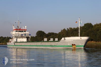
DROGDENBANK
General Cargo

Current Trip
| Time Travelled | 1 day |
|---|---|
| Remaining Time | 10 h, 37 mins |
| Distance Travelled | 521.70 nm |
| Remaining Distance | 133.51 nm |
| AVG Speed | 12.2 Noeuds |
| MAX Speed | 13.1 Noeuds |
| AVG Wind | 11.7 knots |
| MAX Wind | 20 knots |
| MIN Temp | 0.9°C / 33.62°F |
| MAX Temp | 4.7°C / 40.46°F |
| Tirant d eau | 4 m |
| Position reçue | 3 h, 18 m depuis |
Current Position
| Longitude | --- |
|---|---|
| Latitude | --- |
| Etat | Under way using engine |
| Vitesse | 12.2 Noeuds |
| Parcours | 50.8° |
| Zone | Gulf of Bothnia |
| Station | T-AIS |
| Position reçue | 3 h, 18 m depuis |
Information
The current position of DROGDENBANK is in Gulf of Bothnia with coordinates 63.52833° / 20.73489° as reported on 2025-03-28 00:27 by AIS to our vessel tracker app. The vessel's current speed is 12.2 Noeuds and is heading at the port of ROYTTA. The estimated time of arrival as calculated by MyShipTracking vessel tracking app is 2025-03-28 14:22 LT
The vessel DROGDENBANK (IMO: 9474163, MMSI: 244689000) is a General Cargo that was built in 2009 ( 16 Age ). It's sailing under the flag of [NL] Netherlands.
In this page you can find informations about the vessels current position, last detected port calls, and current voyage information. If the vessels is not in coverage by AIS you will find the latest position.
The current position of DROGDENBANK is detected by our AIS receivers and we are not responsible for the reliability of the data. The last position was recorded while the vessel was in Coverage by the Ais receivers of our vessel tracking app.
The current draught of DROGDENBANK as reported by AIS is 4 meters
Weather
| Temperature | 1°C / 33.8°F |
|---|---|
| Wind Speed | 13 knots |
| Direction | 194° SSW |
| Pressure | 999.8 hPa |
| Humidity | 95.3 % |
| Cloud Coverage | 100 % |


Featured Company
Last Port Calls
| Port | Arrival | Departure | Time In Port |
|---|---|---|---|
| 2025-03-23 22:02 | 2025-03-26 09:06 | 2 d | |
| 2025-03-14 16:45 | 2025-03-18 08:24 | 3 d | |
| 2025-03-05 23:41 | 2025-03-07 11:40 | 1 d | |
| 2025-03-02 16:41 | 2025-03-03 19:35 | 1 d | |
| 2025-02-23 13:04 | 2025-03-01 20:07 | 6 d | |
| 2025-02-08 11:40 | 2025-02-14 07:44 | 5 d | |
| 2025-02-05 16:41 | 2025-02-06 21:33 | 1 d | |
| 2025-01-21 11:52 | 2025-01-24 02:43 | 2 d | |
| 2025-01-19 06:34 | 2025-01-20 15:04 | 1 d | |
| 2025-01-09 01:59 | 2025-01-13 18:52 | 4 d |
Last Trips
| Origin | Departure | Destination | Arrival | Distance | |
|---|---|---|---|---|---|
| 2025-03-18 09:24 | 2025-03-24 00:02 | 1416.93 nm | |||
| 2025-03-07 12:40 | 2025-03-14 17:45 | 762.86 nm | |||
| 2025-03-03 20:35 | 2025-03-06 00:41 | 419.33 nm | |||
| 2025-03-01 21:07 | 2025-03-02 17:41 | 165.48 nm | |||
| 2025-02-14 08:44 | 2025-02-23 14:04 | 1951.43 nm | |||
| 2025-02-06 22:33 | 2025-02-08 12:40 | 116.25 nm | |||
| 2025-01-24 03:43 | 2025-02-05 17:41 | 2056.56 nm | |||
| 2025-01-20 15:04 | 2025-01-21 12:52 | 250.56 nm | |||
| 2025-01-13 19:52 | 2025-01-19 06:34 | 779.50 nm | |||
| 2025-01-08 19:38 | 2025-01-09 02:59 | 86.31 nm |
Events
| Heure | Evenement | Détails | Position/ Destination | Info |
|---|---|---|---|---|
| 2025-03-28 00:34 | Etat Changé | Default Under way using engine |
63.54175 / 20.77700
FITOR
|
Vitesse: 12.2 kn Parcours: 50.8° |
| 2025-03-28 00:27 | Hors de la zone couverte |
63.52833 / 20.73489
Gulf of Bothnia
FITOR
|
Vitesse: 12.2 kn Parcours: 50.8° |
|
| 2025-03-28 00:14 | Changement de zone | Swedish part of the Gulf of Bothnia Finnish part of the Gulf of Bothnia |
63.49135 / 20.68228
Gulf of Bothnia
FITOR
|
Vitesse: 12.4 kn Parcours: 28.3° |
| 2025-03-28 00:14 | Etat Changé | Under way using engine Default |
63.49135 / 20.68228
FITOR
|
Vitesse: 12.4 kn Parcours: 28° |
| 2025-03-27 23:58 | Dans la zone couverte |
63.49135 / 20.68228
Gulf of Bothnia
FITOR
|
Vitesse: 12.4 kn Parcours: 28.3° |
|
| 2025-03-27 15:23 | Etat Changé | Default Under way using engine |
61.71419 / 19.67552
FITOR
|
Vitesse: 12.6 kn Parcours: 13.5° |
| 2025-03-27 15:19 | Hors de la zone couverte |
61.70126 / 19.66932
Gulf of Bothnia
FITOR
|
Vitesse: 12.6 kn Parcours: 13.5° |
|
| 2025-03-27 15:16 | Etat Changé | Under way using engine Default |
61.69284 / 19.66508
FITOR
|
Vitesse: 12.7 kn Parcours: 13° |
| 2025-03-27 15:00 | Etat Changé | Default Under way using engine |
61.63557 / 19.63697
FITOR
|
Vitesse: 12.7 kn Parcours: 13.1° |
| 2025-03-27 14:56 | Etat Changé | Under way using engine Default |
61.62307 / 19.63113
FITOR
|
Vitesse: 12.5 kn Parcours: 14° |