
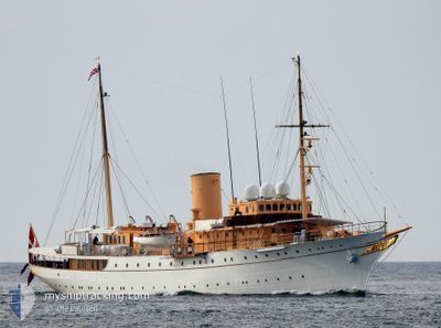
DANNEBROG
Military ops
Current Trip
| Trip Time | 2 days |
|---|---|
| Trip Distance | 453.62 nm |
| AVG Speed | 9 Noeuds |
| MAX Speed | 13 Noeuds |
| Tirant d eau | 4 m |
| AVG Wind | 10 knots |
| MAX Wind | 17.1 knots |
| MIN Temp | 5.4°C / 41.72°F |
| MAX Temp | 13°C / 55.4°F |
| Position reçue | 2 m depuis |
Current Position
| Longitude | 18.07654° |
|---|---|
| Latitude | 59.32441° |
| Etat | Moored |
| Vitesse | |
| Parcours | 189° |
| Zone | Baltic Sea |
| Station | T-AIS |
| Position reçue | 2 m depuis |
Info
Information
The current position of DANNEBROG is in Baltic Sea with coordinates 59.32441° / 18.07654° as reported on 2024-05-07 02:37 by AIS to our vessel tracker app. The vessel's current speed is 0 Noeuds and is currently inside the port of STOCKHOLM.
The vessel DANNEBROG (IMO: 4537661, MMSI: 219517000) is a Military ops It's sailing under the flag of [DK] Denmark.
In this page you can find informations about the vessels current position, last detected port calls, and current voyage information. If the vessels is not in coverage by AIS you will find the latest position.
The current position of DANNEBROG is detected by our AIS receivers and we are not responsible for the reliability of the data. The last position was recorded while the vessel was in Coverage by the Ais receivers of our vessel tracking app.
The current draught of DANNEBROG as reported by AIS is 4 meters
Weather
| Temperature | 0.7°C / 33.26°F |
|---|---|
| Wind Speed | 7 knots |
| Direction | 350° N |
| Pressure | 1019 hPa |
| Humidity | 74.6 % |
| Cloud Coverage | 1 % |
Featured Company
Last Port Calls
| Port | Arrival | Departure | Time In Port |
|---|---|---|---|
| 2024-05-06 07:53 | |||
| 2024-05-02 16:44 | 2024-05-03 17:15 | 1 d | |
| 2024-05-02 13:21 | 2024-05-02 14:47 | 1 h | |
| 2024-04-27 10:36 | 2024-05-02 11:11 | 5 d | |
| 2024-04-26 11:30 | 2024-04-26 13:23 | 1 h | |
| 2024-04-26 07:32 | 2024-04-26 08:31 | 58 m | |
| 2024-04-24 11:46 | 2024-04-25 08:14 | 20 h | |
| 2024-04-15 06:50 | 2024-04-17 08:18 | 2 d | |
| 2024-03-19 17:28 | 2024-04-11 14:07 | 22 d | |
| 2024-03-19 08:13 |
Most Visited Ports (Last year)
| Port | Arrivals | |
|---|---|---|
| 15 | ||
| 6 | ||
| 3 | ||
| 2 | ||
| 2 | ||
| 2 |
Last Trips
| Origin | Departure | Destination | Arrival | Distance | |
|---|---|---|---|---|---|
| 2024-05-03 19:15 | 2024-05-06 09:53 | 453.62 nm | |||
| 2024-05-02 16:47 | 2024-05-02 18:44 | 21.40 nm | |||
| 2024-05-02 13:11 | 2024-05-02 15:21 | 22.00 nm | |||
| 2024-04-26 15:23 | 2024-04-27 12:36 | 42.90 nm | |||
| 2024-04-26 10:31 | 2024-04-26 13:30 | 26.23 nm | |||
| 2024-04-25 10:14 | 2024-04-26 09:32 | 153.47 nm | |||
| 2024-04-17 10:18 | 2024-04-24 13:46 | 677.36 nm | |||
| 2024-04-11 16:07 | 2024-04-15 08:50 | 648.99 nm | |||
| 2024-03-19 09:13 | 2024-03-19 18:28 | 80.17 nm |
Events
| Heure | Evenement | Détails | Position/ Destination | Info |
|---|---|---|---|---|
| 2024-05-06 08:58 | Etat Changé | Moored Under way using engine |
59.32456 / 18.07670
[SE] STOCKHOLM
|
Vitesse: 0.4 kn Parcours: 207° |
| 2024-05-06 08:53 | Arret |
59.32456 / 18.07750
[SE] STOCKHOLM
|
Vitesse: 0.3 kn Parcours: 237° |
|
| 2024-05-06 08:28 | Démarrage |
59.31761 / 18.10796
[SE] STOCKHOLM
|
Vitesse: 3.1 kn Parcours: 301° |
|
| 2024-05-06 07:54 | Arret |
59.31827 / 18.11456
[SE] STOCKHOLM
|
Vitesse: 0.2 kn Parcours: 263° |
|
| 2024-05-06 07:53 | Port d'arrivée |
|
59.31828 / 18.11461
[SE] STOCKHOLM
|
Vitesse: 0.6 kn Parcours: 265° |
| 2024-05-06 07:32 | Démarrage | 2.31 nm, East of STOCKHOLM |
59.32110 / 18.16183
HOME
|
Vitesse: 4.2 kn Parcours: 232° |
| 2024-05-06 06:44 | Arret | 2.47 nm, East of STOCKHOLM |
59.32510 / 18.16632
HOME
|
Vitesse: 0.3 kn Parcours: 41° |
| 2024-05-06 02:17 | Dans la zone couverte |
59.20594 / 19.14542
Baltic Sea
|
Vitesse: 6.6 kn Parcours: 301.7° |
|
| 2024-05-06 01:01 | Hors de la zone couverte |
59.09846 / 19.04603
Baltic Sea
|
Vitesse: 7.3 kn Parcours: 48.3° |
|
| 2024-05-05 19:34 | Démarrage | 2.27 nm, South East of NYNASHAMN |
58.88356 / 18.01996
HOME
|
Vitesse: 3.1 kn Parcours: 138° |