

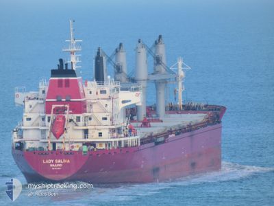
DEVBULK SALIHA
Cargo

Current Trip
| Time Travelled | 24 days |
|---|---|
| Remaining Time | --- |
| Distance Travelled | 4415.15 nm |
| Remaining Distance | --- |
| AVG Speed | 10.3 Noeuds |
| MAX Speed | 13.7 Noeuds |
| AVG Wind | 13.8 knots |
| MAX Wind | 36.5 knots |
| MIN Temp | -8°C / 17.6°F |
| MAX Temp | 17.1°C / 62.78°F |
| Tirant d eau | 10.1 m |
| Position reçue | 1 d depuis |
Current Position
| Longitude | --- |
|---|---|
| Latitude | --- |
| Etat | Under way using engine |
| Vitesse | 9.1 Noeuds |
| Parcours | 260° |
| Zone | North Atlantic Ocean |
| Station | T-AIS |
| Position reçue | 1 d depuis |
Information
The current position of DEVBULK SALIHA is in North Atlantic Ocean with coordinates 41.28438° / -33.58430° as reported on 2025-03-01 16:42 by AIS to our vessel tracker app. The vessel's current speed is 9.1 Noeuds and is heading at the port of FAIRLESS HILLS. The estimated time of arrival as calculated by MyShipTracking vessel tracking app is 2025-03-09 04:00 LT
The vessel DEVBULK SALIHA (IMO: 9449871, MMSI: 538005170) is a Cargo It's sailing under the flag of [MH] Marshall Is.
In this page you can find informations about the vessels current position, last detected port calls, and current voyage information. If the vessels is not in coverage by AIS you will find the latest position.
The current position of DEVBULK SALIHA is detected by our AIS receivers and we are not responsible for the reliability of the data. The last position was recorded while the vessel was in Coverage by the Ais receivers of our vessel tracking app.
The current draught of DEVBULK SALIHA as reported by AIS is 10.1 meters
Weather
| Temperature | 16.9°C / 62.42°F |
|---|---|
| Wind Speed | 18 knots |
| Direction | 210° SSW |
| Pressure | 1023.8 hPa |
| Humidity | 95.4 % |
| Cloud Coverage | 67 % |


Featured Company
Events
| Heure | Evenement | Détails | Position/ Destination | Info |
|---|---|---|---|---|
| 2025-03-01 16:45 | Etat Changé | Default Under way using engine |
41.28304 / -33.59372
US FAH
|
Vitesse: 9.1 kn Parcours: 260° |
| 2025-03-01 16:42 | Hors de la zone couverte |
41.28438 / -33.58430
North Atlantic Ocean
US FAH
|
Vitesse: 9.1 kn Parcours: 260° |
|
| 2025-03-01 16:23 | Etat Changé | Under way using engine Default |
41.28961 / -33.52316
US FAH
|
Vitesse: 8.9 kn Parcours: 266° |
| 2025-03-01 16:09 | Etat Changé | Default Under way using engine |
41.29125 / -33.47806
US FAH
|
Vitesse: 8.6 kn Parcours: 266.4° |
| 2025-03-01 15:25 | Etat Changé | Under way using engine Default |
41.30112 / -33.33702
US FAH
|
Vitesse: 8.9 kn Parcours: 259° |
| 2025-03-01 15:22 | Etat Changé | Default Under way using engine |
41.30210 / -33.32584
US FAH
|
Vitesse: 9 kn Parcours: 262.1° |
| 2025-03-01 15:09 | Etat Changé | Under way using engine Default |
41.30638 / -33.28171
US FAH
|
Vitesse: 9.2 kn Parcours: 265° |
| 2025-03-01 15:06 | Dans la zone couverte |
41.30638 / -33.28171
North Atlantic Ocean
US FAH
|
Vitesse: 9.4 kn Parcours: 267.9° |
|
| 2025-03-01 14:14 | Etat Changé | Default Under way using engine |
41.32155 / -33.09483
US FAH
|
Vitesse: 9.4 kn Parcours: 268.7° |
| 2025-03-01 13:57 | Hors de la zone couverte |
41.32289 / -33.03748
North Atlantic Ocean
US FAH
|
Vitesse: 9.4 kn Parcours: 268.7° |