
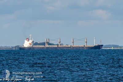
DEVBULK CANSEN
Cargo
Current Trip
| Time Travelled | 16 days |
|---|---|
| Remaining Time | --- |
| Distance Travelled | 2820.59 nm |
| Remaining Distance | 3308.22 nm |
| AVG Speed | 9.6 Noeuds |
| MAX Speed | 13.6 Noeuds |
| AVG Wind | 11.8 knots |
| MAX Wind | 29 knots |
| MIN Temp | -17.8°C / -0.040000000000006°F |
| MAX Temp | 11.6°C / 52.88°F |
| Tirant d eau | 9 m |
| Position reçue | 20 h, 44 m depuis |
Current Position
| Longitude | --- |
|---|---|
| Latitude | --- |
| Etat | Under way using engine |
| Vitesse | 11 Noeuds |
| Parcours | 254.9° |
| Zone | English Channel |
| Station | T-AIS |
| Position reçue | 20 h, 44 m depuis |
Info
Information
The current position of DEVBULK CANSEN is in English Channel with coordinates 50.12860° / -2.09409° as reported on 2026-02-25 16:02 by AIS to our vessel tracker app. The vessel's current speed is 11 Noeuds and is heading at the port of ABIDJAN. The estimated time of arrival as calculated by MyShipTracking vessel tracking app is 2026-03-09 12:00 LT
The vessel DEVBULK CANSEN (IMO: 9703459, MMSI: 538010507) is a Cargo It's sailing under the flag of [MH] Marshall Is.
In this page you can find informations about the vessels current position, last detected port calls, and current voyage information. If the vessels is not in coverage by AIS you will find the latest position.
The current position of DEVBULK CANSEN is detected by our AIS receivers and we are not responsible for the reliability of the data. The last position was recorded while the vessel was in Coverage by the Ais receivers of our vessel tracking app.
The current draught of DEVBULK CANSEN as reported by AIS is 9 meters
Weather
| Temperature | 11.6°C / 52.88°F |
|---|---|
| Wind Speed | 23 knots |
| Direction | 216° SW |
| Pressure | 1019 hPa |
| Humidity | 91.3 % |
| Cloud Coverage | 87 % |
Featured Company
Last Port Calls
| Port | Arrival | Departure | Time In Port |
|---|---|---|---|
| 2026-02-07 00:12 | 2026-02-09 20:13 | 2 d | |
| 2026-01-14 01:48 | 2026-01-15 05:10 | 1 d | |
| 2025-12-16 02:00 | 2026-01-03 03:26 | 18 d |
Most Visited Ports (Last year)
| Port | Arrivals | |
|---|---|---|
| 3 | ||
| 2 | ||
| 1 | ||
| 1 | ||
| 1 | ||
| 1 |
Last Trips
| Origin | Departure | Destination | Arrival | Distance | |
|---|---|---|---|---|---|
| 2026-01-15 05:10 | 2026-02-07 00:12 | 5494.21 nm | |||
| 2026-01-03 03:26 | 2026-01-14 01:48 | 1790.28 nm | |||
| 2025-10-07 11:08 | 2025-12-16 02:00 | 13480.93 nm |
Events
| Heure | Evenement | Détails | Position/ Destination | Info |
|---|---|---|---|---|
| 2026-02-25 16:07 | Etat Changé | Default Under way using engine |
50.12449 / -2.11881
CIABJ
|
Vitesse: 11 kn Parcours: 254.9° |
| 2026-02-25 16:02 | Hors de la zone couverte |
50.12860 / -2.09409
English Channel
CIABJ
|
Vitesse: 11 kn Parcours: 254.9° |
|
| 2026-02-25 16:01 | Detecté en mer | Guernsey part of the English Channel |
50.12939 / -2.08956
English Channel
CIABJ
|
Vitesse: 10.9 kn Parcours: 255.9° |
| 2026-02-25 16:00 | Etat Changé | Under way using engine Default |
50.13002 / -2.08576
CIABJ
|
Vitesse: 10.9 kn Parcours: 256° |
| 2026-02-25 15:47 | Etat Changé | Default Under way using engine |
50.13966 / -2.02852
CIABJ
|
Vitesse: 10.1 kn Parcours: 256.4° |
| 2026-02-25 15:28 | Detecté en mer | French part of the English Channel |
50.15429 / -1.94508
English Channel
CIABJ
|
Vitesse: 10.1 kn Parcours: 255.2° |
| 2026-02-25 06:26 | Etat Changé | Under way using engine Default |
50.62979 / .66812
CIABJ
|
Vitesse: 12.7 kn Parcours: 240° |
| 2026-02-25 06:21 | Etat Changé | Default Under way using engine |
50.63810 / .69050
CIABJ
|
Vitesse: 12.5 kn Parcours: 239.9° |
| 2026-02-25 06:16 | Etat Changé | Under way using engine Default |
50.64635 / .71260
CIABJ
|
Vitesse: 12.6 kn Parcours: 239° |
| 2026-02-25 05:49 | Etat Changé | Default Under way using engine |
50.69508 / .83895
CIABJ
|
Vitesse: 12 kn Parcours: 233.1° |