
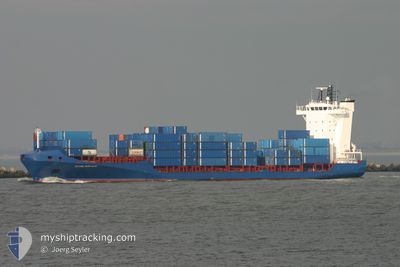
DENEB
Container Ship
Current Trip
GTSTC
| Time Travelled | 3 h, 7 mins |
|---|---|
| Remaining Time | --- |
| Distance Travelled | 39.41 nm |
| Remaining Distance | --- |
| AVG Speed | 13.8 Noeuds |
| MAX Speed | 15 Noeuds |
| AVG Wind | 4.3 knots |
| MAX Wind | 7 knots |
| MIN Temp | 21.1°C / 69.98°F |
| MAX Temp | 25.6°C / 78.08°F |
| Tirant d eau | 7 m |
| Position reçue | 3 d depuis |
Current Position
| Longitude | --- |
|---|---|
| Latitude | --- |
| Etat | Under way using engine |
| Vitesse | 12.5 Noeuds |
| Parcours | 178.1° |
| Zone | North Atlantic Ocean |
| Station | T-AIS |
| Position reçue | 3 d depuis |
Info
Information
The current position of DENEB is in North Atlantic Ocean with coordinates 25.39464° / -79.67537° as reported on 2025-03-04 07:54 by AIS to our vessel tracker app. The vessel's current speed is 12.5 Noeuds
The vessel DENEB (IMO: 9344241, MMSI: 304941000) is a Container Ship that was built in 2006 ( 19 Age ). It's sailing under the flag of [AG] Antigua Barbuda.
In this page you can find informations about the vessels current position, last detected port calls, and current voyage information. If the vessels is not in coverage by AIS you will find the latest position.
The current position of DENEB is detected by our AIS receivers and we are not responsible for the reliability of the data. The last position was recorded while the vessel was in Coverage by the Ais receivers of our vessel tracking app.
The current draught of DENEB as reported by AIS is 7 meters
Weather
| Temperature | 25.6°C / 78.08°F |
|---|---|
| Wind Speed | 5 knots |
| Direction | 148° SSE |
| Pressure | 1015.4 hPa |
| Humidity | 81.5 % |
| Cloud Coverage | 97 % |
Featured Company
Last Port Calls
| Port | Arrival | Departure | Time In Port |
|---|---|---|---|
| 2025-03-06 18:23 | 2025-03-07 10:43 | 16 h | |
| 2025-03-03 12:53 | 2025-03-04 03:28 | 14 h | |
| 2025-03-03 12:42 | 2025-03-03 12:51 | 9 m | |
| 2025-02-26 23:06 | 2025-03-01 04:56 | 2 d | |
| 2025-02-25 16:39 | 2025-02-26 09:59 | 17 h | |
| 2025-02-22 12:51 | 2025-02-23 03:30 | 14 h | |
| 2025-02-22 12:39 | 2025-02-22 12:46 | 6 m | |
| 2025-02-19 05:47 | 2025-02-19 20:19 | 14 h | |
| 2025-02-18 00:50 | 2025-02-19 00:51 | 1 d | |
| 2025-02-13 18:40 | 2025-02-14 12:51 | 18 h |
Most Visited Ports (Last year)
| Port | Arrivals | |
|---|---|---|
| 33 | ||
| 33 | ||
| 23 | ||
| 20 | ||
| 15 | ||
| 8 |
Last Trips
| Origin | Departure | Destination | Arrival | Distance | |
|---|---|---|---|---|---|
| 2025-03-03 22:28 | 2025-03-06 12:23 | 878.20 nm | |||
| 2025-03-03 07:51 | 2025-03-03 07:53 | 0.30 nm | |||
| 2025-02-28 22:56 | 2025-03-03 07:42 | 829.98 nm | |||
| 2025-02-26 03:59 | 2025-02-26 17:06 | 69.16 nm | |||
| 2025-02-22 22:30 | 2025-02-25 10:39 | 874.16 nm | |||
| 2025-02-22 07:46 | 2025-02-22 07:51 | 0.66 nm | |||
| 2025-02-19 14:19 | 2025-02-22 07:39 | 875.88 nm | |||
| 2025-02-18 18:51 | 2025-02-18 23:47 | 60.45 nm | |||
| 2025-02-14 07:51 | 2025-02-17 18:50 | 856.70 nm | |||
| 2025-02-13 13:35 | 2025-02-13 13:40 | 0.58 nm |
Events
| Heure | Evenement | Détails | Position/ Destination | Info |
|---|---|---|---|---|
| 2025-03-07 10:43 | Démarrage | 0.31 nm, North West of PUERTO SANTO TOMAS |
15.70194 / -88.61929
GTSTC
|
Vitesse: 7.6 kn Parcours: 6° |
| 2025-03-07 10:43 | PORT DE DEPART |
|
15.70194 / -88.61929
GTSTC
|
Vitesse: 1.9 kn Parcours: 15° |
| 2025-03-06 18:38 | Arret |
15.69512 / -88.61930
[GT] PUERTO SANTO TOMAS
|
Vitesse: Parcours: 64° |
|
| 2025-03-06 18:23 | Port d'arrivée |
|
15.69796 / -88.61884
[GT] PUERTO SANTO TOMAS
|
Vitesse: 4.6 kn Parcours: 187° |
| 2025-03-04 07:54 | Hors de la zone couverte |
25.39464 / -79.67537
North Atlantic Ocean
GTSTC
|
Vitesse: 12.5 kn Parcours: 178.1° |
|
| 2025-03-04 06:34 | Detecté en mer | Bahamas part of the North Atlantic Ocean |
25.66543 / -79.70537
North Atlantic Ocean
GTSTC
|
Vitesse: 12 kn Parcours: 145° |
| 2025-03-04 03:28 | PORT DE DEPART |
|
26.08699 / -80.11357
GTSTC
|
Vitesse: 7.1 kn Parcours: 358° |
| 2025-03-04 03:21 | Démarrage |
26.07599 / -80.11443
[US] FORT LAUDERDALE
|
Vitesse: 3.1 kn Parcours: 4° |
|
| 2025-03-04 02:39 | Etat Changé | Under way using engine Moored |
26.06593 / -80.11618
[US] FORT LAUDERDALE
|
Vitesse: Parcours: 207° |
| 2025-03-04 02:25 | Tirant d'eau modifié | 7 6.8 |
26.06592 / -80.11618
[US] FORT LAUDERDALE
|
Vitesse: Parcours: 207° |