
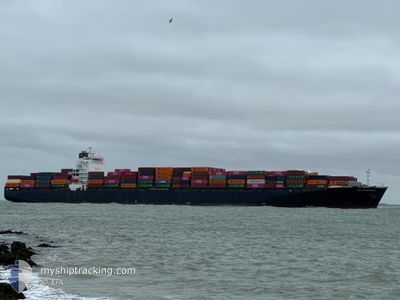
DELPHINUS C
Container Ship
Current Trip
| Time Travelled | 16 h, 45 mins |
|---|---|
| Remaining Time | 1 day |
| Distance Travelled | 151.76 nm |
| Remaining Distance | 233.74 nm |
| AVG Speed | 9.2 Noeuds |
| MAX Speed | 10.4 Noeuds |
| AVG Wind | 6.8 knots |
| MAX Wind | 13 knots |
| MIN Temp | 14.9°C / 58.82°F |
| MAX Temp | 19.2°C / 66.56°F |
| Tirant d eau | 10.6 m |
| Position reçue | 2 m depuis |
Current Position
| Longitude | -121.08555° |
|---|---|
| Latitude | 34.48628° |
| Etat | Under way using engine |
| Vitesse | 9.1 Noeuds |
| Parcours | 284.5° |
| Zone | North Pacific Ocean |
| Station | T-AIS |
| Position reçue | 2 m depuis |
Info
Information
The current position of DELPHINUS C is in North Pacific Ocean with coordinates 34.48628° / -121.08555° as reported on 2024-09-14 03:39 by AIS to our vessel tracker app. The vessel's current speed is 9.1 Noeuds and is heading at the port of OAKLAND. The estimated time of arrival as calculated by MyShipTracking vessel tracking app is 2024-09-15 05:27 LT
The vessel DELPHINUS C (IMO: 9337652, MMSI: 636018222) is a Container Ship that was built in 2007 ( 17 Age ). It's sailing under the flag of [LR] Liberia.
In this page you can find informations about the vessels current position, last detected port calls, and current voyage information. If the vessels is not in coverage by AIS you will find the latest position.
The current position of DELPHINUS C is detected by our AIS receivers and we are not responsible for the reliability of the data. The last position was recorded while the vessel was in Coverage by the Ais receivers of our vessel tracking app.
The current draught of DELPHINUS C as reported by AIS is 10.6 meters
Weather
| Temperature | 15.2°C / 59.36°F |
|---|---|
| Wind Speed | 12 knots |
| Direction | 335° NNW |
| Pressure | 1010.7 hPa |
| Humidity | 88.5 % |
| Cloud Coverage | 84 % |
Featured Company
Last Port Calls
| Port | Arrival | Departure | Time In Port |
|---|---|---|---|
| 2024-09-09 11:59 | 2024-09-13 10:57 | 3 d | |
| 2024-08-28 18:01 | 2024-08-29 12:00 | 17 h | |
| 2024-08-23 11:50 | 2024-08-23 12:13 | 23 m | |
| 2024-08-22 15:50 | |||
| 2024-08-22 15:20 | 2024-08-22 15:36 | 16 m | |
| 2024-08-16 09:44 | 2024-08-17 01:05 | 15 h | |
| 2024-08-08 11:17 | 2024-08-09 05:14 | 17 h | |
| 2024-08-06 03:06 | 2024-08-06 21:51 | 18 h | |
| 2024-08-03 20:04 | 2024-08-04 18:34 | 22 h | |
| 2024-07-30 16:41 | 2024-07-31 17:36 | 1 d |
Most Visited Ports (Last year)
| Port | Arrivals | |
|---|---|---|
| 9 | ||
| 9 | ||
| 8 | ||
| 8 | ||
| 5 | ||
| 5 |
Last Trips
| Origin | Departure | Destination | Arrival | Distance | |
|---|---|---|---|---|---|
| 2024-08-29 07:00 | 2024-09-09 04:59 | 3281.29 nm | |||
| 2024-08-23 08:13 | 2024-08-28 13:01 | 1195.91 nm | |||
| 2024-08-22 11:36 | 2024-08-23 07:50 | 2.18 nm | |||
| 2024-08-22 11:36 | 2024-08-22 11:50 | 0.76 nm | |||
| 2024-08-16 22:05 | 2024-08-22 11:20 | 1545.85 nm | |||
| 2024-08-09 07:14 | 2024-08-16 06:44 | 2821.62 nm | |||
| 2024-08-06 23:51 | 2024-08-08 13:17 | 406.24 nm | |||
| 2024-08-04 20:34 | 2024-08-06 05:06 | 313.95 nm | |||
| 2024-07-31 19:36 | 2024-08-03 22:04 | 245.99 nm | |||
| 2024-07-30 08:28 | 2024-07-30 18:41 | 112.52 nm |
Events
| Heure | Evenement | Détails | Position/ Destination | Info |
|---|---|---|---|---|
| 2024-09-14 03:30 | Etat Changé | Under way using engine Default |
34.48081 / -121.05849
USOAK
|
Vitesse: 9.1 kn Parcours: 284° |
| 2024-09-14 03:23 | Etat Changé | Default Under way using engine |
34.47637 / -121.03722
USOAK
|
Vitesse: 9.1 kn Parcours: 284.4° |
| 2024-09-14 03:06 | Etat Changé | Under way using engine Default |
34.46565 / -120.98692
USOAK
|
Vitesse: 8.9 kn Parcours: 288° |
| 2024-09-14 02:55 | Dans la zone couverte |
34.46652 / -120.99075
North Pacific Ocean
USOAK
|
Vitesse: 9.1 kn Parcours: 285.4° |
|
| 2024-09-14 02:03 | Etat Changé | Default Under way using engine |
34.42642 / -120.80678
USOAK
|
Vitesse: 8.6 kn Parcours: 280.3° |
| 2024-09-14 01:55 | Hors de la zone couverte |
34.42253 / -120.78578
North Pacific Ocean
USOAK
|
Vitesse: 8.6 kn Parcours: 280.3° |
|
| 2024-09-13 22:27 | Etat Changé | Under way using engine Default |
34.28173 / -120.16950
USOAK
|
Vitesse: 9.2 kn Parcours: 283° |
| 2024-09-13 22:11 | Etat Changé | Default Under way using engine |
34.27214 / -120.12161
USOAK
|
Vitesse: 9.4 kn Parcours: 284.6° |
| 2024-09-13 21:59 | Etat Changé | Under way using engine Default |
34.26365 / -120.08381
USOAK
|
Vitesse: 9.2 kn Parcours: 285° |
| 2024-09-13 21:55 | Etat Changé | Default Under way using engine |
34.26089 / -120.07237
USOAK
|
Vitesse: 9 kn Parcours: 285.3° |