
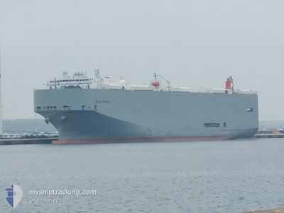
DALIAN HIGHWAY
Vehicles Carrier
Current Trip
| Trip Time | 6 days |
|---|---|
| Trip Distance | 2612.97 nm |
| AVG Speed | 16.2 Noeuds |
| MAX Speed | 20.6 Noeuds |
| Tirant d eau | 8.7 m |
| AVG Wind | 10 knots |
| MAX Wind | 24.8 knots |
| MIN Temp | 3.8°C / 38.84°F |
| MAX Temp | 28.7°C / 83.66°F |
| Position reçue | Maintenant |
Current Position
| Longitude | --- |
|---|---|
| Latitude | --- |
| Etat | Moored |
| Vitesse | |
| Parcours | 30° |
| Zone | Singapore Strait |
| Station | T-AIS |
| Position reçue | Maintenant |
Info
Information
The current position of DALIAN HIGHWAY is in Singapore Strait with coordinates 1.28300° / 103.75152° as reported on 2025-02-17 00:46 by AIS to our vessel tracker app. The vessel's current speed is 0 Noeuds and is currently inside the port of SINGAPORE.
The vessel DALIAN HIGHWAY (IMO: 9565560, MMSI: 357694000) is a Vehicles Carrier that was built in 2011 ( 14 Age ). It's sailing under the flag of [PA] Panama.
In this page you can find informations about the vessels current position, last detected port calls, and current voyage information. If the vessels is not in coverage by AIS you will find the latest position.
The current position of DALIAN HIGHWAY is detected by our AIS receivers and we are not responsible for the reliability of the data. The last position was recorded while the vessel was in Coverage by the Ais receivers of our vessel tracking app.
The current draught of DALIAN HIGHWAY as reported by AIS is 8.7 meters
Weather
| Temperature | 25.8°C / 78.44°F |
|---|---|
| Wind Speed | 5 knots |
| Direction | 360° N |
| Pressure | 1011.7 hPa |
| Humidity | 81.5 % |
| Cloud Coverage | 100 % |
Featured Company
Last Port Calls
| Port | Arrival | Departure | Time In Port |
|---|---|---|---|
| 2025-02-17 05:39 | |||
| 2025-02-09 22:37 | 2025-02-10 11:25 | 12 h | |
| 2025-02-04 10:18 | 2025-02-06 18:08 | 2 d | |
| 2025-01-03 04:40 | 2025-01-04 00:19 | 19 h | |
| 2024-12-27 04:42 | 2024-12-29 22:38 | 2 d | |
| 2024-12-20 11:43 | 2024-12-20 18:37 | 6 h | |
| 2024-12-17 19:30 | 2024-12-19 05:32 | 1 d | |
| 2024-12-15 16:01 | 2024-12-17 05:36 | 1 d | |
| 2024-12-14 00:17 | 2024-12-14 21:24 | 21 h | |
| 2024-12-06 12:21 | 2024-12-10 10:33 | 3 d |
Last Trips
| Origin | Departure | Destination | Arrival | Distance | |
|---|---|---|---|---|---|
| 2025-02-10 11:25 | 2025-02-17 05:39 | 2612.97 nm | |||
| 2025-02-06 18:08 | 2025-02-09 22:37 | 966.97 nm | |||
| 2025-01-04 00:19 | 2025-02-04 10:18 | 11921.20 nm | |||
| 2024-12-29 22:38 | 2025-01-03 04:40 | 1434.86 nm | |||
| 2024-12-20 18:37 | 2024-12-27 04:42 | 1094.87 nm | |||
| 2024-12-19 05:32 | 2024-12-20 11:43 | 180.40 nm | |||
| 2024-12-17 05:36 | 2024-12-17 19:30 | 226.48 nm | |||
| 2024-12-14 21:24 | 2024-12-15 16:01 | 287.50 nm | |||
| 2024-12-10 10:33 | 2024-12-14 00:17 | 1436.57 nm | |||
| 2024-11-29 11:04 | 2024-12-06 12:21 | 1498.21 nm |
Events
| Heure | Evenement | Détails | Position/ Destination | Info |
|---|---|---|---|---|
| 2025-02-16 23:43 | Etat Changé | Moored Default |
1.28301 / 103.75152
[SG] SINGAPORE
|
Vitesse: Parcours: 30° |
| 2025-02-16 23:37 | Etat Changé | Default Moored |
1.28301 / 103.75150
[SG] SINGAPORE
|
Vitesse: Parcours: 30° |
| 2025-02-16 21:52 | Etat Changé | Moored Under way using engine |
1.28302 / 103.75153
[SG] SINGAPORE
|
Vitesse: 0.1 kn Parcours: 30° |
| 2025-02-16 21:43 | Arret |
1.28314 / 103.75128
[SG] SINGAPORE
|
Vitesse: 0.3 kn Parcours: 27° |
|
| 2025-02-16 21:39 | Port d'arrivée |
|
1.28338 / 103.75096
[SG] SINGAPORE
|
Vitesse: 0.6 kn Parcours: 28° |
| 2025-02-16 19:05 | Detecté en mer | Singaporean part of the Singapore Strait |
1.27438 / 104.05250
Singapore Strait
SG SIN PEBGA
|
Vitesse: 11 kn Parcours: 259° |
| 2025-02-16 18:34 | Changement d'ETA | 2025/02/16 20:00 2025/02/16 20:30 |
1.28603 / 104.14370
SG SIN PEBGA
|
Vitesse: 7.5 kn Parcours: 272.9° |
| 2025-02-16 18:28 | Tirant d'eau modifié | 8.7 7.4 |
1.28569 / 104.15323
SG SIN PEBGA
|
Vitesse: 5.4 kn Parcours: 270.8° |
| 2025-02-16 18:28 | Changement de destination | SG SIN PEBGA JP NGO |
1.28569 / 104.15323
SG SIN PEBGA
|
Vitesse: 5.4 kn Parcours: 270.8° |
| 2025-02-16 18:28 | Changement d'ETA | 2025/02/16 20:30 2025/02/01 02:45 |
1.28569 / 104.15323
SG SIN PEBGA
|
Vitesse: 5.4 kn Parcours: 270.8° |