
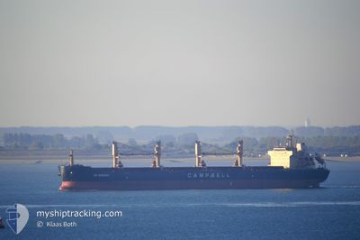
CS SONOMA
Bulk Carrier
Current Trip
| Time Travelled | 31 days |
|---|---|
| Remaining Time | 7 days |
| Distance Travelled | 7891.62 nm |
| Remaining Distance | 1850.12 nm |
| AVG Speed | 10.7 Noeuds |
| MAX Speed | 13.9 Noeuds |
| AVG Wind | 11.5 knots |
| MAX Wind | 23 knots |
| MIN Temp | 13.7°C / 56.66°F |
| MAX Temp | 30°C / 86°F |
| Tirant d eau | 13 m |
| Position reçue | 7 d depuis |
Current Position
| Longitude | --- |
|---|---|
| Latitude | --- |
| Etat | At anchor |
| Vitesse | |
| Parcours | 73° |
| Zone | Indian Ocean |
| Station | T-AIS |
| Position reçue | 7 d depuis |
Info
Information
The current position of CS SONOMA is in Indian Ocean with coordinates -20.15600° / 57.43452° as reported on 2025-02-18 19:29 by AIS to our vessel tracker app. The vessel's current speed is 0 Noeuds and is heading at the port of PORT LOUIS. The estimated time of arrival as calculated by MyShipTracking vessel tracking app is 2025-03-05 16:42 LT
The vessel CS SONOMA (IMO: 9569944, MMSI: 311033300) is a Bulk Carrier that was built in 2010 ( 15 Age ). It's sailing under the flag of [BS] Bahamas.
In this page you can find informations about the vessels current position, last detected port calls, and current voyage information. If the vessels is not in coverage by AIS you will find the latest position.
The current position of CS SONOMA is detected by our AIS receivers and we are not responsible for the reliability of the data. The last position was recorded while the vessel was in Coverage by the Ais receivers of our vessel tracking app.
The current draught of CS SONOMA as reported by AIS is 13 meters
Weather
| Temperature | 28°C / 82.4°F |
|---|---|
| Wind Speed | 10 knots |
| Direction | 42° NE |
| Pressure | 1012.7 hPa |
| Humidity | 75.3 % |
| Cloud Coverage | 38 % |
Featured Company
Events
| Heure | Evenement | Détails | Position/ Destination | Info |
|---|---|---|---|---|
| 2025-02-18 21:32 | Démarrage | 2.96 nm, West of PORT LOUIS |
-20.15190 / 57.43142
MU PLU
|
Vitesse: 6.5 kn Parcours: 354° |
| 2025-02-18 19:38 | Etat Changé | Default At anchor |
-20.15607 / 57.43448
MU PLU
|
Vitesse: Parcours: 73° |
| 2025-02-18 19:29 | Etat Changé | At anchor Default |
-20.15600 / 57.43452
MU PLU
|
Vitesse: Parcours: 67° |
| 2025-02-18 19:29 | Hors de la zone couverte |
-20.15600 / 57.43452
Indian Ocean
|
Vitesse: Parcours: 30° |
|
| 2025-02-18 19:14 | Dans la zone couverte |
-20.15600 / 57.43452
Indian Ocean
|
Vitesse: Parcours: 30° |
|
| 2025-02-18 18:04 | Tirant d'eau modifié | 13 12.6 |
-20.15610 / 57.43438
MU PLU
|
Vitesse: Parcours: 66° |
| 2025-02-18 18:02 | Etat Changé | Default At anchor |
-20.15598 / 57.43450
MU PLU
|
Vitesse: Parcours: 66° |
| 2025-02-18 17:53 | Etat Changé | At anchor Default |
-20.15610 / 57.43438
MU PLU
|
Vitesse: Parcours: 61° |
| 2025-02-18 17:53 | Hors de la zone couverte |
-20.15610 / 57.43438
Indian Ocean
|
Vitesse: Parcours: 143° |
|
| 2025-02-18 17:38 | Dans la zone couverte |
-20.15610 / 57.43438
Indian Ocean
|
Vitesse: Parcours: 143° |