

CS SERVICE
Reefer

Current Trip
PABLB
| Time Travelled | 8 days |
|---|---|
| Remaining Time | --- |
| Distance Travelled | 3301.71 nm |
| Remaining Distance | --- |
| AVG Speed | 16.4 Noeuds |
| MAX Speed | 18.6 Noeuds |
| AVG Wind | 15.7 knots |
| MAX Wind | 32.2 knots |
| MIN Temp | 11.5°C / 52.7°F |
| MAX Temp | 27.2°C / 80.96°F |
| Tirant d eau | 9.9 m |
| Position reçue | 7 d depuis |
Current Position
| Longitude | --- |
|---|---|
| Latitude | --- |
| Etat | Under way using engine |
| Vitesse | 16.6 Noeuds |
| Parcours | 53.3° |
| Zone | Caribbean Sea |
| Station | T-AIS |
| Position reçue | 7 d depuis |
Information
The current position of CS SERVICE is in Caribbean Sea with coordinates 11.81896° / -76.98961° as reported on 2025-02-27 00:05 by AIS to our vessel tracker app. The vessel's current speed is 16.6 Noeuds
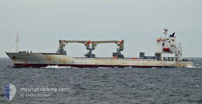
The vessel CS SERVICE (IMO: 9438482, MMSI: 566028000) is a Reefer that was built in 2008 ( 17 Age ). It's sailing under the flag of [SG] Singapore.
In this page you can find informations about the vessels current position, last detected port calls, and current voyage information. If the vessels is not in coverage by AIS you will find the latest position.
The current position of CS SERVICE is detected by our AIS receivers and we are not responsible for the reliability of the data. The last position was recorded while the vessel was in Coverage by the Ais receivers of our vessel tracking app.
The current draught of CS SERVICE as reported by AIS is 9.9 meters
Weather
| Temperature | 11.5°C / 52.7°F |
|---|---|
| Wind Speed | 26 knots |
| Direction | 287° WNW |
| Pressure | 1012.7 hPa |
| Humidity | 81.7 % |
| Cloud Coverage | 100 % |


Featured Company
Last Port Calls
| Port | Arrival | Departure | Time In Port |
|---|---|---|---|
| 2025-02-26 00:53 | 2025-02-26 01:15 | 22 m | |
| 2025-02-23 05:22 | 2025-02-23 12:17 | 6 h | |
| 2025-02-19 12:38 | 2025-02-21 07:26 | 1 d | |
| 2025-02-11 22:31 | 2025-02-12 09:59 | 11 h | |
| 2025-02-09 19:13 | 2025-02-11 06:03 | 1 d | |
| 2025-02-07 16:31 | 2025-02-08 00:21 | 7 h | |
| 2025-02-07 04:41 | 2025-02-07 09:08 | 4 h | |
| 2025-01-25 06:29 | 2025-01-25 16:13 | 9 h | |
| 2025-01-22 03:55 | 2025-01-24 14:27 | 2 d | |
| 2025-01-20 06:24 | 2025-01-21 20:40 | 1 d |
Last Trips
| Origin | Departure | Destination | Arrival | Distance | |
|---|---|---|---|---|---|
| 2025-02-23 07:17 | 2025-02-25 19:53 | 878.29 nm | |||
| 2025-02-21 02:26 | 2025-02-23 00:22 | 334.49 nm | |||
| 2025-02-12 05:59 | 2025-02-19 07:38 | 2372.17 nm | |||
| 2025-02-11 03:03 | 2025-02-11 18:31 | 221.29 nm | |||
| 2025-02-07 20:21 | 2025-02-09 16:13 | 739.81 nm | |||
| 2025-02-07 05:08 | 2025-02-07 12:31 | 114.03 nm | |||
| 2025-01-25 17:13 | 2025-02-07 00:41 | 3745.47 nm | |||
| 2025-01-24 15:27 | 2025-01-25 07:29 | 264.84 nm | |||
| 2025-01-21 20:40 | 2025-01-22 04:55 | 96.70 nm | |||
| 2025-01-05 07:53 | 2025-01-20 06:24 | 5762.73 nm |
Events
| Heure | Evenement | Détails | Position/ Destination | Info |
|---|---|---|---|---|
| 2025-02-27 00:22 | Etat Changé | Default Under way using engine |
11.90597 / -76.87144
PABLB
|
Vitesse: 16.6 kn Parcours: 53.3° |
| 2025-02-27 00:05 | Hors de la zone couverte |
11.81896 / -76.98961
Caribbean Sea
|
Vitesse: 16.6 kn Parcours: 53.3° |
|
| 2025-02-26 23:25 | Changement de zone | Colombian part of the Caribbean Sea Panamanian part of the Caribbean Sea |
11.73495 / -77.10597
Caribbean Sea
|
Vitesse: 16 kn Parcours: 53.5° |
| 2025-02-26 23:25 | Etat Changé | Under way using engine Default |
11.73495 / -77.10597
PABLB
|
Vitesse: 16.1 kn Parcours: 53° |
| 2025-02-26 23:20 | Dans la zone couverte |
11.73495 / -77.10597
Caribbean Sea
|
Vitesse: 16 kn Parcours: 53.5° |
|
| 2025-02-26 11:16 | Etat Changé | Default Under way using engine |
9.78429 / -79.81865
PABLB
|
Vitesse: 17.2 kn Parcours: 53.1° |
| 2025-02-26 11:12 | Hors de la zone couverte |
9.77032 / -79.83757
Caribbean Sea
|
Vitesse: 17.2 kn Parcours: 53.1° |
|
| 2025-02-26 11:04 | Etat Changé | Under way using engine Default |
9.74787 / -79.86712
PABLB
|
Vitesse: 17.1 kn Parcours: 52° |
| 2025-02-26 10:54 | Etat Changé | Default Under way using engine |
9.71902 / -79.90435
PABLB
|
Vitesse: 17.3 kn Parcours: 51.6° |
| 2025-02-26 09:22 | Changement de zone | Panamanian part of the Caribbean Sea Panamanian part of the North Pacific Ocean |
9.37050 / -79.91877
Caribbean Sea
|
Vitesse: 12 kn Parcours: 1.4° |