

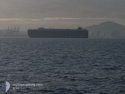
CRYSTAL RAY
Ro-Ro/Passenger Ship

Current Trip
| Time Travelled | 10 h, 58 mins |
|---|---|
| Remaining Time | 1 day |
| Distance Travelled | 112.87 nm |
| Remaining Distance | 373.72 nm |
| AVG Speed | 10.1 Noeuds |
| MAX Speed | 12 Noeuds |
| AVG Wind | 6.5 knots |
| MAX Wind | 8.7 knots |
| MIN Temp | 13.9°C / 57.02°F |
| MAX Temp | 15°C / 59°F |
| Tirant d eau | 8.6 m |
| Position reçue | 3 m depuis |
Current Position
| Longitude | --- |
|---|---|
| Latitude | --- |
| Etat | Under way using engine |
| Vitesse | 10.6 Noeuds |
| Parcours | 299.6° |
| Zone | North Pacific Ocean |
| Station | T-AIS |
| Position reçue | 3 m depuis |
Information
The current position of CRYSTAL RAY is in North Pacific Ocean with coordinates 33.84782° / -118.78154° as reported on 2025-03-27 12:14 by AIS to our vessel tracker app. The vessel's current speed is 10.6 Noeuds and is heading at the port of BENICIA. The estimated time of arrival as calculated by MyShipTracking vessel tracking app is 2025-03-28 23:37 LT
The vessel CRYSTAL RAY (IMO: 9210440, MMSI: 311039000) is a Ro-Ro/Passenger Ship that was built in 2000 ( 25 Age ). It's sailing under the flag of [BS] Bahamas.
In this page you can find informations about the vessels current position, last detected port calls, and current voyage information. If the vessels is not in coverage by AIS you will find the latest position.
The current position of CRYSTAL RAY is detected by our AIS receivers and we are not responsible for the reliability of the data. The last position was recorded while the vessel was in Coverage by the Ais receivers of our vessel tracking app.
The current draught of CRYSTAL RAY as reported by AIS is 8.6 meters
Weather
| Temperature | 14°C / 57.2°F |
|---|---|
| Wind Speed | 6 knots |
| Direction | 279° W |
| Pressure | 1016.9 hPa |
| Humidity | 81.6 % |
| Cloud Coverage | 100 % |


Featured Company
Last Port Calls
| Port | Arrival | Departure | Time In Port |
|---|---|---|---|
| 2025-03-25 23:52 | 2025-03-27 01:20 | 1 d | |
| 2025-03-13 20:15 | 2025-03-14 07:59 | 11 h | |
| 2025-02-26 07:18 | 2025-02-27 15:35 | 1 d | |
| 2025-02-19 06:51 | 2025-02-20 08:06 | 1 d | |
| 2025-02-16 12:56 | 2025-02-16 18:07 | 5 h | |
| 2025-01-27 14:26 | 2025-01-29 19:47 | 2 d | |
| 2025-01-18 06:35 | 2025-01-19 11:48 | 1 d | |
| 2025-01-13 05:20 | 2025-01-14 05:40 | 1 d | |
| 2025-01-06 17:33 | 2025-01-07 04:44 | 11 h | |
| 2025-01-02 19:16 | 2025-01-03 21:05 | 1 d |
Most Visited Ports (Last year)
| Port | Arrivals | |
|---|---|---|
| 3 | ||
| 3 | ||
| 3 | ||
| 3 | ||
| 3 | ||
| 2 |
Last Trips
| Origin | Departure | Destination | Arrival | Distance | |
|---|---|---|---|---|---|
| 2025-03-14 02:59 | 2025-03-25 16:52 | 3315.75 nm | |||
| 2025-02-27 16:35 | 2025-03-13 15:15 | 4844.66 nm | |||
| 2025-02-20 09:06 | 2025-02-26 08:18 | 398.42 nm | |||
| 2025-02-16 19:07 | 2025-02-19 07:51 | 851.48 nm | |||
| 2025-01-29 21:47 | 2025-02-16 13:56 | 6137.54 nm | |||
| 2025-01-19 13:48 | 2025-01-27 16:26 | 433.84 nm | |||
| 2025-01-14 07:40 | 2025-01-18 08:35 | 1191.58 nm | |||
| 2025-01-07 04:44 | 2025-01-13 07:20 | 1910.14 nm | |||
| 2025-01-03 21:05 | 2025-01-06 17:33 | 1038.01 nm | |||
| 2025-01-01 09:15 | 2025-01-02 19:16 | 484.07 nm |
Events
| Heure | Evenement | Détails | Position/ Destination | Info |
|---|---|---|---|---|
| 2025-03-27 12:09 | Etat Changé | Under way using engine Default |
33.84028 / -118.76536
USBNC
|
Vitesse: 10.7 kn Parcours: 299° |
| 2025-03-27 12:08 | Etat Changé | Default Under way using engine |
33.83834 / -118.76118
USBNC
|
Vitesse: 10.7 kn Parcours: 299.2° |
| 2025-03-27 10:05 | Etat Changé | Under way using engine Default |
33.65416 / -118.37852
USBNC
|
Vitesse: 10.3 kn Parcours: 298° |
| 2025-03-27 10:04 | Etat Changé | Default Under way using engine |
33.65203 / -118.37389
USBNC
|
Vitesse: 10.4 kn Parcours: 296.7° |
| 2025-03-27 02:16 | Tirant d'eau modifié | 8.6 8 |
32.66428 / -117.34766
USBNC
|
Vitesse: 10 kn Parcours: 311.9° |
| 2025-03-27 02:16 | Changement d'ETA | 2025/03/29 06:30 |
32.66428 / -117.34766
USBNC
|
Vitesse: 10 kn Parcours: 311.9° |
| 2025-03-27 02:10 | Tirant d'eau modifié | 8 8.6 |
32.65311 / -117.33266
USBNC
|
Vitesse: 9.9 kn Parcours: 311° |
| 2025-03-27 01:20 | PORT DE DEPART |
|
32.67605 / -117.22931
USBNC
|
Vitesse: 7.7 kn Parcours: 175° |
| 2025-03-27 00:58 | Tirant d'eau modifié | 8.6 8 |
32.71822 / -117.20374
[US] SAN DIEGO
|
Vitesse: 10.2 kn Parcours: 270° |
| 2025-03-27 00:58 | Changement d'ETA | 2025/03/29 06:30 |
32.71822 / -117.20374
[US] SAN DIEGO
|
Vitesse: 10.2 kn Parcours: 270° |