

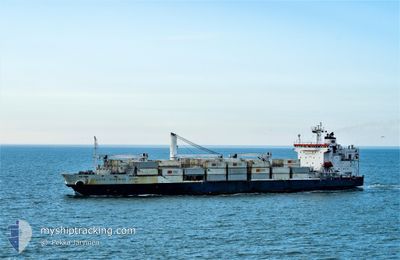
COTE D IVOIRIAN STAR
Reefer

Current Trip
| Time Travelled | 6 days |
|---|---|
| Remaining Time | 3 days |
| Distance Travelled | 2487.87 nm |
| Remaining Distance | 1288.44 nm |
| AVG Speed | 15.2 Noeuds |
| MAX Speed | 18 Noeuds |
| AVG Wind | 12.9 knots |
| MAX Wind | 32 knots |
| MIN Temp | 7.9°C / 46.22°F |
| MAX Temp | 20.4°C / 68.72°F |
| Tirant d eau | 9.1 m |
| Position reçue | 1 d depuis |
Current Position
| Longitude | --- |
|---|---|
| Latitude | --- |
| Etat | Under way using engine |
| Vitesse | 16.3 Noeuds |
| Parcours | 193.9° |
| Zone | North Atlantic Ocean |
| Station | T-AIS |
| Position reçue | 1 d depuis |
Information
The current position of COTE D IVOIRIAN STAR is in North Atlantic Ocean with coordinates 27.74860° / -16.37548° as reported on 2025-03-12 23:04 by AIS to our vessel tracker app. The vessel's current speed is 16.3 Noeuds and is heading at the port of ABIDJAN. The estimated time of arrival as calculated by MyShipTracking vessel tracking app is 2025-03-17 23:21 LT
The vessel COTE D IVOIRIAN STAR (IMO: 9172478, MMSI: 636014241) is a Reefer that was built in 1998 ( 27 Age ). It's sailing under the flag of [LR] Liberia.
In this page you can find informations about the vessels current position, last detected port calls, and current voyage information. If the vessels is not in coverage by AIS you will find the latest position.
The current position of COTE D IVOIRIAN STAR is detected by our AIS receivers and we are not responsible for the reliability of the data. The last position was recorded while the vessel was in Coverage by the Ais receivers of our vessel tracking app.
The current draught of COTE D IVOIRIAN STAR as reported by AIS is 9.1 meters
Weather
| Temperature | 19°C / 66.2°F |
|---|---|
| Wind Speed | 16 knots |
| Direction | 7° N |
| Pressure | 1011.6 hPa |
| Humidity | 86.1 % |
| Cloud Coverage | 12 % |


Featured Company
Last Port Calls
| Port | Arrival | Departure | Time In Port |
|---|---|---|---|
| 2025-03-04 17:27 | 2025-03-08 01:53 | 3 d | |
| 2025-03-02 21:34 | 2025-03-03 22:35 | 1 d | |
| 2025-02-23 20:31 | 2025-02-24 07:15 | 10 h | |
| 2025-02-19 20:55 | 2025-02-20 15:35 | 18 h | |
| 2025-02-18 03:33 | 2025-02-19 01:29 | 21 h | |
| 2025-02-14 21:11 | 2025-02-16 07:33 | 1 d | |
| 2025-02-11 07:59 | 2025-02-12 07:15 | 23 h | |
| 2025-01-30 01:45 | 2025-02-02 00:25 | 2 d | |
| 2025-01-28 11:47 | 2025-01-29 05:37 | 17 h | |
| 2025-01-20 10:39 | 2025-01-20 20:31 | 9 h |
Last Trips
| Origin | Departure | Destination | Arrival | Distance | |
|---|---|---|---|---|---|
| 2025-03-03 22:35 | 2025-03-04 17:27 | 246.43 nm | |||
| 2025-02-24 07:15 | 2025-03-02 21:34 | 2416.21 nm | |||
| 2025-02-20 15:35 | 2025-02-23 20:31 | 1132.41 nm | |||
| 2025-02-19 01:29 | 2025-02-19 20:55 | 275.20 nm | |||
| 2025-02-16 07:33 | 2025-02-18 03:33 | 691.46 nm | |||
| 2025-02-12 07:15 | 2025-02-14 21:11 | 899.69 nm | |||
| 2025-02-02 00:25 | 2025-02-11 07:59 | 3771.63 nm | |||
| 2025-01-29 05:37 | 2025-01-30 01:45 | 246.08 nm | |||
| 2025-01-20 20:31 | 2025-01-28 11:47 | 2521.14 nm | |||
| 2025-01-16 21:39 | 2025-01-20 10:39 | 1172.21 nm |
Events
| Heure | Evenement | Détails | Position/ Destination | Info |
|---|---|---|---|---|
| 2025-03-12 23:12 | Etat Changé | Default Under way using engine |
27.71386 / -16.38556
CIABJ
|
Vitesse: 16.3 kn Parcours: 193.9° |
| 2025-03-12 23:04 | Etat Changé | Under way using engine Default |
27.74860 / -16.37548
CIABJ
|
Vitesse: 16.2 kn Parcours: 193° |
| 2025-03-12 23:04 | Hors de la zone couverte |
27.74860 / -16.37548
North Atlantic Ocean
CIABJ
|
Vitesse: 16.3 kn Parcours: 193.9° |
|
| 2025-03-12 22:56 | Etat Changé | Default Under way using engine |
27.78483 / -16.36622
CIABJ
|
Vitesse: 16.5 kn Parcours: 192.5° |
| 2025-03-12 22:49 | Etat Changé | Under way using engine Default |
27.81340 / -16.35877
CIABJ
|
Vitesse: 16.4 kn Parcours: 193° |
| 2025-03-12 22:43 | Etat Changé | Default Under way using engine |
27.84201 / -16.35138
CIABJ
|
Vitesse: 16.2 kn Parcours: 193.2° |
| 2025-03-12 18:02 | Tirant d'eau modifié | 9.1 9 |
28.89995 / -15.67356
CIABJ
|
Vitesse: 16 kn Parcours: 193.2° |
| 2025-03-12 18:02 | Changement d'ETA | 2025/03/18 03:00 2025/03/18 00:30 |
28.89995 / -15.67356
CIABJ
|
Vitesse: 16 kn Parcours: 193.2° |
| 2025-03-12 17:34 | Etat Changé | Under way using engine Default |
29.02139 / -15.64011
CIABJ
|
Vitesse: 15.8 kn Parcours: 195° |
| 2025-03-12 17:29 | Etat Changé | Default Under way using engine |
29.04107 / -15.63446
CIABJ
|
Vitesse: 15.9 kn Parcours: 193.3° |