
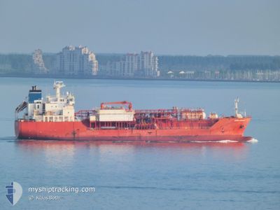
COSTA DO FUTURO
Lpg Tanker
Current Trip
RIO DE JANEIRO-RJ
| Time Travelled | 4 days |
|---|---|
| Remaining Time | --- |
| Distance Travelled | 794.01 nm |
| Remaining Distance | --- |
| AVG Speed | 11.9 Noeuds |
| MAX Speed | 13.6 Noeuds |
| AVG Wind | 8 knots |
| MAX Wind | 13 knots |
| MIN Temp | 23.7°C / 74.66°F |
| MAX Temp | 28.6°C / 83.48°F |
| Tirant d eau | 5.4 m |
| Position reçue | 16 d depuis |
Current Position
| Longitude | --- |
|---|---|
| Latitude | --- |
| Etat | At anchor |
| Vitesse | |
| Parcours | 20° |
| Zone | South Atlantic Ocean |
| Station | T-AIS |
| Position reçue | 16 d depuis |
Info
Information
The current position of COSTA DO FUTURO is in South Atlantic Ocean with coordinates -22.76924° / -43.14900° as reported on 2025-03-01 22:27 by AIS to our vessel tracker app. The vessel's current speed is 0 Noeuds
The vessel COSTA DO FUTURO (IMO: 9403786, MMSI: 256691000) is a Lpg Tanker that was built in 2008 ( 17 Age ). It's sailing under the flag of [MT] Malta.
In this page you can find informations about the vessels current position, last detected port calls, and current voyage information. If the vessels is not in coverage by AIS you will find the latest position.
The current position of COSTA DO FUTURO is detected by our AIS receivers and we are not responsible for the reliability of the data. The last position was recorded while the vessel was in Coverage by the Ais receivers of our vessel tracking app.
The current draught of COSTA DO FUTURO as reported by AIS is 5.4 meters
Weather
| Temperature | 30.5°C / 86.9°F |
|---|---|
| Wind Speed | 6 knots |
| Direction | 114° ESE |
| Pressure | 1015 hPa |
| Humidity | 51.6 % |
| Cloud Coverage | 98 % |
Featured Company
Last Port Calls
| Port | Arrival | Departure | Time In Port |
|---|---|---|---|
| 2025-03-11 15:28 | 2025-03-13 02:23 | 1 d | |
| 2025-02-20 23:02 | 2025-02-22 12:22 | 1 d | |
| 2025-02-09 10:02 | 2025-02-10 21:50 | 1 d | |
| 2025-01-29 00:10 | 2025-01-31 00:23 | 2 d | |
| 2025-01-15 13:53 | 2025-01-17 04:26 | 1 d | |
| 2025-01-03 03:22 | 2025-01-05 04:42 | 2 d |
Most Visited Ports (Last year)
| Port | Arrivals | |
|---|---|---|
| 24 |
Last Trips
| Origin | Departure | Destination | Arrival | Distance | |
|---|---|---|---|---|---|
| 2025-02-22 12:22 | 2025-03-11 15:28 | 1560.12 nm | |||
| 2025-02-10 21:50 | 2025-02-20 23:02 | 1543.17 nm | |||
| 2025-01-31 00:23 | 2025-02-09 10:02 | 1541.73 nm | |||
| 2025-01-17 04:26 | 2025-01-29 00:10 | 1543.89 nm | |||
| 2025-01-05 04:42 | 2025-01-15 13:53 | 1536.66 nm | |||
| 2024-12-23 14:22 | 2025-01-03 03:22 | 1573.21 nm |
Events
| Heure | Evenement | Détails | Position/ Destination | Info |
|---|---|---|---|---|
| 2025-03-16 17:44 | Arret | 7.25 nm, North of NITEROI |
-22.76400 / -43.15358
RIO DE JANEIRO-RJ
|
Vitesse: Parcours: 348° |
| 2025-03-16 15:34 | Démarrage | 7.57 nm, South East of RIO DE JANEIRO |
-23.01649 / -43.10495
RIO DE JANEIRO-RJ
|
Vitesse: 6.7 kn Parcours: 348° |
| 2025-03-16 15:28 | Arret | 7.61 nm, South East of RIO DE JANEIRO |
-23.01875 / -43.10844
RIO DE JANEIRO-RJ
|
Vitesse: 0.3 kn Parcours: 146° |
| 2025-03-13 23:59 | Démarrage | 2.65 nm, North West of SALVADOR |
-12.93060 / -38.53902
RIO DE JANEIRO-RJ
|
Vitesse: 6.3 kn Parcours: 229° |
| 2025-03-13 06:33 | Arret | 2.61 nm, North West of SALVADOR |
-12.92896 / -38.53490
RIO DE JANEIRO-RJ
|
Vitesse: 0.3 kn Parcours: 193° |
| 2025-03-13 05:23 | Démarrage | 2.06 nm, West of ARATU |
-12.78992 / -38.50721
RIO DE JANEIRO-RJ
|
Vitesse: 8.9 kn Parcours: 232° |
| 2025-03-13 05:23 | PORT DE DEPART |
|
-12.78992 / -38.50721
RIO DE JANEIRO-RJ
|
Vitesse: 0.9 kn Parcours: 118° |
| 2025-03-11 18:35 | Arret |
-12.78476 / -38.49824
[BR] ARATU
|
Vitesse: 0.3 kn Parcours: 115° |
|
| 2025-03-11 18:28 | Port d'arrivée |
|
-12.78476 / -38.49951
[BR] ARATU
|
Vitesse: 4.6 kn Parcours: 57° |
| 2025-03-11 16:26 | Démarrage | 8.58 nm, South West of SALVADOR |
-13.06896 / -38.61799
RIO DE JANEIRO-RJ
|
Vitesse: 3.3 kn Parcours: 115° |