
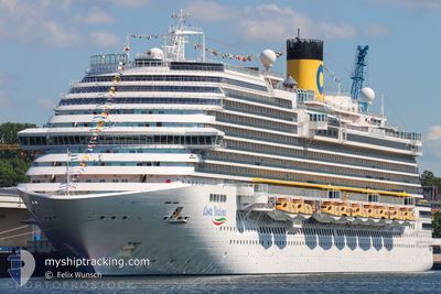
COSTA DIADEMA
Passengers Ship
Current Trip
| Time Travelled | 7 h, 17 mins |
|---|---|
| Remaining Time | 5 h, 18 mins |
| Distance Travelled | 124.49 nm |
| Remaining Distance | --- |
| AVG Speed | 17.2 Noeuds |
| MAX Speed | 19 Noeuds |
| AVG Wind | 28.2 knots |
| MAX Wind | 36 knots |
| MIN Temp | 23.6°C / 74.48°F |
| MAX Temp | 24.7°C / 76.46°F |
| Tirant d eau | 8.5 m |
| Position reçue | 23 h, 59 m depuis |
Current Position
| Longitude | --- |
|---|---|
| Latitude | --- |
| Etat | Under way using engine |
| Vitesse | 16 Noeuds |
| Parcours | 32.1° |
| Zone | South Atlantic Ocean |
| Station | T-AIS |
| Position reçue | 23 h, 59 m depuis |
Info
Information
The current position of COSTA DIADEMA is in South Atlantic Ocean with coordinates -29.00117° / -48.64816° as reported on 2026-01-03 03:50 by AIS to our vessel tracker app. The vessel's current speed is 16 Noeuds and is heading at the port of SANTOS. The estimated time of arrival as calculated by MyShipTracking vessel tracking app is 2026-01-04 06:08 LT
The vessel COSTA DIADEMA (IMO: 9636888, MMSI: 247353700) is a Passengers Ship that was built in 2014 ( 12 Age ). It's sailing under the flag of [IT] Italy.
In this page you can find informations about the vessels current position, last detected port calls, and current voyage information. If the vessels is not in coverage by AIS you will find the latest position.
The current position of COSTA DIADEMA is detected by our AIS receivers and we are not responsible for the reliability of the data. The last position was recorded while the vessel was in Coverage by the Ais receivers of our vessel tracking app.
The current draught of COSTA DIADEMA as reported by AIS is 8.5 meters
Weather
| Temperature | 23.9°C / 75.02°F |
|---|---|
| Wind Speed | 22 knots |
| Direction | 159° SSE |
| Pressure | 1011.4 hPa |
| Humidity | 77.3 % |
| Cloud Coverage | 99 % |
Featured Company
Last Port Calls
| Port | Arrival | Departure | Time In Port |
|---|---|---|---|
| 2026-01-03 11:22 | 2026-01-03 17:33 | 6 h | |
| 2026-01-01 06:57 | 2026-01-01 16:33 | 9 h | |
| 2025-12-31 06:50 | 2025-12-31 18:14 | 11 h | |
| 2025-12-28 06:21 | 2025-12-28 17:41 | 11 h | |
| 2025-12-27 09:13 | 2025-12-27 17:49 | 8 h | |
| 2025-12-25 07:11 | 2025-12-25 16:29 | 9 h | |
| 2025-12-24 06:39 | 2025-12-24 17:51 | 11 h | |
| 2025-12-21 06:27 | 2025-12-21 19:51 | 13 h | |
| 2025-12-20 07:23 | 2025-12-20 17:31 | 10 h | |
| 2025-12-18 06:23 | 2025-12-18 17:27 | 11 h |
Last Trips
| Origin | Departure | Destination | Arrival | Distance | |
|---|---|---|---|---|---|
| 2026-01-01 16:33 | 2026-01-03 11:22 | 721.51 nm | |||
| 2025-12-31 18:14 | 2026-01-01 06:57 | 155.69 nm | |||
| 2025-12-28 17:41 | 2025-12-31 06:50 | 1114.67 nm | |||
| 2025-12-27 17:49 | 2025-12-28 06:21 | 217.30 nm | |||
| 2025-12-25 16:29 | 2025-12-27 09:13 | 721.88 nm | |||
| 2025-12-24 17:51 | 2025-12-25 07:11 | 161.19 nm | |||
| 2025-12-21 19:51 | 2025-12-24 06:39 | 1024.80 nm | |||
| 2025-12-20 17:31 | 2025-12-21 06:27 | 224.07 nm | |||
| 2025-12-18 17:27 | 2025-12-20 07:23 | 396.55 nm | |||
| 2025-12-17 17:31 | 2025-12-18 06:23 | 216.75 nm |
Events
| Heure | Evenement | Détails | Position/ Destination | Info |
|---|---|---|---|---|
| 2026-01-03 20:33 | PORT DE DEPART |
|
-26.91330 / -48.63860
BRITJ
|
Vitesse: 9.9 kn Parcours: 144° |
| 2026-01-03 20:30 | Démarrage |
-26.90870 / -48.64964
[BR] ITAJAI
|
Vitesse: 9.9 kn Parcours: 144° |
|
| 2026-01-03 14:29 | Arret |
-26.89990 / -48.66651
[BR] ITAJAI
|
Vitesse: 0.2 kn Parcours: 121° |
|
| 2026-01-03 14:22 | Port d'arrivée |
|
-26.89998 / -48.66561
[BR] ITAJAI
|
Vitesse: 2.5 kn Parcours: 98° |
| 2026-01-03 03:57 | Etat Changé | Default Under way using engine |
-28.97333 / -48.62833
BRITJ
|
Vitesse: 16 kn Parcours: 32.1° |
| 2026-01-03 03:50 | Hors de la zone couverte |
-29.00117 / -48.64816
South Atlantic Ocean
BRITJ
|
Vitesse: 16 kn Parcours: 32.1° |
|
| 2026-01-03 01:08 | Changement de destination | BRITJ UYMVD |
-29.62384 / -49.09341
BRITJ
|
Vitesse: 16.1 kn Parcours: 33.6° |
| 2026-01-03 01:08 | Changement d'ETA | 2026/01/03 10:48 2026/01/01 09:00 |
-29.62384 / -49.09341
BRITJ
|
Vitesse: 16.1 kn Parcours: 33.6° |
| 2026-01-03 01:00 | Etat Changé | Under way using engine Default |
-29.65027 / -49.11309
UYMVD
|
Vitesse: 16.6 kn Parcours: 32° |
| 2026-01-03 00:56 | Etat Changé | Default Under way using engine |
-29.66523 / -49.12411
UYMVD
|
Vitesse: 16.5 kn Parcours: 32.2° |