
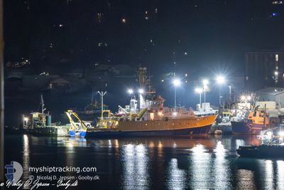
CORIOLIS II
Research/Survey Vessel
Current Trip
MIDDLE BANK
| Time Travelled | 5 days |
|---|---|
| Remaining Time | --- |
| Distance Travelled | 832.91 nm |
| Remaining Distance | --- |
| AVG Speed | 7.3 Noeuds |
| MAX Speed | 11.7 Noeuds |
| AVG Wind | 10.5 knots |
| MAX Wind | 20 knots |
| MIN Temp | 5.1°C / 41.18°F |
| MAX Temp | 11°C / 51.8°F |
| Tirant d eau | 5.3 m |
| Position reçue | 5 d depuis |
Current Position
| Longitude | -62.84720° |
|---|---|
| Latitude | 44.44698° |
| Etat | Under way using engine |
| Vitesse | 10.3 Noeuds |
| Parcours | 105° |
| Zone | North Atlantic Ocean |
| Station | T-AIS |
| Position reçue | 5 d depuis |
Info
Information
The current position of CORIOLIS II is in North Atlantic Ocean with coordinates 44.44698° / -62.84720° as reported on 2024-05-15 19:45 by AIS to our vessel tracker app. The vessel's current speed is 10.3 Noeuds
The vessel CORIOLIS II (IMO: 8818570, MMSI: 316133000) is a Research/Survey Vessel that was built in 1991 ( 33 Age ). It's sailing under the flag of [CA] Canada.
In this page you can find informations about the vessels current position, last detected port calls, and current voyage information. If the vessels is not in coverage by AIS you will find the latest position.
The current position of CORIOLIS II is detected by our AIS receivers and we are not responsible for the reliability of the data. The last position was recorded while the vessel was in Coverage by the Ais receivers of our vessel tracking app.
The current draught of CORIOLIS II as reported by AIS is 5.3 meters
Weather
| Temperature | 6.9°C / 44.42°F |
|---|---|
| Wind Speed | 8 knots |
| Direction | 102° ESE |
| Pressure | 1017.4 hPa |
| Humidity | 90.4 % |
| Cloud Coverage | 48 % |
Featured Company
Most Visited Ports (Last year)
| Port | Arrivals | |
|---|---|---|
| 16 | ||
| 8 | ||
| 3 | ||
| 1 | ||
| 1 | ||
| 1 |
Last Trips
| Origin | Departure | Destination | Arrival | Distance | |
|---|---|---|---|---|---|
| 2024-05-01 15:25 | 2024-05-15 07:54 | 2068.26 nm | |||
| 2024-04-15 09:29 | 2024-04-15 11:42 | 18.58 nm | |||
| 2024-03-25 19:06 | 2024-04-04 13:09 | 1428.16 nm | |||
| 2024-03-13 16:05 | 2024-03-17 20:18 | 796.33 nm | |||
| 2024-01-17 06:42 | 2024-03-08 01:45 | 153.27 nm |
Events
| Heure | Evenement | Détails | Position/ Destination | Info |
|---|---|---|---|---|
| 2024-05-15 19:50 | Etat Changé | Default Under way using engine |
44.44352 / -62.82876
MIDDLE BANK
|
Vitesse: 10.3 kn Parcours: 105° |
| 2024-05-15 19:45 | Hors de la zone couverte |
44.44698 / -62.84720
North Atlantic Ocean
MIDDLE BANK
|
Vitesse: 10.3 kn Parcours: 105° |
|
| 2024-05-15 19:33 | Etat Changé | Under way using engine Default |
44.45585 / -62.89501
MIDDLE BANK
|
Vitesse: 10.6 kn Parcours: 107° |
| 2024-05-15 19:26 | Etat Changé | Default Under way using engine |
44.46079 / -62.92002
MIDDLE BANK
|
Vitesse: 10.5 kn Parcours: 102.5° |
| 2024-05-15 17:26 | Changement de destination | MIDDLE BANK COVE |
44.53975 / -63.40275
MIDDLE BANK
|
Vitesse: 11 kn Parcours: 108.6° |
| 2024-05-15 16:43 | PORT DE DEPART |
|
44.60404 / -63.54122
COVE
|
Vitesse: 9.6 kn Parcours: 162° |
| 2024-05-15 16:18 | Démarrage |
44.65612 / -63.55772
[CA] HALIFAX
|
Vitesse: 5.5 kn Parcours: 180° |
|
| 2024-05-15 15:55 | Etat Changé | Under way using engine Moored |
44.65898 / -63.55743
[CA] HALIFAX
|
Vitesse: 0.1 kn Parcours: 67° |
| 2024-05-15 14:27 | Changement d'ETA | 2024/05/29 12:00 2024/05/15 08:00 |
44.65899 / -63.55743
[CA] HALIFAX
|
Vitesse: 0.1 kn Parcours: 68° |
| 2024-05-15 11:07 | Etat Changé | Moored Under way using engine |
44.65897 / -63.55738
[CA] HALIFAX
|
Vitesse: 0.1 kn Parcours: 68° |