

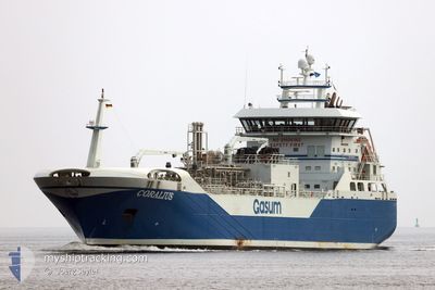
CORALIUS
Tanker
Current Trip
| Time Travelled | 2 days |
|---|---|
| Remaining Time | 15 h, 38 mins |
| Distance Travelled | 394.22 nm |
| Remaining Distance | 184.29 nm |
| AVG Speed | 10.4 Noeuds |
| MAX Speed | 14.3 Noeuds |
| AVG Wind | 9.2 knots |
| MAX Wind | 17 knots |
| MIN Temp | -4°C / 24.8°F |
| MAX Temp | 3.9°C / 39.02°F |
| Tirant d eau | 5.5 m |
| Position reçue | 1 m depuis |
Current Position
| Longitude | --- |
|---|---|
| Latitude | --- |
| Etat | Under way using engine |
| Vitesse | 12 Noeuds |
| Parcours | 194.8° |
| Zone | North Sea |
| Station | T-AIS |
| Position reçue | 1 m depuis |
Information
The current position of CORALIUS is in North Sea with coordinates 55.90125° / 7.32080° as reported on 2025-02-18 13:04 by AIS to our vessel tracker app. The vessel's current speed is 12 Noeuds and is heading at the port of EMDEN. The estimated time of arrival as calculated by MyShipTracking vessel tracking app is 2025-02-19 04:44 LT
The vessel CORALIUS (IMO: 9769128, MMSI: 266436000) is a Tanker It's sailing under the flag of [SE] Sweden.
In this page you can find informations about the vessels current position, last detected port calls, and current voyage information. If the vessels is not in coverage by AIS you will find the latest position.
The current position of CORALIUS is detected by our AIS receivers and we are not responsible for the reliability of the data. The last position was recorded while the vessel was in Coverage by the Ais receivers of our vessel tracking app.
The current draught of CORALIUS as reported by AIS is 5.5 meters
Weather
| Temperature | 1.5°C / 34.7°F |
|---|---|
| Wind Speed | 9 knots |
| Direction | 195° SSW |
| Pressure | 1029.9 hPa |
| Humidity | 53.1 % |
| Cloud Coverage | --- |
Featured Company
Last Port Calls
| Port | Arrival | Departure | Time In Port |
|---|---|---|---|
| 2025-02-16 08:19 | 2025-02-16 11:34 | 3 h | |
| 2025-02-15 06:49 | 2025-02-15 09:26 | 2 h | |
| 2025-02-10 12:37 | 2025-02-10 23:41 | 11 h | |
| 2025-02-06 14:36 | 2025-02-07 01:28 | 10 h | |
| 2025-02-05 08:18 | 2025-02-05 19:15 | 10 h | |
| 2025-02-04 21:51 | 2025-02-04 22:46 | 55 m | |
| 2025-02-01 10:58 | 2025-02-01 15:15 | 4 h | |
| 2025-01-30 19:02 | 2025-01-31 07:16 | 12 h | |
| 2025-01-27 18:01 | 2025-01-27 22:44 | 4 h | |
| 2025-01-22 06:36 | 2025-01-23 18:41 | 1 d |
Most Visited Ports (Last year)
| Port | Arrivals | |
|---|---|---|
| 32 | ||
| 32 | ||
| 26 | ||
| 20 | ||
| 14 | ||
| 8 |
Last Trips
| Origin | Departure | Destination | Arrival | Distance | |
|---|---|---|---|---|---|
| 2025-02-15 10:26 | 2025-02-16 09:19 | 9.27 nm | |||
| 2025-02-11 00:41 | 2025-02-15 07:49 | 451.34 nm | |||
| 2025-02-07 02:28 | 2025-02-10 13:37 | 417.47 nm | |||
| 2025-02-05 20:15 | 2025-02-06 15:36 | 247.10 nm | |||
| 2025-02-04 23:46 | 2025-02-05 09:18 | 26.89 nm | |||
| 2025-02-01 16:15 | 2025-02-04 22:51 | 729.70 nm | |||
| 2025-01-31 08:16 | 2025-02-01 11:58 | 123.30 nm | |||
| 2025-01-27 23:44 | 2025-01-30 20:02 | 604.08 nm | |||
| 2025-01-23 19:41 | 2025-01-27 19:01 | 710.60 nm | |||
| 2025-01-16 23:44 | 2025-01-22 07:36 | 658.27 nm |
Events
| Heure | Evenement | Détails | Position/ Destination | Info |
|---|---|---|---|---|
| 2025-02-18 05:26 | Changement de zone | Danish part of the North Sea Danish part of the Skaggerak |
57.19675 / 8.46136
North Sea
DEEME
|
Vitesse: 13 kn Parcours: 219.9° |
| 2025-02-17 22:22 | Changement de zone | Danish part of the Skaggerak Danish part of the Kattegat |
57.80949 / 10.95577
Skaggerak
DEEME
|
Vitesse: 13.5 kn Parcours: 309.8° |
| 2025-02-17 21:55 | Changement de zone | Danish part of the Kattegat Swedish part of the Kattegat |
57.75011 / 11.10861
Kattegat
DEEME
|
Vitesse: 13.5 kn Parcours: 303.3° |
| 2025-02-17 20:38 | Changement d'ETA | 2025/02/19 09:00 2025/02/20 07:00 |
57.60922 / 11.56260
DEEME
|
Vitesse: 11.9 kn Parcours: 291.6° |
| 2025-02-17 19:53 | Démarrage | 1.02 nm, North of ASPERO |
57.66765 / 11.79268
DEEME
|
Vitesse: 6.1 kn Parcours: 301.2° |
| 2025-02-17 19:42 | Etat Changé | Under way using engine At anchor |
57.66592 / 11.79736
DEEME
|
Vitesse: Parcours: 305° |
| 2025-02-17 19:33 | Changement de destination | DEEME SEGOT |
57.66590 / 11.79737
DEEME
|
Vitesse: Parcours: 296° |
| 2025-02-17 19:33 | Changement d'ETA | 2025/02/20 07:00 2025/02/17 09:00 |
57.66590 / 11.79737
DEEME
|
Vitesse: Parcours: 296° |
| 2025-02-17 16:28 | Etat Changé | At anchor Under way using engine |
57.66639 / 11.79760
SEGOT
|
Vitesse: 0.8 kn Parcours: 272° |
| 2025-02-17 16:23 | Arret | 0.96 nm, North of ASPERO |
57.66660 / 11.79589
SEGOT
|
Vitesse: 0.3 kn Parcours: 296° |