
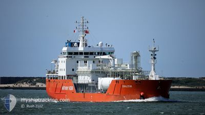
CORAL STAR
Tanker
Current Trip
IT VDA
| Time Travelled | 2 days |
|---|---|
| Remaining Time | --- |
| Distance Travelled | 195.01 nm |
| Remaining Distance | --- |
| AVG Speed | 7 Noeuds |
| MAX Speed | 10.8 Noeuds |
| AVG Wind | 8.4 knots |
| MAX Wind | 15 knots |
| MIN Temp | 9.8°C / 49.64°F |
| MAX Temp | 12.7°C / 54.86°F |
| Tirant d eau | 6.7 m |
| Position reçue | 1 d depuis |
Current Position
| Longitude | --- |
|---|---|
| Latitude | --- |
| Etat | Under way using engine |
| Vitesse | 6.6 Noeuds |
| Parcours | 79.2° |
| Zone | Ligurian Sea |
| Station | T-AIS |
| Position reçue | 1 d depuis |
Info
Information
The current position of CORAL STAR is in Ligurian Sea with coordinates 43.23947° / 9.37914° as reported on 2025-02-17 00:35 by AIS to our vessel tracker app. The vessel's current speed is 6.6 Noeuds
The vessel CORAL STAR (IMO: 9685499, MMSI: 244790522) is a Tanker It's sailing under the flag of [NL] Netherlands.
In this page you can find informations about the vessels current position, last detected port calls, and current voyage information. If the vessels is not in coverage by AIS you will find the latest position.
The current position of CORAL STAR is detected by our AIS receivers and we are not responsible for the reliability of the data. The last position was recorded while the vessel was in Coverage by the Ais receivers of our vessel tracking app.
The current draught of CORAL STAR as reported by AIS is 6.7 meters
Weather
| Temperature | 9.3°C / 48.74°F |
|---|---|
| Wind Speed | 7 knots |
| Direction | 61° ENE |
| Pressure | 1016.7 hPa |
| Humidity | 68.3 % |
| Cloud Coverage | 100 % |
Featured Company
Last Port Calls
| Port | Arrival | Departure | Time In Port |
|---|---|---|---|
| 2025-02-14 03:55 | 2025-02-15 17:13 | 1 d | |
| 2025-02-06 13:45 | 2025-02-08 10:09 | 1 d | |
| 2025-02-01 04:29 | 2025-02-02 18:40 | 1 d | |
| 2025-01-23 17:23 | 2025-01-24 16:10 | 22 h | |
| 2025-01-08 14:15 | 2025-01-10 00:09 | 1 d | |
| 2024-12-19 12:49 | 2024-12-20 15:46 | 1 d | |
| 2024-12-09 21:29 | 2024-12-11 03:19 | 1 d | |
| 2024-12-04 03:49 | 2024-12-05 08:12 | 1 d |
Last Trips
| Origin | Departure | Destination | Arrival | Distance | |
|---|---|---|---|---|---|
| 2025-02-08 11:09 | 2025-02-14 04:55 | 532.15 nm | |||
| 2025-02-02 19:40 | 2025-02-06 14:45 | 527.55 nm | |||
| 2025-01-24 17:10 | 2025-02-01 05:29 | 533.06 nm | |||
| 2025-01-10 01:09 | 2025-01-23 18:23 | 539.76 nm | |||
| 2024-12-20 16:46 | 2025-01-08 15:15 | 665.21 nm | |||
| 2024-12-11 04:19 | 2024-12-19 13:49 | 535.05 nm | |||
| 2024-12-05 09:12 | 2024-12-09 22:29 | 531.30 nm | |||
| 2024-11-28 00:45 | 2024-12-04 04:49 | 534.87 nm |
Events
| Heure | Evenement | Détails | Position/ Destination | Info |
|---|---|---|---|---|
| 2025-02-17 13:48 | Arret | 13.06 nm, South East of LIVORNO |
43.35886 / 10.42154
IT VDA
|
Vitesse: 0.2 kn Parcours: 323° |
| 2025-02-17 13:28 | Démarrage | 13.5 nm, South of LIVORNO |
43.34507 / 10.40075
IT VDA
|
Vitesse: 6.2 kn Parcours: 34° |
| 2025-02-17 07:30 | Arret | 14.14 nm, South of LIVORNO |
43.33091 / 10.38815
IT VDA
|
Vitesse: 0.2 kn Parcours: 90° |
| 2025-02-17 00:36 | Etat Changé | Default Under way using engine |
43.23988 / 9.38211
IT VDA
|
Vitesse: 6.6 kn Parcours: 79.2° |
| 2025-02-17 00:35 | Etat Changé | Under way using engine Default |
43.23947 / 9.37914
IT VDA
|
Vitesse: 6.5 kn Parcours: 78° |
| 2025-02-17 00:35 | Hors de la zone couverte |
43.23947 / 9.37914
Ligurian Sea
IT VDA
|
Vitesse: 6.6 kn Parcours: 79.2° |
|
| 2025-02-17 00:35 | Detecté en mer | French part of the Ligurian Sea |
43.23947 / 9.37914
Ligurian Sea
IT VDA
|
Vitesse: 6.6 kn Parcours: 79.2° |
| 2025-02-17 00:21 | Dans la zone couverte |
43.23947 / 9.37914
Ligurian Sea
IT VDA
|
Vitesse: 6.6 kn Parcours: 79.2° |
|
| 2025-02-16 17:41 | Hors de la zone couverte |
43.06918 / 8.33120
Mediterranean Sea - Western Basin
IT VDA
|
Vitesse: 6.7 kn Parcours: 75.8° |
|
| 2025-02-16 13:55 | Detecté en mer | French part of the Mediterranean Sea - Western Basin |
42.97054 / 7.75814
Mediterranean Sea - Western Basin
IT VDA
|
Vitesse: 7 kn Parcours: 76.4° |