
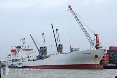
COPPENAME
Reefer
Current Trip
| Time Travelled | --- |
|---|---|
| Remaining Time | 1 h, 19 mins |
| Distance Travelled | 2216.85 nm |
| Remaining Distance | 5.40 nm |
| AVG Speed | 12.6 Noeuds |
| MAX Speed | 15.2 Noeuds |
| AVG Wind | 5.5 knots |
| MAX Wind | 12.7 knots |
| MIN Temp | 26.1°C / 78.98°F |
| MAX Temp | 29.8°C / 85.64°F |
| Tirant d eau | 6.8 m |
| Position reçue | 1 m depuis |
Current Position
| Longitude | 31.10237° |
|---|---|
| Latitude | -29.81003° |
| Etat | Under way using engine |
| Vitesse | 2.2 Noeuds |
| Parcours | 283° |
| Zone | Indian Ocean |
| Station | T-AIS |
| Position reçue | 1 m depuis |
Info
Information
The current position of COPPENAME is in Indian Ocean with coordinates -29.81003° / 31.10237° as reported on 2024-05-07 23:01 by AIS to our vessel tracker app. The vessel's current speed is 2.2 Noeuds and is heading at the port of DURBAN. The estimated time of arrival as calculated by MyShipTracking vessel tracking app is 2024-05-08 00:21 LT
The vessel COPPENAME (IMO: 8807636, MMSI: 311001173) is a Reefer that was built in 1990 ( 34 Age ). It's sailing under the flag of [BS] Bahamas.
In this page you can find informations about the vessels current position, last detected port calls, and current voyage information. If the vessels is not in coverage by AIS you will find the latest position.
The current position of COPPENAME is detected by our AIS receivers and we are not responsible for the reliability of the data. The last position was recorded while the vessel was in Coverage by the Ais receivers of our vessel tracking app.
The current draught of COPPENAME as reported by AIS is 6.8 meters
Weather
| Temperature | 19.9°C / 67.82°F |
|---|---|
| Wind Speed | 4 knots |
| Direction | 290° WNW |
| Pressure | 1016 hPa |
| Humidity | 40.8 % |
| Cloud Coverage | --- |
Featured Company
Last Port Calls
Most Visited Ports (Last year)
| Port | Arrivals | |
|---|---|---|
| 5 | ||
| 2 | ||
| 1 | ||
| 1 |
Last Trips
| Origin | Departure | Destination | Arrival | Distance |
|---|
Events
| Heure | Evenement | Détails | Position/ Destination | Info |
|---|---|---|---|---|
| 2024-05-07 22:42 | Tirant d'eau modifié | 6.8 6.7 |
-29.80244 / 31.12210
DURBAN
|
Vitesse: 2.9 kn Parcours: 320° |
| 2024-05-07 22:20 | Etat Changé | Under way using engine Default |
-29.80508 / 31.13024
DURBAN
|
Vitesse: 0.7 kn Parcours: 100° |
| 2024-05-07 22:14 | Etat Changé | Default Under way using engine |
-29.80420 / 31.13042
DURBAN
|
Vitesse: 0.8 kn Parcours: 107° |
| 2024-05-07 21:23 | Tirant d'eau modifié | 6.7 7 |
-29.75896 / 31.18884
DURBAN
|
Vitesse: 6.6 kn Parcours: 233.6° |
| 2024-05-07 21:03 | Démarrage | 13.09 nm, North East of DURBAN |
-29.73175 / 31.21162
DURBAN
|
Vitesse: 3.4 kn Parcours: 188° |
| 2024-05-07 21:00 | Etat Changé | Under way using engine Default |
-29.73000 / 31.21014
DURBAN
|
Vitesse: 0.6 kn Parcours: 86° |
| 2024-05-07 20:51 | Etat Changé | Default At anchor |
-29.72966 / 31.20876
DURBAN
|
Vitesse: 0.1 kn Parcours: 49° |
| 2024-05-07 20:45 | Etat Changé | At anchor Default |
-29.72990 / 31.20862
DURBAN
|
Vitesse: 0.3 kn Parcours: 52° |
| 2024-05-07 20:43 | Etat Changé | Default At anchor |
-29.72987 / 31.20863
DURBAN
|
Vitesse: 0.2 kn Parcours: 51° |
| 2024-05-07 20:39 | Etat Changé | At anchor Default |
-29.72983 / 31.20876
DURBAN
|
Vitesse: 0.2 kn Parcours: 54° |