

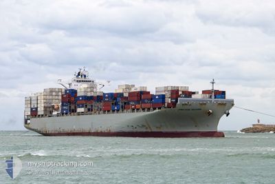
CMA CGM VOLTAIRE
Container Ship

Current Trip
| Time Travelled | 5 days |
|---|---|
| Remaining Time | 1 day |
| Distance Travelled | 2696.07 nm |
| Remaining Distance | 676.91 nm |
| AVG Speed | 18.4 Noeuds |
| MAX Speed | 20.6 Noeuds |
| AVG Wind | 11 knots |
| MAX Wind | 24.2 knots |
| MIN Temp | 14.6°C / 58.28°F |
| MAX Temp | 24.5°C / 76.1°F |
| Tirant d eau | 13.5 m |
| Position reçue | 4 d depuis |
Current Position
| Longitude | --- |
|---|---|
| Latitude | --- |
| Etat | Under way using engine |
| Vitesse | 18.9 Noeuds |
| Parcours | 244.8° |
| Zone | North Atlantic Ocean |
| Station | T-AIS |
| Position reçue | 4 d depuis |
Information
The current position of CMA CGM VOLTAIRE is in North Atlantic Ocean with coordinates 32.73490° / -14.83616° as reported on 2025-02-14 16:33 by AIS to our vessel tracker app. The vessel's current speed is 18.9 Noeuds and is heading at the port of FORT DE FRANCE. The estimated time of arrival as calculated by MyShipTracking vessel tracking app is 2025-02-20 15:35 LT
The vessel CMA CGM VOLTAIRE (IMO: 9635652, MMSI: 229877000) is a Container Ship that was built in 2013 ( 12 Age ). It's sailing under the flag of [MT] Malta.
In this page you can find informations about the vessels current position, last detected port calls, and current voyage information. If the vessels is not in coverage by AIS you will find the latest position.
The current position of CMA CGM VOLTAIRE is detected by our AIS receivers and we are not responsible for the reliability of the data. The last position was recorded while the vessel was in Coverage by the Ais receivers of our vessel tracking app.
The current draught of CMA CGM VOLTAIRE as reported by AIS is 13.5 meters
Weather
| Temperature | 24.4°C / 75.92°F |
|---|---|
| Wind Speed | 15 knots |
| Direction | 79° E |
| Pressure | 1018.5 hPa |
| Humidity | 64.6 % |
| Cloud Coverage | --- |


Featured Company
Last Port Calls
| Port | Arrival | Departure | Time In Port |
|---|---|---|---|
| 2025-02-12 19:53 | 2025-02-13 14:09 | 18 h | |
| 2025-02-07 18:59 | 2025-02-09 11:24 | 1 d | |
| 2025-02-04 08:11 | 2025-02-05 03:23 | 19 h | |
| 2025-01-31 12:03 | 2025-02-02 07:37 | 1 d | |
| 2025-01-29 00:55 | 2025-01-30 06:39 | 1 d | |
| 2025-01-25 11:50 | 2025-01-26 08:16 | 20 h | |
| 2025-01-15 14:51 | 2025-01-16 21:19 | 1 d | |
| 2025-01-11 08:08 | 2025-01-12 10:10 | 1 d | |
| 2025-01-03 14:50 | 2025-01-05 11:35 | 1 d | |
| 2024-12-30 20:14 | 2024-12-31 21:16 | 1 d |
Most Visited Ports (Last year)
| Port | Arrivals | |
|---|---|---|
| 11 | ||
| 8 | ||
| 6 | ||
| 6 | ||
| 6 | ||
| 6 |
Last Trips
| Origin | Departure | Destination | Arrival | Distance | |
|---|---|---|---|---|---|
| 2025-02-09 12:24 | 2025-02-12 20:53 | 517.82 nm | |||
| 2025-02-05 04:23 | 2025-02-07 19:59 | 187.33 nm | |||
| 2025-02-02 08:37 | 2025-02-04 09:11 | 409.77 nm | |||
| 2025-01-30 07:39 | 2025-01-31 13:03 | 552.30 nm | |||
| 2025-01-26 09:16 | 2025-01-29 01:55 | 1042.97 nm | |||
| 2025-01-16 16:19 | 2025-01-25 12:50 | 3945.54 nm | |||
| 2025-01-12 05:10 | 2025-01-15 09:51 | 525.42 nm | |||
| 2025-01-05 06:35 | 2025-01-11 03:08 | 1534.14 nm | |||
| 2024-12-31 16:16 | 2025-01-03 09:50 | 627.10 nm | |||
| 2024-12-27 07:33 | 2024-12-30 15:14 | 726.93 nm |
Events
| Heure | Evenement | Détails | Position/ Destination | Info |
|---|---|---|---|---|
| 2025-02-14 16:37 | Etat Changé | Default Under way using engine |
32.72596 / -14.85881
MQFDF
|
Vitesse: 18.9 kn Parcours: 244.8° |
| 2025-02-14 16:33 | Hors de la zone couverte |
32.73490 / -14.83616
North Atlantic Ocean
MQFDF
|
Vitesse: 18.9 kn Parcours: 244.8° |
|
| 2025-02-14 16:29 | Etat Changé | Under way using engine Default |
32.74462 / -14.81124
MQFDF
|
Vitesse: 19.1 kn Parcours: 247° |
| 2025-02-14 16:03 | Etat Changé | Default Under way using engine |
32.80271 / -14.66259
MQFDF
|
Vitesse: 18.9 kn Parcours: 244.3° |
| 2025-02-14 15:58 | Detecté en mer | Portuguese (Madeira) part of the North Atlantic Ocean |
32.81411 / -14.63426
North Atlantic Ocean
MQFDF
|
Vitesse: 18.9 kn Parcours: 244.3° |
| 2025-02-14 15:57 | Etat Changé | Under way using engine Default |
32.81521 / -14.63154
MQFDF
|
Vitesse: 18.9 kn Parcours: 244° |
| 2025-02-14 15:53 | Dans la zone couverte |
32.81411 / -14.63426
North Atlantic Ocean
MQFDF
|
Vitesse: 18.9 kn Parcours: 244.3° |
|
| 2025-02-13 17:05 | Etat Changé | Default Under way using engine |
35.95845 / -6.39994
MQFDF
|
Vitesse: 18.5 kn Parcours: 264.3° |
| 2025-02-13 16:58 | Hors de la zone couverte |
35.96293 / -6.35232
North Atlantic Ocean
MQFDF
|
Vitesse: 18.5 kn Parcours: 264.3° |
|
| 2025-02-13 16:09 | Changement d'ETA | 2025/02/20 16:00 2025/02/20 17:00 |
35.99376 / -6.04861
MQFDF
|
Vitesse: 18.2 kn Parcours: 272.2° |