

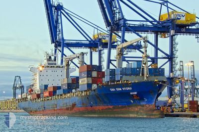
CMA CGM VITORIA
Container Ship

Current Trip
| Time Travelled | 6 h, 33 mins |
|---|---|
| Remaining Time | --- |
| Distance Travelled | --- |
| Remaining Distance | --- |
| AVG Speed | --- |
| MAX Speed | --- |
| AVG Wind | --- |
| MAX Wind | --- |
| MIN Temp | --- |
| MAX Temp | --- |
| Tirant d eau | 11.7 m |
| Position reçue | 6 d depuis |
Current Position
| Longitude | --- |
|---|---|
| Latitude | --- |
| Etat | Under way using engine |
| Vitesse | 14.5 Noeuds |
| Parcours | 187.7° |
| Zone | Gulf of Oman |
| Station | T-AIS |
| Position reçue | 6 d depuis |
Information
The current position of CMA CGM VITORIA is in Gulf of Oman with coordinates 24.68331° / 56.76794° as reported on 2025-03-04 04:22 by AIS to our vessel tracker app. The vessel's current speed is 14.5 Noeuds
The vessel CMA CGM VITORIA (IMO: 9434905, MMSI: 256171000) is a Container Ship that was built in 2008 ( 17 Age ). It's sailing under the flag of [MT] Malta.
In this page you can find informations about the vessels current position, last detected port calls, and current voyage information. If the vessels is not in coverage by AIS you will find the latest position.
The current position of CMA CGM VITORIA is detected by our AIS receivers and we are not responsible for the reliability of the data. The last position was recorded while the vessel was in Coverage by the Ais receivers of our vessel tracking app.
The current draught of CMA CGM VITORIA as reported by AIS is 11.7 meters
Weather
| Temperature | 26.5°C / 79.7°F |
|---|---|
| Wind Speed | 6 knots |
| Direction | 95° E |
| Pressure | 1010.4 hPa |
| Humidity | 73.5 % |
| Cloud Coverage | 35 % |


Featured Company
Last Port Calls
| Port | Arrival | Departure | Time In Port |
|---|---|---|---|
| 2025-03-09 08:05 | 2025-03-10 12:24 | 1 d | |
| 2025-03-04 07:34 | 2025-03-05 00:37 | 17 h | |
| 2025-03-02 11:49 | 2025-03-03 09:37 | 21 h | |
| 2025-02-27 04:21 | 2025-02-27 21:13 | 16 h | |
| 2025-02-24 05:57 | 2025-02-24 21:25 | 15 h | |
| 2025-02-22 12:41 | 2025-02-23 00:37 | 11 h | |
| 2025-02-15 15:34 | 2025-02-16 13:43 | 22 h | |
| 2025-02-11 21:37 | 2025-02-14 20:15 | 2 d | |
| 2025-02-10 10:34 | 2025-02-10 21:39 | 11 h | |
| 2025-02-06 07:54 | 2025-02-07 02:04 | 18 h |
Last Trips
| Origin | Departure | Destination | Arrival | Distance | |
|---|---|---|---|---|---|
| 2025-03-05 04:37 | 2025-03-09 11:05 | 1578.56 nm | |||
| 2025-03-03 13:37 | 2025-03-04 11:34 | 267.87 nm | |||
| 2025-02-28 01:13 | 2025-03-02 15:49 | 349.96 nm | |||
| 2025-02-25 02:55 | 2025-02-27 08:21 | 744.77 nm | |||
| 2025-02-23 06:07 | 2025-02-24 11:27 | 424.17 nm | |||
| 2025-02-16 16:43 | 2025-02-22 18:11 | 1611.90 nm | |||
| 2025-02-14 23:15 | 2025-02-15 18:34 | 257.73 nm | |||
| 2025-02-11 00:39 | 2025-02-12 00:37 | 151.15 nm | |||
| 2025-02-07 06:04 | 2025-02-10 13:34 | 503.55 nm | |||
| 2025-02-01 12:01 | 2025-02-06 11:54 | 801.62 nm |
Events
| Heure | Evenement | Détails | Position/ Destination | Info |
|---|---|---|---|---|
| 2025-03-10 12:24 | PORT DE DEPART |
|
11.62229 / 43.07503
OMSOH
|
Vitesse: 8.2 kn Parcours: 304° |
| 2025-03-10 12:02 | Démarrage |
11.60214 / 43.10431
[DJ] DJIBOUTI
|
Vitesse: 4.1 kn Parcours: 151° |
|
| 2025-03-09 08:10 | Arret |
11.59887 / 43.10591
[DJ] DJIBOUTI
|
Vitesse: 0.1 kn Parcours: 124° |
|
| 2025-03-09 08:05 | Port d'arrivée |
|
11.59914 / 43.10592
[DJ] DJIBOUTI
|
Vitesse: 1 kn Parcours: 129° |
| 2025-03-05 00:37 | PORT DE DEPART |
|
24.53059 / 56.62879
OMSOH
|
Vitesse: 7.5 kn Parcours: 1° |
| 2025-03-05 00:18 | Démarrage |
24.50634 / 56.62012
[OM] SOHAR
|
Vitesse: 5.2 kn Parcours: 140° |
|
| 2025-03-04 07:56 | Arret |
24.51232 / 56.61271
[OM] SOHAR
|
Vitesse: 0.2 kn Parcours: 323° |
|
| 2025-03-04 07:34 | Port d'arrivée |
|
24.50728 / 56.62840
[OM] SOHAR
|
Vitesse: 8.6 kn Parcours: 175° |
| 2025-03-04 04:29 | Etat Changé | Default Under way using engine |
24.66015 / 56.76249
OMSOH
|
Vitesse: 14.5 kn Parcours: 187.7° |
| 2025-03-04 04:22 | Hors de la zone couverte |
24.68331 / 56.76794
Gulf of Oman
OMSOH
|
Vitesse: 14.5 kn Parcours: 187.7° |