
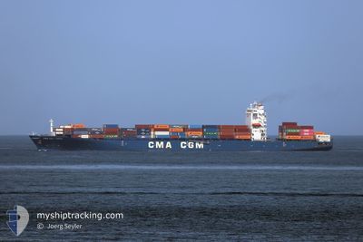
CMA CGM TOPAZ
Container Ship
Current Trip
| Time Travelled | 1 day |
|---|---|
| Remaining Time | --- |
| Distance Travelled | 451.61 nm |
| Remaining Distance | 1860.30 nm |
| AVG Speed | 12.6 Noeuds |
| MAX Speed | 13.3 Noeuds |
| AVG Wind | 16.4 knots |
| MAX Wind | 22 knots |
| MIN Temp | 17.5°C / 63.5°F |
| MAX Temp | 21.9°C / 71.42°F |
| Tirant d eau | 12.2 m |
| Position reçue | 25 d depuis |
Current Position
| Longitude | --- |
|---|---|
| Latitude | --- |
| Etat | Under way using engine |
| Vitesse | 14.8 Noeuds |
| Parcours | 177.1° |
| Zone | North Atlantic Ocean |
| Station | T-AIS |
| Position reçue | 25 d depuis |
Information
The current position of CMA CGM TOPAZ is in North Atlantic Ocean with coordinates 12.90591° / -17.79586° as reported on 2025-01-30 02:10 by AIS to our vessel tracker app. The vessel's current speed is 14.8 Noeuds and is heading at the port of TEMA.
The vessel CMA CGM TOPAZ (IMO: 9397602, MMSI: 636014169) is a Container Ship that was built in 2009 ( 16 Age ). It's sailing under the flag of [LR] Liberia.
In this page you can find informations about the vessels current position, last detected port calls, and current voyage information. If the vessels is not in coverage by AIS you will find the latest position.
The current position of CMA CGM TOPAZ is detected by our AIS receivers and we are not responsible for the reliability of the data. The last position was recorded while the vessel was in Coverage by the Ais receivers of our vessel tracking app.
The current draught of CMA CGM TOPAZ as reported by AIS is 12.2 meters
Weather
| Temperature | 17.5°C / 63.5°F |
|---|---|
| Wind Speed | 21 knots |
| Direction | 36° NE |
| Pressure | 1021 hPa |
| Humidity | 87.9 % |
| Cloud Coverage | --- |
Featured Company
Last Port Calls
| Port | Arrival | Departure | Time In Port |
|---|---|---|---|
| 2025-02-21 16:35 | 2025-02-22 14:43 | 22 h | |
| 2025-02-16 16:37 | 2025-02-18 14:19 | 1 d | |
| 2025-02-12 10:17 | 2025-02-13 20:57 | 1 d | |
| 2025-01-24 07:16 | 2025-01-25 09:54 | 1 d | |
| 2025-01-20 11:58 | 2025-01-21 07:00 | 19 h | |
| 2025-01-16 19:34 | 2025-01-18 01:40 | 1 d | |
| 2025-01-06 09:28 | 2025-01-07 18:18 | 1 d | |
| 2025-01-04 00:44 | 2025-01-05 06:20 | 1 d | |
| 2024-12-13 04:03 | 2024-12-14 17:40 | 1 d | |
| 2024-12-11 05:27 | 2024-12-11 21:05 | 15 h |
Most Visited Ports (Last year)
| Port | Arrivals | |
|---|---|---|
| 9 | ||
| 8 | ||
| 5 | ||
| 5 | ||
| 4 | ||
| 3 |
Last Trips
| Origin | Departure | Destination | Arrival | Distance | |
|---|---|---|---|---|---|
| 2025-02-18 14:19 | 2025-02-21 16:35 | 1184.94 nm | |||
| 2025-02-13 21:57 | 2025-02-16 16:37 | 473.46 nm | |||
| 2025-01-25 10:54 | 2025-02-12 11:17 | 3522.30 nm | |||
| 2025-01-21 08:00 | 2025-01-24 08:16 | 158.77 nm | |||
| 2025-01-18 01:40 | 2025-01-20 12:58 | 753.70 nm | |||
| 2025-01-07 19:18 | 2025-01-16 19:34 | 3267.01 nm | |||
| 2025-01-05 07:20 | 2025-01-06 10:28 | 299.56 nm | |||
| 2024-12-14 18:40 | 2025-01-04 01:44 | 3934.21 nm | |||
| 2024-12-11 22:05 | 2024-12-13 05:03 | 134.95 nm | |||
| 2024-12-10 01:17 | 2024-12-11 06:27 | 348.04 nm |
Events
| Heure | Evenement | Détails | Position/ Destination | Info |
|---|---|---|---|---|
| 2025-02-22 14:43 | PORT DE DEPART |
|
14.67800 / -17.41866
TEMA
|
Vitesse: 3.4 kn Parcours: 112° |
| 2025-02-22 14:39 | Démarrage |
14.67890 / -17.42407
[SN] DAKAR
|
Vitesse: 3.4 kn Parcours: 112° |
|
| 2025-02-21 16:47 | Arret |
14.68698 / -17.42757
[SN] DAKAR
|
Vitesse: 0.1 kn Parcours: 329° |
|
| 2025-02-21 16:35 | Port d'arrivée |
|
14.68344 / -17.42709
[SN] DAKAR
|
Vitesse: 7.6 kn Parcours: 273° |
| 2025-02-21 15:19 | Démarrage | 2.48 nm, South East of GOREE |
14.63686 / -17.37196
TEMA
|
Vitesse: 4.6 kn Parcours: 351° |
| 2025-02-21 14:15 | Arret | 2.25 nm, South East of GOREE |
14.64296 / -17.37082
TEMA
|
Vitesse: 0.2 kn Parcours: 343° |
| 2025-02-18 14:19 | PORT DE DEPART |
|
5.24492 / -3.99739
TEMA
|
Vitesse: 9.4 kn Parcours: 128° |
| 2025-02-18 13:59 | Démarrage |
5.27544 / -4.01799
[CI] ABIDJAN
|
Vitesse: 3.3 kn Parcours: 234° |
|
| 2025-02-16 16:37 | Arret |
5.27430 / -4.01351
[CI] ABIDJAN
|
Vitesse: 0.2 kn Parcours: 357° |
|
| 2025-02-16 16:37 | Port d'arrivée |
|
5.27430 / -4.01351
[CI] ABIDJAN
|
Vitesse: 0.6 kn Parcours: 359° |