

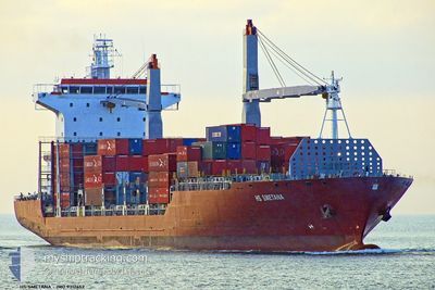
CMA CGM SUEZ
Container Ship

Current Trip
| Time Travelled | 7 days |
|---|---|
| Remaining Time | --- |
| Distance Travelled | 1956.82 nm |
| Remaining Distance | --- |
| AVG Speed | 12.8 Noeuds |
| MAX Speed | 17.6 Noeuds |
| AVG Wind | 13.1 knots |
| MAX Wind | 25 knots |
| MIN Temp | 5°C / 41°F |
| MAX Temp | 36.2°C / 97.16°F |
| Tirant d eau | 7.2 m |
| Position reçue | 2025-01-19 12:36 |
Current Position
| Longitude | --- |
|---|---|
| Latitude | --- |
| Etat | Under way using engine |
| Vitesse | 13.3 Noeuds |
| Parcours | 80.4° |
| Zone | Singapore Strait |
| Station | T-AIS |
| Position reçue | 2025-01-19 12:36 |
Information
The current position of CMA CGM SUEZ is in Singapore Strait with coordinates 1.24389° / 104.01985° as reported on 2025-01-19 12:36 by AIS to our vessel tracker app. The vessel's current speed is 13.3 Noeuds
The vessel CMA CGM SUEZ (IMO: 9312652, MMSI: 248269000) is a Container Ship that was built in 2006 ( 19 Age ). It's sailing under the flag of [MT] Malta.
In this page you can find informations about the vessels current position, last detected port calls, and current voyage information. If the vessels is not in coverage by AIS you will find the latest position.
The current position of CMA CGM SUEZ is detected by our AIS receivers and we are not responsible for the reliability of the data. The last position was recorded while the vessel was in Coverage by the Ais receivers of our vessel tracking app.
The current draught of CMA CGM SUEZ as reported by AIS is 7.2 meters
Weather
| Temperature | 26.3°C / 79.34°F |
|---|---|
| Wind Speed | 14 knots |
| Direction | 141° SE |
| Pressure | 1006.9 hPa |
| Humidity | 83 % |
| Cloud Coverage | 94 % |


Featured Company
Last Port Calls
| Port | Arrival | Departure | Time In Port |
|---|---|---|---|
| 2025-03-18 08:51 | 2025-03-18 21:28 | 12 h | |
| 2025-01-19 03:34 | 2025-01-19 11:05 | 7 h | |
| 2025-01-03 08:30 | 2025-01-04 13:54 | 1 d |
Last Trips
| Origin | Departure | Destination | Arrival | Distance | |
|---|---|---|---|---|---|
| 2025-01-19 19:05 | 2025-03-18 16:51 | 47.64 nm | |||
| 2025-01-04 15:54 | 2025-01-19 11:34 | 4106.58 nm | |||
| 2024-12-29 11:40 | 2025-01-03 10:30 | 954.46 nm |
Events
| Heure | Evenement | Détails | Position/ Destination | Info |
|---|---|---|---|---|
| 2025-03-25 07:30 | Démarrage | 16.86 nm, North West of PHU MY |
10.75366 / 106.78620
SG SIN >> CN SHG
|
Vitesse: 7.1 kn Parcours: 245° |
| 2025-03-24 12:43 | Arret | 16.76 nm, North West of PHU MY |
10.75744 / 106.79089
SG SIN >> CN SHG
|
Vitesse: Parcours: 62° |
| 2025-03-18 21:33 | Démarrage | 4.09 nm, South East of SHANGHAI |
31.33213 / 121.67419
SG SIN >> CN SHG
|
Vitesse: 7.6 kn Parcours: 105° |
| 2025-03-18 21:28 | PORT DE DEPART |
|
31.33213 / 121.67419
SG SIN >> CN SHG
|
Vitesse: Parcours: 303° |
| 2025-03-18 09:34 | Arret |
31.33472 / 121.66113
[CN] SHANGHAI
|
Vitesse: Parcours: 303° |
|
| 2025-03-18 08:51 | Port d'arrivée |
|
31.33472 / 121.66113
[CN] SHANGHAI
|
Vitesse: 6.6 kn Parcours: 117° |
| 2025-03-18 07:06 | Démarrage | 13.5 nm, South East of TAICANG |
31.52161 / 121.40030
SG SIN >> CN SHG
|
Vitesse: 9.7 kn Parcours: 145° |
| 2025-03-17 09:55 | Arret | 13.13 nm, South East of TAICANG |
31.52842 / 121.39747
SG SIN >> CN SHG
|
Vitesse: 0.1 kn Parcours: 288° |
| 2025-03-17 06:33 | Démarrage | 4.14 nm, East of SHANGHAI |
31.37746 / 121.68332
SG SIN >> CN SHG
|
Vitesse: 3.2 kn Parcours: 115° |