
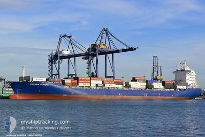
CMA CGM SEMARANG
Container Ship
Current Trip
| Time Travelled | 5 days |
|---|---|
| Remaining Time | 6 h, 2 mins |
| Distance Travelled | 1616.93 nm |
| Remaining Distance | 66.95 nm |
| AVG Speed | 13.4 Noeuds |
| MAX Speed | 20.9 Noeuds |
| AVG Wind | 16.5 knots |
| MAX Wind | 34.8 knots |
| MIN Temp | 19.5°C / 67.1°F |
| MAX Temp | 31.3°C / 88.34°F |
| Tirant d eau | 8.6 m |
| Position reçue | 1 m depuis |
Current Position
| Longitude | --- |
|---|---|
| Latitude | --- |
| Etat | Under way using engine |
| Vitesse | 9.8 Noeuds |
| Parcours | 180.6° |
| Zone | South Pacific Ocean |
| Station | T-AIS |
| Position reçue | 1 m depuis |
Info
Information
The current position of CMA CGM SEMARANG is in South Pacific Ocean with coordinates -35.91528° / 174.89452° as reported on 2025-02-17 10:05 by AIS to our vessel tracker app. The vessel's current speed is 9.8 Noeuds and is heading at the port of AUCKLAND. The estimated time of arrival as calculated by MyShipTracking vessel tracking app is 2025-02-17 16:08 LT
The vessel CMA CGM SEMARANG (IMO: 9377133, MMSI: 229756000) is a Container Ship that was built in 2007 ( 18 Age ). It's sailing under the flag of [MT] Malta.
In this page you can find informations about the vessels current position, last detected port calls, and current voyage information. If the vessels is not in coverage by AIS you will find the latest position.
The current position of CMA CGM SEMARANG is detected by our AIS receivers and we are not responsible for the reliability of the data. The last position was recorded while the vessel was in Coverage by the Ais receivers of our vessel tracking app.
The current draught of CMA CGM SEMARANG as reported by AIS is 8.6 meters
Weather
| Temperature | 21.6°C / 70.88°F |
|---|---|
| Wind Speed | 11 knots |
| Direction | 252° WSW |
| Pressure | 1005.6 hPa |
| Humidity | 94 % |
| Cloud Coverage | 66 % |
Featured Company
Last Port Calls
| Port | Arrival | Departure | Time In Port |
|---|---|---|---|
| 2025-02-10 18:36 | 2025-02-12 07:18 | 1 d | |
| 2025-02-08 01:43 | 2025-02-09 03:57 | 1 d | |
| 2025-02-03 17:02 | 2025-02-04 13:21 | 20 h | |
| 2025-01-30 03:48 | 2025-01-30 18:59 | 15 h | |
| 2025-01-28 08:57 | 2025-01-29 07:05 | 22 h | |
| 2025-01-25 07:35 | 2025-01-26 02:36 | 19 h | |
| 2025-01-23 20:49 | 2025-01-24 11:48 | 14 h | |
| 2025-01-21 00:52 | 2025-01-21 23:31 | 22 h | |
| 2025-01-13 17:35 | 2025-01-14 19:57 | 1 d | |
| 2025-01-08 19:48 | 2025-01-09 11:11 | 15 h |
Last Trips
| Origin | Departure | Destination | Arrival | Distance | |
|---|---|---|---|---|---|
| 2025-02-09 14:57 | 2025-02-11 05:36 | 593.50 nm | |||
| 2025-02-05 02:21 | 2025-02-08 12:43 | 1362.16 nm | |||
| 2025-01-31 07:59 | 2025-02-04 06:02 | 317.83 nm | |||
| 2025-01-29 20:05 | 2025-01-30 16:48 | 340.37 nm | |||
| 2025-01-26 15:36 | 2025-01-28 21:57 | 442.74 nm | |||
| 2025-01-25 00:48 | 2025-01-25 20:35 | 214.35 nm | |||
| 2025-01-22 12:31 | 2025-01-24 09:49 | 689.90 nm | |||
| 2025-01-15 06:57 | 2025-01-21 13:52 | 1691.24 nm | |||
| 2025-01-10 00:11 | 2025-01-14 04:35 | 1745.77 nm | |||
| 2025-01-07 12:08 | 2025-01-09 08:48 | 586.93 nm |
Events
| Heure | Evenement | Détails | Position/ Destination | Info |
|---|---|---|---|---|
| 2025-02-17 07:02 | Etat Changé | Under way using engine Default |
-35.39880 / 174.89400
NZAKL
|
Vitesse: 13.5 kn Parcours: 186° |
| 2025-02-17 07:00 | Etat Changé | Default Under way using engine |
-35.38746 / 174.89452
NZAKL
|
Vitesse: 13.5 kn Parcours: 137.3° |
| 2025-02-17 06:48 | Etat Changé | Under way using engine Default |
-35.35630 / 174.86328
NZAKL
|
Vitesse: 13.6 kn Parcours: 127° |
| 2025-02-17 06:37 | Etat Changé | Default Under way using engine |
-35.33012 / 174.82318
NZAKL
|
Vitesse: 13.5 kn Parcours: 128.2° |
| 2025-02-17 01:56 | Changement d'ETA | 2025/03/02 16:00 2025/02/17 15:30 |
-34.70796 / 173.81465
NZAKL
|
Vitesse: 13.4 kn Parcours: 126.8° |
| 2025-02-17 01:52 | Etat Changé | Under way using engine Default |
-34.69908 / 173.80044
NZAKL
|
Vitesse: 13.4 kn Parcours: 127° |
| 2025-02-17 01:44 | Etat Changé | Default Under way using engine |
-34.68133 / 173.77150
NZAKL
|
Vitesse: 13.8 kn Parcours: 127.2° |
| 2025-02-17 01:43 | Etat Changé | Under way using engine Default |
-34.67909 / 173.76784
NZAKL
|
Vitesse: 13.3 kn Parcours: 130° |
| 2025-02-17 01:43 | Changement de zone | New Zealand part of the South Pacific Ocean Australian part of the Tasman Sea |
-34.67909 / 173.76784
South Pacific Ocean
NZAKL
|
Vitesse: 13.8 kn Parcours: 127.2° |
| 2025-02-17 01:36 | Dans la zone couverte |
-34.67909 / 173.76784
South Pacific Ocean
NZAKL
|
Vitesse: 13.8 kn Parcours: 127.2° |