
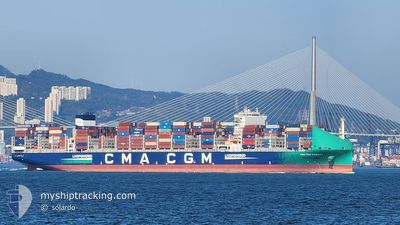
CMA CGM PARATY
Cargo A
Current Trip
| Time Travelled | --- |
|---|---|
| Remaining Time | 3 h, 9 mins |
| Distance Travelled | --- |
| Remaining Distance | 180.05 nm |
| AVG Speed | --- |
| MAX Speed | --- |
| AVG Wind | --- |
| MAX Wind | --- |
| MIN Temp | --- |
| MAX Temp | --- |
| Tirant d eau | 11.1 m |
| Position reçue | 7 h, 42 m depuis |
Current Position
| Longitude | --- |
|---|---|
| Latitude | --- |
| Etat | Under way using engine |
| Vitesse | 17.8 Noeuds |
| Parcours | 39.2° |
| Zone | South Atlantic Ocean |
| Station | T-AIS |
| Position reçue | 7 h, 42 m depuis |
Information
The current position of CMA CGM PARATY is in South Atlantic Ocean with coordinates -26.46226° / -48.16931° as reported on 2025-03-12 19:26 by AIS to our vessel tracker app. The vessel's current speed is 17.8 Noeuds and is heading at the port of SANTOS. The estimated time of arrival as calculated by MyShipTracking vessel tracking app is 2025-03-13 06:17 LT
The vessel CMA CGM PARATY (IMO: 9938262, MMSI: 256807000) is a Cargo A It's sailing under the flag of [MT] Malta.
In this page you can find informations about the vessels current position, last detected port calls, and current voyage information. If the vessels is not in coverage by AIS you will find the latest position.
The current position of CMA CGM PARATY is detected by our AIS receivers and we are not responsible for the reliability of the data. The last position was recorded while the vessel was in Coverage by the Ais receivers of our vessel tracking app.
The current draught of CMA CGM PARATY as reported by AIS is 11.1 meters
Weather
| Temperature | 26.5°C / 79.7°F |
|---|---|
| Wind Speed | 5 knots |
| Direction | 82° E |
| Pressure | 1014.2 hPa |
| Humidity | 74.9 % |
| Cloud Coverage | 100 % |
Featured Company
Last Trips
Events
| Heure | Evenement | Détails | Position/ Destination | Info |
|---|---|---|---|---|
| 2025-03-12 19:26 | Hors de la zone couverte |
-26.46226 / -48.16931
South Atlantic Ocean
BRSSZ
|
Vitesse: 17.8 kn Parcours: 39.2° |
|
| 2025-03-12 17:04 | Changement de destination | BRSSZ BRNVT |
-26.91200 / -48.61562
BRSSZ
|
Vitesse: 10.3 kn Parcours: 83.6° |
| 2025-03-12 17:04 | Changement d'ETA | 2025/03/14 10:00 2025/03/10 08:00 |
-26.91200 / -48.61562
BRSSZ
|
Vitesse: 10.3 kn Parcours: 83.6° |
| 2025-03-12 17:01 | Dans la zone couverte |
-26.91284 / -48.62440
South Atlantic Ocean
|
Vitesse: 9.6 kn Parcours: 84.7° |
|
| 2025-03-11 11:49 | Hors de la zone couverte |
-26.91284 / -48.62000
South Atlantic Ocean
|
Vitesse: 9 kn Parcours: 264.9° |
|
| 2025-03-11 10:00 | Démarrage | 9.27 nm, East of CAMBORIU |
-26.99522 / -48.43130
BRNVT
|
Vitesse: 3.1 kn Parcours: 12° |
| 2025-03-11 04:32 | Arret | 9.61 nm, North East of PORTO BELO |
-27.03769 / -48.41616
BRNVT
|
Vitesse: 0.3 kn Parcours: 90° |
| 2025-03-10 12:41 | Démarrage | 13.6 nm, East of NAVEGANTES |
-26.81718 / -48.42399
BRNVT
|
Vitesse: 3.1 kn Parcours: 188° |
| 2025-03-10 07:43 | Arret | 12.25 nm, North East of CAMBORIU |
-26.88198 / -48.41839
BRNVT
|
Vitesse: 0.3 kn Parcours: 107° |
| 2025-03-10 05:14 | Tirant d'eau modifié | 11.1 11.8 |
-26.48437 / -48.30924
BRNVT
|
Vitesse: 12.1 kn Parcours: 193.2° |