
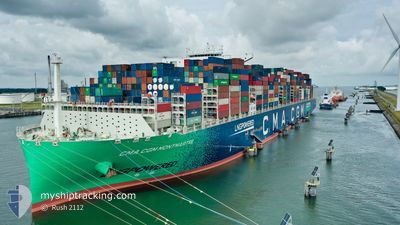
CMA CGM MONTMARTRE
Cargo A
Current Trip
| Time Travelled | 3 days |
|---|---|
| Remaining Time | 1 day |
| Distance Travelled | 1836.25 nm |
| Remaining Distance | 713.47 nm |
| AVG Speed | 18.8 Noeuds |
| MAX Speed | 23.3 Noeuds |
| AVG Wind | 6.7 knots |
| MAX Wind | 20.9 knots |
| MIN Temp | 24.6°C / 76.28°F |
| MAX Temp | 30.4°C / 86.72°F |
| Tirant d eau | 11.2 m |
| Position reçue | 1 h, 35 m depuis |
Current Position
| Longitude | 122.26568° |
|---|---|
| Latitude | 24.82177° |
| Etat | Under way using engine |
| Vitesse | 22.9 Noeuds |
| Parcours | 12.3° |
| Zone | Philippine Sea |
| Station | T-AIS |
| Position reçue | 1 h, 35 m depuis |
Info
Information
The current position of CMA CGM MONTMARTRE is in Philippine Sea with coordinates 24.82177° / 122.26568° as reported on 2024-05-07 08:14 by AIS to our vessel tracker app. The vessel's current speed is 22.9 Noeuds and is heading at the port of QINGDAO. The estimated time of arrival as calculated by MyShipTracking vessel tracking app is 2024-05-08 17:22 LT
The vessel CMA CGM MONTMARTRE (IMO: 9839155, MMSI: 228397700) is a Cargo A It's sailing under the flag of [FR] France.
In this page you can find informations about the vessels current position, last detected port calls, and current voyage information. If the vessels is not in coverage by AIS you will find the latest position.
The current position of CMA CGM MONTMARTRE is detected by our AIS receivers and we are not responsible for the reliability of the data. The last position was recorded while the vessel was in Coverage by the Ais receivers of our vessel tracking app.
The current draught of CMA CGM MONTMARTRE as reported by AIS is 11.2 meters
Weather
| Temperature | 24.8°C / 76.64°F |
|---|---|
| Wind Speed | 10 knots |
| Direction | 64° ENE |
| Pressure | 1014 hPa |
| Humidity | 67.3 % |
| Cloud Coverage | 100 % |
Featured Company
Last Port Calls
| Port | Arrival | Departure | Time In Port |
|---|---|---|---|
| 2024-05-02 05:07 | 2024-05-03 13:56 | 1 d | |
| 2024-04-06 23:26 | 2024-04-08 13:23 | 1 d | |
| 2024-04-01 03:11 | 2024-04-02 21:19 | 1 d | |
| 2024-03-26 12:05 | 2024-03-29 23:37 | 3 d | |
| 2024-03-22 15:40 | 2024-03-25 19:28 | 3 d | |
| 2024-03-20 23:02 | 2024-03-22 07:03 | 1 d | |
| 2024-03-17 01:48 | 2024-03-17 23:59 | 22 h |
Most Visited Ports (Last year)
| Port | Arrivals | |
|---|---|---|
| 7 | ||
| 6 | ||
| 5 | ||
| 5 | ||
| 5 | ||
| 3 |
Last Trips
| Origin | Departure | Destination | Arrival | Distance | |
|---|---|---|---|---|---|
| 2024-04-08 13:23 | 2024-05-02 13:07 | 10750.25 nm | |||
| 2024-04-02 23:19 | 2024-04-06 23:26 | 1437.95 nm | |||
| 2024-03-29 23:37 | 2024-04-01 05:11 | 275.93 nm | |||
| 2024-03-25 20:28 | 2024-03-26 12:05 | 260.86 nm | |||
| 2024-03-22 08:03 | 2024-03-22 16:40 | 131.96 nm | |||
| 2024-03-17 23:59 | 2024-03-21 00:02 | 1300.97 nm | |||
| 2024-02-19 14:54 | 2024-03-17 01:48 | 10733.99 nm |
Events
| Heure | Evenement | Détails | Position/ Destination | Info |
|---|---|---|---|---|
| 2024-05-07 08:20 | Etat Changé | Default Under way using engine |
24.85500 / 122.27167
SGSIN>CNTAO
|
Vitesse: 22.9 kn Parcours: 12.3° |
| 2024-05-07 08:14 | Etat Changé | Under way using engine Default |
24.82177 / 122.26568
SGSIN>CNTAO
|
Vitesse: 23.1 kn Parcours: 12° |
| 2024-05-07 08:14 | Hors de la zone couverte |
24.82177 / 122.26568
Philippine Sea
SGSIN>CNTAO
|
Vitesse: 22.9 kn Parcours: 12.3° |
|
| 2024-05-07 08:12 | Etat Changé | Default Under way using engine |
24.80482 / 122.26168
SGSIN>CNTAO
|
Vitesse: 23.1 kn Parcours: 13.8° |
| 2024-05-07 08:05 | Changement de zone | Taiwanese part of the Philippine Sea Malaysian part of the South China Sea |
24.76468 / 122.25223
Philippine Sea
SGSIN>CNTAO
|
Vitesse: 23.1 kn Parcours: 13.8° |
| 2024-05-07 08:05 | Etat Changé | Under way using engine Default |
24.76156 / 122.25141
SGSIN>CNTAO
|
Vitesse: 23 kn Parcours: 14° |
| 2024-05-07 07:48 | Dans la zone couverte |
24.76468 / 122.25223
Philippine Sea
SGSIN>CNTAO
|
Vitesse: 23.1 kn Parcours: 13.8° |
|
| 2024-05-03 17:04 | Etat Changé | Default Under way using engine |
1.33834 / 104.37727
SGSIN>CNTAO
|
Vitesse: 17.7 kn Parcours: 48° |
| 2024-05-03 16:58 | Changement de zone | Malaysian part of the South China Sea Malaysian part of the Singapore Strait |
1.31856 / 104.35469
South China Sea
SGSIN>CNTAO
|
Vitesse: 17.7 kn Parcours: 48° |
| 2024-05-03 16:58 | Hors de la zone couverte |
1.31856 / 104.35469
South China Sea
SGSIN>CNTAO
|
Vitesse: 17.7 kn Parcours: 48° |