
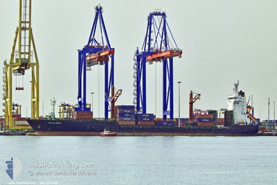
CMA CGM MAPUTO
Cargo A
Current Trip
| Trip Time | 3 days |
|---|---|
| Trip Distance | 195.50 nm |
| AVG Speed | 12.7 Noeuds |
| MAX Speed | 17.3 Noeuds |
| Tirant d eau | 10.8 m |
| AVG Wind | 9 knots |
| MAX Wind | 20 knots |
| MIN Temp | 11.5°C / 52.7°F |
| MAX Temp | 18.7°C / 65.66°F |
| Position reçue | 7 h, 7 m depuis |
Current Position
| Longitude | --- |
|---|---|
| Latitude | --- |
| Etat | Moored |
| Vitesse | |
| Parcours | 34° |
| Zone | Mediterranean Sea - Eastern Basin |
| Station | T-AIS |
| Position reçue | 7 h, 7 m depuis |
Info
Information
The current position of CMA CGM MAPUTO is in Mediterranean Sea - Eastern Basin with coordinates 36.80147° / 34.64231° as reported on 2025-03-06 18:29 by AIS to our vessel tracker app. The vessel's current speed is 0 Noeuds and is currently inside the port of MERSIN.
The vessel CMA CGM MAPUTO (IMO: 9491628, MMSI: 229786000) is a Cargo A It's sailing under the flag of [MT] Malta.
In this page you can find informations about the vessels current position, last detected port calls, and current voyage information. If the vessels is not in coverage by AIS you will find the latest position.
The current position of CMA CGM MAPUTO is detected by our AIS receivers and we are not responsible for the reliability of the data. The last position was recorded while the vessel was in Coverage by the Ais receivers of our vessel tracking app.
The current draught of CMA CGM MAPUTO as reported by AIS is 10.7 meters
Weather
| Temperature | 15.1°C / 59.18°F |
|---|---|
| Wind Speed | 7 knots |
| Direction | 67° ENE |
| Pressure | 1019.7 hPa |
| Humidity | 50.9 % |
| Cloud Coverage | 59 % |
Featured Company
Last Port Calls
| Port | Arrival | Departure | Time In Port |
|---|---|---|---|
| 2025-03-06 02:39 | |||
| 2025-03-01 16:48 | 2025-03-02 04:53 | 12 h | |
| 2025-02-28 05:26 | 2025-02-28 22:21 | 16 h | |
| 2025-02-27 02:12 | 2025-02-27 15:03 | 12 h | |
| 2025-02-24 01:00 | 2025-02-25 13:28 | 1 d | |
| 2025-02-15 21:24 | 2025-02-17 06:33 | 1 d | |
| 2025-02-12 15:17 | 2025-02-13 07:30 | 16 h | |
| 2025-02-10 00:36 | 2025-02-12 02:10 | 2 d | |
| 2025-02-07 19:29 | 2025-02-09 10:47 | 1 d | |
| 2025-02-03 18:44 | 2025-02-04 05:15 | 10 h |
Most Visited Ports (Last year)
| Port | Arrivals | |
|---|---|---|
| 15 | ||
| 11 | ||
| 9 | ||
| 9 | ||
| 9 | ||
| 9 |
Last Trips
| Origin | Departure | Destination | Arrival | Distance | |
|---|---|---|---|---|---|
| 2025-03-02 06:53 | 2025-03-06 05:39 | 195.50 nm | |||
| 2025-03-01 00:21 | 2025-03-01 18:48 | 295.83 nm | |||
| 2025-02-27 17:03 | 2025-02-28 07:26 | 214.73 nm | |||
| 2025-02-25 15:28 | 2025-02-27 04:12 | 571.03 nm | |||
| 2025-02-17 08:33 | 2025-02-24 03:00 | 297.21 nm | |||
| 2025-02-13 08:30 | 2025-02-15 23:24 | 760.22 nm | |||
| 2025-02-12 04:10 | 2025-02-12 16:17 | 207.75 nm | |||
| 2025-02-09 11:47 | 2025-02-10 02:36 | 212.30 nm | |||
| 2025-02-04 07:15 | 2025-02-07 20:29 | 1102.72 nm | |||
| 2025-02-03 09:43 | 2025-02-03 20:44 | 190.03 nm |
Events
| Heure | Evenement | Détails | Position/ Destination | Info |
|---|---|---|---|---|
| 2025-03-06 18:29 | Hors de la zone couverte |
36.80147 / 34.64231
Mediterranean Sea - Eastern Basin
[TR] MERSIN
|
Vitesse: Parcours: 65° |
|
| 2025-03-06 18:29 | Etat Changé | Moored Default |
36.80147 / 34.64231
[TR] MERSIN
|
Vitesse: Parcours: 34° |
| 2025-03-06 18:20 | Etat Changé | Default Moored |
36.80151 / 34.64227
[TR] MERSIN
|
Vitesse: Parcours: 34° |
| 2025-03-06 16:53 | Etat Changé | Moored Default |
36.80152 / 34.64225
[TR] MERSIN
|
Vitesse: Parcours: 34° |
| 2025-03-06 16:38 | Dans la zone couverte |
36.80152 / 34.64225
Mediterranean Sea - Eastern Basin
[TR] MERSIN
|
Vitesse: Parcours: 234.6° |
|
| 2025-03-06 13:11 | Etat Changé | Default Moored |
36.80151 / 34.64225
[TR] MERSIN
|
Vitesse: Parcours: 34° |
| 2025-03-06 13:05 | Etat Changé | Moored Default |
36.80151 / 34.64225
[TR] MERSIN
|
Vitesse: Parcours: 34° |
| 2025-03-06 13:05 | Hors de la zone couverte |
36.80151 / 34.64225
Mediterranean Sea - Eastern Basin
[TR] MERSIN
|
Vitesse: Parcours: 105.9° |
|
| 2025-03-06 12:59 | Etat Changé | Default Moored |
36.80152 / 34.64225
[TR] MERSIN
|
Vitesse: Parcours: 34° |
| 2025-03-06 12:53 | Etat Changé | Moored Default |
36.80152 / 34.64224
[TR] MERSIN
|
Vitesse: Parcours: 34° |