
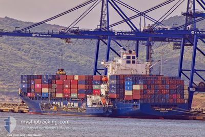
CMA CGM LAPIS
Container Ship
Current Trip
| Time Travelled | 1 day |
|---|---|
| Remaining Time | 3 h, 4 mins |
| Distance Travelled | 636.90 nm |
| Remaining Distance | 73.91 nm |
| AVG Speed | 13.8 Noeuds |
| MAX Speed | 16.2 Noeuds |
| AVG Wind | 8.7 knots |
| MAX Wind | 30 knots |
| MIN Temp | 14.5°C / 58.1°F |
| MAX Temp | 21.2°C / 70.16°F |
| Tirant d eau | 10.2 m |
| Position reçue | 59 m depuis |
Current Position
| Longitude | --- |
|---|---|
| Latitude | --- |
| Etat | Under way using engine |
| Vitesse | 13.1 Noeuds |
| Parcours | 57.8° |
| Zone | Aegean Sea |
| Station | T-AIS |
| Position reçue | 59 m depuis |
Info
Information
The current position of CMA CGM LAPIS is in Aegean Sea with coordinates 38.64444° / 25.77420° as reported on 2025-12-07 15:00 by AIS to our vessel tracker app. The vessel's current speed is 13.1 Noeuds and is heading at the port of ALIAGA. The estimated time of arrival as calculated by MyShipTracking vessel tracking app is 2025-12-07 22:04 LT
The vessel CMA CGM LAPIS (IMO: 9386495, MMSI: 636014199) is a Container Ship that was built in 2009 ( 16 Age ). It's sailing under the flag of [LR] Liberia.
In this page you can find informations about the vessels current position, last detected port calls, and current voyage information. If the vessels is not in coverage by AIS you will find the latest position.
The current position of CMA CGM LAPIS is detected by our AIS receivers and we are not responsible for the reliability of the data. The last position was recorded while the vessel was in Coverage by the Ais receivers of our vessel tracking app.
The current draught of CMA CGM LAPIS as reported by AIS is 10.2 meters
Weather
| Temperature | 15.5°C / 59.9°F |
|---|---|
| Wind Speed | 17 knots |
| Direction | 16° NNE |
| Pressure | 1009.5 hPa |
| Humidity | 74.3 % |
| Cloud Coverage | 20 % |
Featured Company
Last Port Calls
| Port | Arrival | Departure | Time In Port |
|---|---|---|---|
| 2025-12-04 20:49 | 2025-12-05 20:37 | 23 h | |
| 2025-11-12 19:40 | 2025-11-13 19:28 | 23 h | |
| 2025-11-09 16:01 | 2025-11-10 07:36 | 15 h | |
| 2025-11-08 12:20 | 2025-11-08 13:14 | 53 m | |
| 2025-11-07 14:19 | 2025-11-07 15:23 | 1 h | |
| 2025-10-22 21:51 | 2025-10-23 15:13 | 17 h | |
| 2025-10-21 02:08 | 2025-10-21 23:25 | 21 h | |
| 2025-10-19 15:16 | 2025-10-20 02:28 | 11 h | |
| 2025-10-16 19:54 | 2025-10-17 18:49 | 22 h |
Last Trips
| Origin | Departure | Destination | Arrival | Distance | |
|---|---|---|---|---|---|
| 2025-11-13 19:28 | 2025-12-04 20:49 | 5893.32 nm | |||
| 2025-11-10 07:36 | 2025-11-12 19:40 | 516.34 nm | |||
| 2025-11-08 13:14 | 2025-11-09 16:01 | 309.81 nm | |||
| 2025-11-07 15:23 | 2025-11-08 12:20 | 6.57 nm | |||
| 2025-10-23 15:13 | 2025-11-07 14:19 | 5031.86 nm | |||
| 2025-10-21 23:25 | 2025-10-22 21:51 | 352.77 nm | |||
| 2025-10-20 02:28 | 2025-10-21 02:08 | 260.78 nm | |||
| 2025-10-17 18:49 | 2025-10-19 15:16 | 694.31 nm | |||
| 2025-09-21 08:38 | 2025-10-16 19:54 | 5905.20 nm |
Events
| Heure | Evenement | Détails | Position/ Destination | Info |
|---|---|---|---|---|
| 2025-12-07 15:11 | Etat Changé | Default Under way using engine |
38.66308 / 25.81769
TRALI
|
Vitesse: 13.1 kn Parcours: 57.8° |
| 2025-12-07 15:00 | Etat Changé | Under way using engine Default |
38.64444 / 25.77420
TRALI
|
Vitesse: 14 kn Parcours: 6° |
| 2025-12-07 15:00 | Dans la zone couverte |
38.64444 / 25.77420
Aegean Sea
TRALI
|
Vitesse: 13.1 kn Parcours: 57.8° |
|
| 2025-12-07 09:51 | Hors de la zone couverte |
37.46935 / 25.83536
Aegean Sea
TRALI
|
Vitesse: 14.5 kn Parcours: 325.1° |
|
| 2025-12-07 07:04 | Tirant d'eau modifié | 10.2 10 |
37.13644 / 26.51394
TRALI
|
Vitesse: 12.9 kn Parcours: 300.4° |
| 2025-12-07 07:04 | Changement d'ETA | 2025/12/07 19:00 |
37.13644 / 26.51394
TRALI
|
Vitesse: 12.9 kn Parcours: 300.4° |
| 2025-12-07 05:58 | Tirant d'eau modifié | 10 10.2 |
36.94224 / 26.66974
TRALI
|
Vitesse: 13.6 kn Parcours: 347.4° |
| 2025-12-07 05:52 | Tirant d'eau modifié | 10.2 10 |
36.91996 / 26.67611
TRALI
|
Vitesse: 13.5 kn Parcours: 347° |
| 2025-12-07 05:52 | Changement d'ETA | 2025/12/07 19:00 |
36.91996 / 26.67611
TRALI
|
Vitesse: 13.5 kn Parcours: 347° |
| 2025-12-07 05:46 | Tirant d'eau modifié | 10 10.2 |
36.89789 / 26.68229
TRALI
|
Vitesse: 13.4 kn Parcours: 347° |