
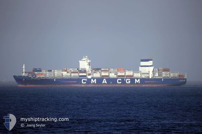
CMA CGM COLUMBIA
Cargo A
Current Trip
DJJIB
| Time Travelled | 18 h, 11 mins |
|---|---|
| Remaining Time | --- |
| Distance Travelled | 41.80 nm |
| Remaining Distance | --- |
| AVG Speed | 16.3 Noeuds |
| MAX Speed | 18 Noeuds |
| AVG Wind | 10.3 knots |
| MAX Wind | 14 knots |
| MIN Temp | 24.9°C / 76.82°F |
| MAX Temp | 26.8°C / 80.24°F |
| Tirant d eau | 14.5 m |
| Position reçue | 10 d depuis |
Current Position
| Longitude | --- |
|---|---|
| Latitude | --- |
| Etat | Under way using engine |
| Vitesse | 18.5 Noeuds |
| Parcours | 310.4° |
| Zone | Malacca Strait |
| Station | T-AIS |
| Position reçue | 10 d depuis |
Info
Information
The current position of CMA CGM COLUMBIA is in Malacca Strait with coordinates 3.22973° / 100.59778° as reported on 2025-12-26 13:00 by AIS to our vessel tracker app. The vessel's current speed is 18.5 Noeuds
The vessel CMA CGM COLUMBIA (IMO: 9722663, MMSI: 256968000) is a Cargo A It's sailing under the flag of [MT] Malta.
In this page you can find informations about the vessels current position, last detected port calls, and current voyage information. If the vessels is not in coverage by AIS you will find the latest position.
The current position of CMA CGM COLUMBIA is detected by our AIS receivers and we are not responsible for the reliability of the data. The last position was recorded while the vessel was in Coverage by the Ais receivers of our vessel tracking app.
The current draught of CMA CGM COLUMBIA as reported by AIS is 14.5 meters
Weather
| Temperature | 25.2°C / 77.36°F |
|---|---|
| Wind Speed | 11 knots |
| Direction | 130° SE |
| Pressure | 1016.4 hPa |
| Humidity | 65 % |
| Cloud Coverage | 32 % |
Featured Company
Last Port Calls
| Port | Arrival | Departure | Time In Port |
|---|---|---|---|
| 2026-01-03 22:29 | 2026-01-05 12:43 | 1 d | |
| 2025-12-25 01:28 | 2025-12-26 06:46 | 1 d | |
| 2025-12-17 09:22 | 2025-12-18 01:32 | 16 h | |
| 2025-12-15 12:14 | 2025-12-16 05:18 | 17 h | |
| 2025-12-10 04:00 | 2025-12-10 18:04 | 14 h | |
| 2025-12-08 06:05 | 2025-12-08 22:33 | 16 h | |
| 2025-12-02 17:01 |
Last Trips
| Origin | Departure | Destination | Arrival | Distance | |
|---|---|---|---|---|---|
| 2025-12-26 06:46 | 2026-01-03 22:29 | 3816.92 nm | |||
| 2025-12-18 01:32 | 2025-12-25 01:28 | 1601.50 nm | |||
| 2025-12-16 05:18 | 2025-12-17 09:22 | 119.98 nm | |||
| 2025-12-10 18:04 | 2025-12-15 12:14 | 1007.88 nm | |||
| 2025-12-08 22:33 | 2025-12-10 04:00 | 440.56 nm | |||
| 2025-12-02 17:01 | 2025-12-08 06:05 | 301.78 nm |
Events
| Heure | Evenement | Détails | Position/ Destination | Info |
|---|---|---|---|---|
| 2026-01-05 09:43 | PORT DE DEPART |
|
11.61333 / 43.07834
DJJIB
|
Vitesse: 7.7 kn Parcours: 283° |
| 2026-01-05 09:33 | Démarrage |
11.60874 / 43.09894
[DJ] DJIBOUTI
|
Vitesse: 3.9 kn Parcours: 283° |
|
| 2026-01-03 20:03 | Arret |
11.59833 / 43.10667
[DJ] DJIBOUTI
|
Vitesse: Parcours: -1° |
|
| 2026-01-03 19:29 | Port d'arrivée |
|
11.61022 / 43.09555
[DJ] DJIBOUTI
|
Vitesse: 4.1 kn Parcours: 122° |
| 2026-01-03 18:55 | Démarrage | 4.05 nm, West of DJIBOUTI |
11.63176 / 43.06058
DJJIB
|
Vitesse: 4.3 kn Parcours: 130° |
| 2026-01-03 18:18 | Arret | 4.55 nm, West of DJIBOUTI |
11.63667 / 43.05333
DJJIB
|
Vitesse: Parcours: -1° |