
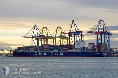
CMA CGM BETTER WAYS
Cargo
Current Trip
| Time Travelled | 4 days |
|---|---|
| Remaining Time | 4 days |
| Distance Travelled | 1992.01 nm |
| Remaining Distance | 2156.86 nm |
| AVG Speed | 18.1 Noeuds |
| MAX Speed | 21.8 Noeuds |
| AVG Wind | 9.5 knots |
| MAX Wind | 20 knots |
| MIN Temp | 23.7°C / 74.66°F |
| MAX Temp | 28.7°C / 83.66°F |
| Tirant d eau | 14 m |
| Position reçue | 2 d depuis |
Current Position
| Longitude | -62.16182° |
|---|---|
| Latitude | 16.47457° |
| Etat | Under way using engine |
| Vitesse | 20.6 Noeuds |
| Parcours | 71.9° |
| Zone | Caribbean Sea |
| Station | T-AIS |
| Position reçue | 2 d depuis |
Info
Information
The current position of CMA CGM BETTER WAYS is in Caribbean Sea with coordinates 16.47457° / -62.16182° as reported on 2024-05-14 05:34 by AIS to our vessel tracker app. The vessel's current speed is 20.6 Noeuds and is heading at the port of ALGECIRAS. The estimated time of arrival as calculated by MyShipTracking vessel tracking app is 2024-05-20 18:57 LT
The vessel CMA CGM BETTER WAYS (IMO: 9950557, MMSI: 256587000) is a Cargo It's sailing under the flag of [MT] Malta.
In this page you can find informations about the vessels current position, last detected port calls, and current voyage information. If the vessels is not in coverage by AIS you will find the latest position.
The current position of CMA CGM BETTER WAYS is detected by our AIS receivers and we are not responsible for the reliability of the data. The last position was recorded while the vessel was in Coverage by the Ais receivers of our vessel tracking app.
The current draught of CMA CGM BETTER WAYS as reported by AIS is 14 meters
Weather
| Temperature | 24.1°C / 75.38°F |
|---|---|
| Wind Speed | 8 knots |
| Direction | 169° S |
| Pressure | 1018.1 hPa |
| Humidity | 77.3 % |
| Cloud Coverage | 47 % |
Featured Company
Last Port Calls
| Port | Arrival | Departure | Time In Port |
|---|---|---|---|
| 2024-05-11 11:16 | 2024-05-12 06:27 | 19 h | |
| 2024-05-03 19:46 | 2024-05-05 21:48 | 2 d | |
| 2024-05-01 02:00 | 2024-05-01 12:29 | 10 h | |
| 2024-04-28 19:59 | 2024-04-28 20:17 | 18 m | |
| 2024-04-25 16:17 | 2024-04-26 10:58 | 18 h | |
| 2024-04-22 18:30 | 2024-04-23 22:54 | 1 d | |
| 2024-04-20 20:16 | 2024-04-21 13:24 | 17 h | |
| 2024-04-18 09:42 | 2024-04-19 01:48 | 16 h | |
| 2024-04-09 08:51 | 2024-04-10 07:47 | 22 h | |
| 2024-04-06 18:21 | 2024-04-07 15:15 | 20 h |
Most Visited Ports (Last year)
| Port | Arrivals | |
|---|---|---|
| 6 | ||
| 3 | ||
| 3 | ||
| 3 | ||
| 3 | ||
| 3 |
Last Trips
| Origin | Departure | Destination | Arrival | Distance | |
|---|---|---|---|---|---|
| 2024-05-05 16:48 | 2024-05-11 06:16 | 1520.40 nm | |||
| 2024-05-01 07:29 | 2024-05-03 14:46 | 256.50 nm | |||
| 2024-04-28 15:17 | 2024-04-30 21:00 | 667.15 nm | |||
| 2024-04-26 05:58 | 2024-04-28 14:59 | 695.19 nm | |||
| 2024-04-23 17:54 | 2024-04-25 11:17 | 488.64 nm | |||
| 2024-04-21 09:24 | 2024-04-22 13:30 | 450.28 nm | |||
| 2024-04-18 21:48 | 2024-04-20 16:16 | 562.30 nm | |||
| 2024-04-10 07:47 | 2024-04-18 05:42 | 3272.87 nm | |||
| 2024-04-07 17:15 | 2024-04-09 08:51 | 463.33 nm | |||
| 2024-04-05 03:28 | 2024-04-06 20:21 | 204.30 nm |
Events
| Heure | Evenement | Détails | Position/ Destination | Info |
|---|---|---|---|---|
| 2024-05-14 05:40 | Etat Changé | Default Under way using engine |
16.48515 / -62.12893
ESALG
|
Vitesse: 20.6 kn Parcours: 71.9° |
| 2024-05-14 05:34 | Hors de la zone couverte |
16.47457 / -62.16182
Caribbean Sea
ESALG
|
Vitesse: 20.6 kn Parcours: 71.9° |
|
| 2024-05-14 05:27 | Etat Changé | Under way using engine Default |
16.46239 / -62.20072
ESALG
|
Vitesse: 20.7 kn Parcours: 71° |
| 2024-05-14 05:05 | Etat Changé | Default Under way using engine |
16.42277 / -62.32287
ESALG
|
Vitesse: 20.3 kn Parcours: 71.2° |
| 2024-05-14 04:58 | Changement de zone | Montserrat part of the Caribbean Sea Venezuelan part of the Caribbean Sea |
16.41021 / -62.36089
Caribbean Sea
ESALG
|
Vitesse: 20.3 kn Parcours: 71.2° |
| 2024-05-14 04:58 | Etat Changé | Under way using engine Default |
16.41021 / -62.36089
ESALG
|
Vitesse: 20.2 kn Parcours: 69° |
| 2024-05-14 04:58 | Dans la zone couverte |
16.41021 / -62.36089
Caribbean Sea
ESALG
|
Vitesse: 20.3 kn Parcours: 71.2° |
|
| 2024-05-14 02:34 | Etat Changé | Default Under way using engine |
16.12647 / -63.14175
ESALG
|
Vitesse: 20 kn Parcours: 69.6° |
| 2024-05-14 02:30 | Detecté en mer | Venezuelan part of the Caribbean Sea |
16.11813 / -63.16514
Caribbean Sea
ESALG
|
Vitesse: 20 kn Parcours: 69.6° |
| 2024-05-14 02:30 | Hors de la zone couverte |
16.11813 / -63.16514
Caribbean Sea
ESALG
|
Vitesse: 20 kn Parcours: 69.6° |