
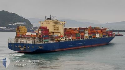
CMA CGM AMAZON
Cargo A
Current Trip
DJJIB
| Time Travelled | 1 h, 17 mins |
|---|---|
| Remaining Time | --- |
| Distance Travelled | --- |
| Remaining Distance | --- |
| AVG Speed | --- |
| MAX Speed | --- |
| AVG Wind | --- |
| MAX Wind | --- |
| MIN Temp | --- |
| MAX Temp | --- |
| Tirant d eau | 14.5 m |
| Position reçue | 3 d depuis |
Current Position
| Longitude | --- |
|---|---|
| Latitude | --- |
| Etat | Under way using engine |
| Vitesse | 0.4 Noeuds |
| Parcours | 288° |
| Zone | Red Sea |
| Station | T-AIS |
| Position reçue | 3 d depuis |
Info
Information
The current position of CMA CGM AMAZON is in Red Sea with coordinates 21.55655° / 38.69442° as reported on 2026-01-07 05:59 by AIS to our vessel tracker app. The vessel's current speed is 0.4 Noeuds
The vessel CMA CGM AMAZON (IMO: 9706308, MMSI: 215499000) is a Cargo A It's sailing under the flag of [MT] Malta.
In this page you can find informations about the vessels current position, last detected port calls, and current voyage information. If the vessels is not in coverage by AIS you will find the latest position.
The current position of CMA CGM AMAZON is detected by our AIS receivers and we are not responsible for the reliability of the data. The last position was recorded while the vessel was in Coverage by the Ais receivers of our vessel tracking app.
The current draught of CMA CGM AMAZON as reported by AIS is 14.5 meters
Weather
| Temperature | 24.6°C / 76.28°F |
|---|---|
| Wind Speed | 11 knots |
| Direction | 110° ESE |
| Pressure | 1017 hPa |
| Humidity | 63 % |
| Cloud Coverage | 5 % |
Featured Company
Last Port Calls
| Port | Arrival | Departure | Time In Port |
|---|---|---|---|
| 2026-01-09 14:46 | 2026-01-10 21:04 | 1 d | |
| 2026-01-06 16:41 | 2026-01-07 02:24 | 9 h | |
| 2026-01-04 14:26 | 2026-01-05 06:56 | 16 h | |
| 2025-12-31 21:06 | 2026-01-03 19:43 | 2 d | |
| 2025-12-28 17:05 | 2025-12-30 13:26 | 1 d | |
| 2025-12-24 22:52 | 2025-12-26 10:12 | 1 d | |
| 2025-12-15 06:06 | 2025-12-16 02:39 | 20 h | |
| 2025-12-08 06:37 | 2025-12-08 19:29 | 12 h | |
| 2025-12-05 23:53 | 2025-12-06 12:19 | 12 h | |
| 2025-11-28 04:05 | 2025-11-29 07:13 | 1 d |
Last Trips
| Origin | Departure | Destination | Arrival | Distance | |
|---|---|---|---|---|---|
| 2026-01-07 02:24 | 2026-01-09 14:46 | 701.77 nm | |||
| 2026-01-05 06:56 | 2026-01-06 16:41 | 569.05 nm | |||
| 2026-01-03 19:43 | 2026-01-04 14:26 | 297.33 nm | |||
| 2025-12-30 13:26 | 2025-12-31 21:06 | 617.05 nm | |||
| 2025-12-26 10:12 | 2025-12-28 17:05 | 663.76 nm | |||
| 2025-12-16 02:39 | 2025-12-24 22:52 | 3815.95 nm | |||
| 2025-12-08 19:29 | 2025-12-15 06:06 | 1500.55 nm | |||
| 2025-12-06 12:19 | 2025-12-08 06:37 | 205.53 nm | |||
| 2025-11-29 07:13 | 2025-12-05 23:53 | 1453.19 nm | |||
| 2025-11-18 13:48 | 2025-11-28 04:05 | 2648.58 nm |
Events
| Heure | Evenement | Détails | Position/ Destination | Info |
|---|---|---|---|---|
| 2026-01-10 18:04 | PORT DE DEPART |
|
11.61508 / 43.08909
DJJIB
|
Vitesse: 6.4 kn Parcours: 310° |
| 2026-01-10 17:57 | Démarrage |
11.60827 / 43.09801
[DJ] DJIBOUTI
|
Vitesse: 4 kn Parcours: 310° |
|
| 2026-01-09 11:51 | Arret |
11.59901 / 43.10574
[DJ] DJIBOUTI
|
Vitesse: Parcours: 126° |
|
| 2026-01-09 11:46 | Port d'arrivée |
|
11.59901 / 43.10579
[DJ] DJIBOUTI
|
Vitesse: 0.6 kn Parcours: 130° |
| 2026-01-07 07:57 | Démarrage |
21.56985 / 38.67983
DJJIB
|
Vitesse: 3.4 kn Parcours: 259° |
|
| 2026-01-07 06:05 | Etat Changé | Default Under way using engine |
21.55714 / 38.69397
DJJIB
|
Vitesse: 0.4 kn Parcours: 288° |
| 2026-01-07 05:59 | Hors de la zone couverte |
21.55655 / 38.69442
Red Sea
|
Vitesse: 0.4 kn Parcours: 331.9° |
|
| 2026-01-07 05:56 | Changement de zone | Saudi Arabian part of the Red Sea Malaysian part of the Malacca Strait |
21.55635 / 38.69456
Red Sea
|
Vitesse: 0.4 kn Parcours: 331.3° |
| 2026-01-07 05:54 | Etat Changé | Under way using engine Default |
21.55616 / 38.69470
DJJIB
|
Vitesse: 0.3 kn Parcours: 281° |
| 2026-01-07 05:52 | Dans la zone couverte |
21.55635 / 38.69456
Red Sea
|
Vitesse: 0.4 kn Parcours: 331.3° |