
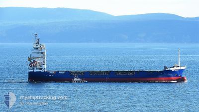
CHRISTINA 1
Container Ship
Current Trip
| Time Travelled | 2 days |
|---|---|
| Remaining Time | --- |
| Distance Travelled | 197.66 nm |
| Remaining Distance | --- |
| AVG Speed | 9.6 Noeuds |
| MAX Speed | 12.2 Noeuds |
| AVG Wind | 9.7 knots |
| MAX Wind | 17.8 knots |
| MIN Temp | 5.8°C / 42.44°F |
| MAX Temp | 10.2°C / 50.36°F |
| Tirant d eau | 7.2 m |
| Position reçue | 2 m depuis |
Current Position
| Longitude | --- |
|---|---|
| Latitude | --- |
| Etat | At anchor |
| Vitesse | |
| Parcours | 66° |
| Zone | Sea of Marmara |
| Station | T-AIS |
| Position reçue | 2 m depuis |
Info
Information
The current position of CHRISTINA 1 is in Sea of Marmara with coordinates 40.96574° / 28.89652° as reported on 2025-02-17 05:14 by AIS to our vessel tracker app. The vessel's current speed is 0 Noeuds and is heading at the port of DAMIETTA. The estimated time of arrival as calculated by MyShipTracking vessel tracking app is 2025-02-20 05:00 LT
The vessel CHRISTINA 1 (IMO: 9061253, MMSI: 352898693) is a Container Ship that was built in 1993 ( 32 Age ). It's sailing under the flag of [PA] Panama.
In this page you can find informations about the vessels current position, last detected port calls, and current voyage information. If the vessels is not in coverage by AIS you will find the latest position.
The current position of CHRISTINA 1 is detected by our AIS receivers and we are not responsible for the reliability of the data. The last position was recorded while the vessel was in Coverage by the Ais receivers of our vessel tracking app.
The current draught of CHRISTINA 1 as reported by AIS is 7.2 meters
Weather
| Temperature | 5.1°C / 41.18°F |
|---|---|
| Wind Speed | 14 knots |
| Direction | 45° NE |
| Pressure | 1015.5 hPa |
| Humidity | 90 % |
| Cloud Coverage | 100 % |
Featured Company
Events
| Heure | Evenement | Détails | Position/ Destination | Info |
|---|---|---|---|---|
| 2025-02-15 22:05 | Etat Changé | At anchor Under way using engine |
40.96612 / 28.89731
EG DAM
|
Vitesse: 0.2 kn Parcours: 78° |
| 2025-02-15 21:56 | Arret | 0.81 nm, South of ZEYTINBURNU |
40.96601 / 28.89711
EG DAM
|
Vitesse: 0.3 kn Parcours: 47° |
| 2025-02-15 19:17 | Changement de zone | Turkish part of the Sea of Marmara Turkish part of the Black Sea |
41.23218 / 29.12929
Sea of Marmara
EG DAM
|
Vitesse: 7.8 kn Parcours: 188.5° |
| 2025-02-15 17:44 | Changement d'ETA | 2025/02/20 05:00 2025/02/21 12:00 |
41.49063 / 29.11166
EG DAM
|
Vitesse: 10.5 kn Parcours: 164.3° |
| 2025-02-15 17:41 | Changement de zone | Turkish part of the Black Sea Romanian part of the Black Sea |
41.49708 / 29.10907
Black Sea
EG DAM
|
Vitesse: 10.4 kn Parcours: 160.7° |
| 2025-02-15 17:40 | Etat Changé | Under way using engine Default |
41.49844 / 29.10840
EG DAM
|
Vitesse: 10.2 kn Parcours: 146° |
| 2025-02-15 17:40 | Dans la zone couverte |
41.49708 / 29.10907
Black Sea
EG DAM
|
Vitesse: 10.4 kn Parcours: 160.7° |
|
| 2025-02-15 00:17 | Etat Changé | Default Under way using engine |
44.01204 / 28.77260
EG DAM
|
Vitesse: 10.2 kn Parcours: 140.9° |
| 2025-02-15 00:10 | Etat Changé | Under way using engine Default |
44.02706 / 28.75589
EG DAM
|
Vitesse: 10.2 kn Parcours: 141° |
| 2025-02-15 00:10 | Hors de la zone couverte |
44.02706 / 28.75589
Black Sea
EG DAM
|
Vitesse: 10.2 kn Parcours: 140.9° |