
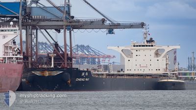
CHENG MAY
Cargo
Current Trip
PORT ACU
| Time Travelled | 52 days |
|---|---|
| Remaining Time | --- |
| Distance Travelled | 12318.07 nm |
| Remaining Distance | --- |
| AVG Speed | 11.5 Noeuds |
| MAX Speed | 14.6 Noeuds |
| AVG Wind | 13.2 knots |
| MAX Wind | 31 knots |
| MIN Temp | 17.9°C / 64.22°F |
| MAX Temp | 29.5°C / 85.1°F |
| Tirant d eau | 9.6 m |
| Position reçue | 23 d depuis |
Current Position
| Longitude | --- |
|---|---|
| Latitude | --- |
| Etat | Under way using engine |
| Vitesse | 12.4 Noeuds |
| Parcours | 281.4° |
| Zone | South Atlantic Ocean |
| Station | T-AIS |
| Position reçue | 23 d depuis |
Info
Information
The current position of CHENG MAY is in South Atlantic Ocean with coordinates -34.60474° / 17.93219° as reported on 2025-01-26 00:52 by AIS to our vessel tracker app. The vessel's current speed is 12.4 Noeuds
The vessel CHENG MAY (IMO: 9751028, MMSI: 636016581) is a Cargo It's sailing under the flag of [LR] Liberia.
In this page you can find informations about the vessels current position, last detected port calls, and current voyage information. If the vessels is not in coverage by AIS you will find the latest position.
The current position of CHENG MAY is detected by our AIS receivers and we are not responsible for the reliability of the data. The last position was recorded while the vessel was in Coverage by the Ais receivers of our vessel tracking app.
The current draught of CHENG MAY as reported by AIS is 9.6 meters
Weather
| Temperature | 22.8°C / 73.04°F |
|---|---|
| Wind Speed | 12 knots |
| Direction | 305° NW |
| Pressure | 1015.2 hPa |
| Humidity | 86.9 % |
| Cloud Coverage | 5 % |
Featured Company
Events
| Heure | Evenement | Détails | Position/ Destination | Info |
|---|---|---|---|---|
| 2025-02-10 09:57 | Démarrage | 3.81 nm, North East of PORTO DO ACU |
-21.79557 / -40.98299
PORT ACU
|
Vitesse: 3.6 kn Parcours: 78° |
| 2025-02-08 12:12 | Arret | 3.12 nm, North East of PORTO DO ACU |
-21.80856 / -40.98277
PORT ACU
|
Vitesse: Parcours: 345° |
| 2025-02-08 11:06 | Démarrage | 6.2 nm, North East of PORTO DO ACU |
-21.77141 / -40.94352
PORT ACU
|
Vitesse: 5.2 kn Parcours: 267° |