
CHAYANEE NAREE
Cargo
Current Trip
| Time Travelled | 9 days |
|---|---|
| Remaining Time | 41 days |
| Distance Travelled | 2197.91 nm |
| Remaining Distance | 10873.05 nm |
| AVG Speed | 10.3 Noeuds |
| MAX Speed | 12 Noeuds |
| AVG Wind | 14.4 knots |
| MAX Wind | 24.9 knots |
| MIN Temp | 22°C / 71.6°F |
| MAX Temp | 28.7°C / 83.66°F |
| Tirant d eau | 13 m |
| Position reçue | 13 h, 32 m depuis |
Current Position
| Longitude | -60.64862° |
|---|---|
| Latitude | 14.11380° |
| Etat | Under way using engine |
| Vitesse | 9.8 Noeuds |
| Parcours | 118° |
| Zone | Caribbean Sea |
| Station | T-AIS |
| Position reçue | 13 h, 32 m depuis |
Info
Information
The current position of CHAYANEE NAREE is in Caribbean Sea with coordinates 14.11380° / -60.64862° as reported on 2024-05-05 00:53 by AIS to our vessel tracker app. The vessel's current speed is 9.8 Noeuds and is heading at the port of SINGAPORE. The estimated time of arrival as calculated by MyShipTracking vessel tracking app is 2024-06-16 11:54 LT
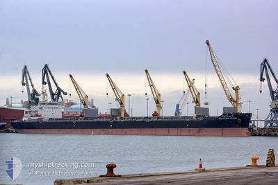
The vessel CHAYANEE NAREE (MMSI: 566708000) is a Cargo It's sailing under the flag of [SG] Singapore.
In this page you can find informations about the vessels current position, last detected port calls, and current voyage information. If the vessels is not in coverage by AIS you will find the latest position.
The current position of CHAYANEE NAREE is detected by our AIS receivers and we are not responsible for the reliability of the data. The last position was recorded while the vessel was in Coverage by the Ais receivers of our vessel tracking app.
The current draught of CHAYANEE NAREE as reported by AIS is 13 meters
Weather
| Temperature | 28.3°C / 82.94°F |
|---|---|
| Wind Speed | 14 knots |
| Direction | 99° E |
| Pressure | 1014.1 hPa |
| Humidity | 81.2 % |
| Cloud Coverage | 36 % |
Featured Company
Last Port Calls
| Port | Arrival | Departure | Time In Port |
|---|---|---|---|
| 2024-04-22 05:42 | 2024-04-25 23:06 | 3 d | |
| 2024-04-17 06:52 | 2024-04-18 00:25 | 17 h | |
| 2024-04-12 23:22 | 2024-04-15 21:56 | 2 d | |
| 2024-03-03 01:53 |
Most Visited Ports (Last year)
| Port | Arrivals | |
|---|---|---|
| 1 | ||
| 1 | ||
| 1 | ||
| 1 | ||
| 1 | ||
| 1 |
Last Trips
| Origin | Departure | Destination | Arrival | Distance | |
|---|---|---|---|---|---|
| 2024-04-17 19:25 | 2024-04-22 00:42 | 695.31 nm | |||
| 2024-04-15 16:56 | 2024-04-17 01:52 | 258.49 nm | |||
| 2024-02-28 12:33 | 2024-03-03 10:53 | 323.68 nm |
Events
| Heure | Evenement | Détails | Position/ Destination | Info |
|---|---|---|---|---|
| 2024-05-05 00:58 | Etat Changé | Default Under way using engine |
14.10758 / -60.63552
SGSIN
|
Vitesse: 9.8 kn Parcours: 118° |
| 2024-05-05 00:53 | Hors de la zone couverte |
14.11380 / -60.64862
Caribbean Sea
|
Vitesse: 9.8 kn Parcours: 118° |
|
| 2024-05-04 22:40 | Changement de zone | Saint Lucia part of the Caribbean Sea Guadeloupe and Martinique part of the Caribbean Sea |
14.26795 / -60.99697
Caribbean Sea
|
Vitesse: 10.4 kn Parcours: 128.4° |
| 2024-05-04 22:35 | Changement d'ETA | 2024/06/14 22:00 |
14.27780 / -61.01049
SGSIN
|
Vitesse: 10.6 kn Parcours: 120.6° |
| 2024-05-04 18:11 | Tirant d'eau modifié | 13 13.2 |
14.69390 / -61.68578
SGSIN
|
Vitesse: 11.3 kn Parcours: 126.1° |
| 2024-05-04 18:11 | Changement d'ETA | 2024/06/14 22:00 2024/06/10 03:00 |
14.69390 / -61.68578
SGSIN
|
Vitesse: 11.3 kn Parcours: 126.1° |
| 2024-05-04 18:01 | Changement de zone | Guadeloupe and Martinique part of the Caribbean Sea Bahamas part of the North Atlantic Ocean |
14.71090 / -61.71083
Caribbean Sea
|
Vitesse: 11.3 kn Parcours: 124.5° |
| 2024-05-04 18:01 | Etat Changé | Under way using engine Default |
14.71147 / -61.71167
SGSIN
|
Vitesse: 11.3 kn Parcours: 125° |
| 2024-05-04 17:58 | Dans la zone couverte |
14.71090 / -61.71083
Caribbean Sea
|
Vitesse: 11.3 kn Parcours: 124.5° |
|
| 2024-04-30 15:47 | Hors de la zone couverte |
20.66557 / -73.53615
North Atlantic Ocean
|
Vitesse: 10.5 kn Parcours: 95° |