

CHASSEUR
Not available

Current Trip
| Trip Time | 7 days |
|---|---|
| Trip Distance | 152.04 nm |
| AVG Speed | 11.1 Noeuds |
| MAX Speed | 13.5 Noeuds |
| Tirant d eau | 0 m |
| AVG Wind | 12.1 knots |
| MAX Wind | 16 knots |
| MIN Temp | 24.6°C / 76.28°F |
| MAX Temp | 26.9°C / 80.42°F |
| Position reçue | 2 m depuis |
Current Position
| Longitude | --- |
|---|---|
| Latitude | --- |
| Etat | Moored |
| Vitesse | |
| Parcours | --- |
| Zone | Caribbean Sea |
| Station | T-AIS |
| Position reçue | 2 m depuis |
Information
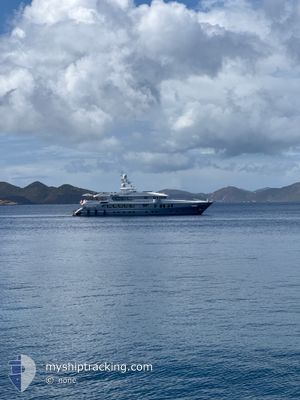
The current position of CHASSEUR is in Caribbean Sea with coordinates 18.03979° / -63.09616° as reported on 2025-03-27 17:53 by AIS to our vessel tracker app. The vessel's current speed is 0 Noeuds and is currently inside the port of ST MAARTEN.
The vessel CHASSEUR (IMO: 9707948, MMSI: 369125000) is a Not available It's sailing under the flag of [US] USA.
In this page you can find informations about the vessels current position, last detected port calls, and current voyage information. If the vessels is not in coverage by AIS you will find the latest position.
The current position of CHASSEUR is detected by our AIS receivers and we are not responsible for the reliability of the data. The last position was recorded while the vessel was in Coverage by the Ais receivers of our vessel tracking app.
Weather
| Temperature | 26.4°C / 79.52°F |
|---|---|
| Wind Speed | 16 knots |
| Direction | 115° ESE |
| Pressure | 1017 hPa |
| Humidity | 74.5 % |
| Cloud Coverage | 42 % |


Featured Company
Last Port Calls
| Port | Arrival | Departure | Time In Port |
|---|---|---|---|
| 2025-03-23 09:43 | |||
| 2025-03-11 08:11 | 2025-03-15 12:38 | 4 d | |
| 2025-03-07 07:58 | 2025-03-10 16:00 | 3 d | |
| 2025-02-26 08:58 | 2025-02-28 12:47 | 2 d | |
| 2025-02-11 16:52 | 2025-02-21 15:38 | 9 d | |
| 2025-01-28 11:39 | 2025-02-11 08:37 | 13 d | |
| 2025-01-15 17:10 | 2025-01-24 13:24 | 8 d | |
| 2025-01-11 07:52 | 2025-01-15 07:50 | 3 d | |
| 2025-01-04 16:57 |
Most Visited Ports (Last year)
| Port | Arrivals | |
|---|---|---|
| 7 | ||
| 7 | ||
| 3 | ||
| 3 | ||
| 2 | ||
| 2 |
Last Trips
| Origin | Departure | Destination | Arrival | Distance | |
|---|---|---|---|---|---|
| 2025-03-15 12:38 | 2025-03-23 09:43 | 152.04 nm | |||
| 2025-03-10 16:00 | 2025-03-11 08:11 | 198.53 nm | |||
| 2025-02-28 12:47 | 2025-03-07 07:58 | 122.21 nm | |||
| 2025-02-21 15:38 | 2025-02-26 08:58 | 91.32 nm | |||
| 2025-02-11 08:37 | 2025-02-11 16:52 | 106.93 nm | |||
| 2025-01-24 13:24 | 2025-01-28 11:39 | 36.34 nm | |||
| 2025-01-15 07:50 | 2025-01-15 17:10 | 106.55 nm | |||
| 2025-01-04 16:57 | 2025-01-11 07:52 | 103.95 nm |
Events
| Heure | Evenement | Détails | Position/ Destination | Info |
|---|---|---|---|---|
| 2025-03-23 13:55 | Etat Changé | Moored Under way using engine |
18.03971 / -63.09609
[SX] ST MAARTEN
|
Vitesse: Parcours: 511° |
| 2025-03-23 13:43 | Arret |
18.03992 / -63.09493
[SX] ST MAARTEN
|
Vitesse: 0.3 kn Parcours: 511° |
|
| 2025-03-23 13:43 | Port d'arrivée |
|
18.03992 / -63.09493
[SX] ST MAARTEN
|
Vitesse: 0.8 kn Parcours: 511° |
| 2025-03-23 13:32 | Démarrage | 0.37 nm, South West of ST MAARTEN |
18.03422 / -63.09759
ST MARTIN
|
Vitesse: 3.9 kn Parcours: 65.2° |
| 2025-03-23 13:23 | Arret | 0.46 nm, South West of ST MAARTEN |
18.03403 / -63.09950
ST MARTIN
|
Vitesse: 0.2 kn Parcours: 511° |
| 2025-03-23 13:08 | Changement de destination | ST MARTIN ANGUILLA |
18.02984 / -63.11308
ST MARTIN
|
Vitesse: 11.5 kn Parcours: 81.7° |
| 2025-03-23 13:08 | Changement d'ETA | 2025/03/23 14:00 |
18.02984 / -63.11308
ST MARTIN
|
Vitesse: 11.5 kn Parcours: 81.7° |
| 2025-03-23 12:53 | Changement de zone | Sint-Maarten part of the Caribbean Sea Saint-Martin part of the Caribbean Sea |
18.04711 / -63.15292
Caribbean Sea
|
Vitesse: 12.2 kn Parcours: 109.8° |
| 2025-03-23 12:31 | Changement de zone | Saint-Martin part of the Caribbean Sea Anguilla part of the Caribbean Sea |
18.11555 / -63.14908
Caribbean Sea
|
Vitesse: 13.1 kn Parcours: 203.3° |
| 2025-03-23 12:12 | Démarrage | 0.94 nm, West of ANGUILLA |
18.17034 / -63.10960
ANGUILLA
|
Vitesse: 7 kn Parcours: 224.9° |