
CHARISMA
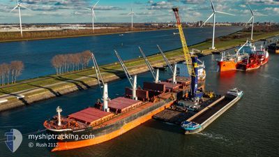
Bulk Carrier
Current Trip
| Time Travelled | 3 days |
|---|---|
| Remaining Time | --- |
| Distance Travelled | 871.05 nm |
| Remaining Distance | --- |
| AVG Speed | 9.2 Noeuds |
| MAX Speed | 15.3 Noeuds |
| AVG Wind | 4.9 knots |
| MAX Wind | 14.3 knots |
| MIN Temp | 8.5°C / 47.3°F |
| MAX Temp | 15.3°C / 59.54°F |
| Tirant d eau | 8.9 m |
| Position reçue | 1 h, 49 m depuis |
Current Position
| Longitude | -10.10438° |
|---|---|
| Latitude | 43.21275° |
| Etat | Under way using engine |
| Vitesse | 13.8 Noeuds |
| Parcours | 179° |
| Zone | North Atlantic Ocean |
| Station | T-AIS |
| Position reçue | 1 h, 49 m depuis |
Info
Information
The current position of CHARISMA is in North Atlantic Ocean with coordinates 43.21275° / -10.10438° as reported on 2024-05-11 22:59 by AIS to our vessel tracker app. The vessel's current speed is 13.8 Noeuds and is heading at the port of NEMRUT. The estimated time of arrival as calculated by MyShipTracking vessel tracking app is 2024-05-19 06:00 LT
The vessel CHARISMA (IMO: 9409132, MMSI: 538007730) is a Bulk Carrier that was built in 2010 ( 14 Age ). It's sailing under the flag of [MH] Marshall Is.
In this page you can find informations about the vessels current position, last detected port calls, and current voyage information. If the vessels is not in coverage by AIS you will find the latest position.
The current position of CHARISMA is detected by our AIS receivers and we are not responsible for the reliability of the data. The last position was recorded while the vessel was in Coverage by the Ais receivers of our vessel tracking app.
The current draught of CHARISMA as reported by AIS is 8.9 meters
Weather
| Temperature | 14.9°C / 58.82°F |
|---|---|
| Wind Speed | 8 knots |
| Direction | 327° NNW |
| Pressure | 1020.2 hPa |
| Humidity | 88.2 % |
| Cloud Coverage | 92 % |
Featured Company
Last Trips
| Origin | Departure | Destination | Arrival | Distance | |
|---|---|---|---|---|---|
| 2024-05-06 00:15 | 2024-05-06 01:14 | 6.00 nm | |||
| 2024-04-29 17:38 | 2024-05-04 09:51 | 950.34 nm | |||
| 2024-04-06 03:41 | 2024-04-18 20:49 | 2580.98 nm | |||
| 2024-03-23 10:28 | 2024-03-29 15:41 | 229.88 nm | |||
| 2024-02-23 19:27 | 2024-03-19 12:35 | 5589.61 nm |
Events
| Heure | Evenement | Détails | Position/ Destination | Info |
|---|---|---|---|---|
| 2024-05-11 23:03 | Etat Changé | Default Under way using engine |
43.19423 / -10.10445
NEMRUT
|
Vitesse: 13.8 kn Parcours: 179° |
| 2024-05-11 22:59 | Hors de la zone couverte |
43.21275 / -10.10438
North Atlantic Ocean
NEMRUT
|
Vitesse: 13.8 kn Parcours: 179° |
|
| 2024-05-11 22:58 | Etat Changé | Under way using engine Default |
43.21413 / -10.10442
NEMRUT
|
Vitesse: 13.8 kn Parcours: 180° |
| 2024-05-11 22:58 | Dans la zone couverte |
43.21413 / -10.10442
North Atlantic Ocean
NEMRUT
|
Vitesse: 13.8 kn Parcours: 179° |
|
| 2024-05-11 21:43 | Etat Changé | Default Under way using engine |
43.47660 / -9.99525
NEMRUT
|
Vitesse: 13.2 kn Parcours: 189° |
| 2024-05-11 21:35 | Hors de la zone couverte |
43.50292 / -9.98683
North Atlantic Ocean
NEMRUT
|
Vitesse: 13.2 kn Parcours: 189° |
|
| 2024-05-11 21:21 | Changement d'ETA | 2024/05/19 06:00 2024/05/19 07:00 |
43.55385 / -9.98350
NEMRUT
|
Vitesse: 13 kn Parcours: 177° |
| 2024-05-11 21:19 | Etat Changé | Under way using engine Default |
43.56352 / -9.98407
NEMRUT
|
Vitesse: 12.5 kn Parcours: 176° |
| 2024-05-11 21:19 | Dans la zone couverte |
43.56110 / -9.98393
North Atlantic Ocean
NEMRUT
|
Vitesse: 13 kn Parcours: 177° |
|
| 2024-05-11 18:16 | Hors de la zone couverte |
44.15188 / -9.56960
North Atlantic Ocean
NEMRUT
|
Vitesse: 13.3 kn Parcours: 208° |