

CHANG HANG RUN HAI
Cargo

Current Trip
| Time Travelled | 4 days |
|---|---|
| Remaining Time | --- |
| Distance Travelled | 1047.93 nm |
| Remaining Distance | --- |
| AVG Speed | 11.9 Noeuds |
| MAX Speed | 13.7 Noeuds |
| AVG Wind | 7.4 knots |
| MAX Wind | 20.7 knots |
| MIN Temp | 14.5°C / 58.1°F |
| MAX Temp | 25.4°C / 77.72°F |
| Tirant d eau | 9.1 m |
| Position reçue | 1 d depuis |
Current Position
| Longitude | --- |
|---|---|
| Latitude | --- |
| Etat | Under way using engine |
| Vitesse | 12.3 Noeuds |
| Parcours | 123.7° |
| Zone | Gulf of Oman |
| Station | T-AIS |
| Position reçue | 1 d depuis |
Information
The current position of CHANG HANG RUN HAI is in Gulf of Oman with coordinates 24.84884° / 57.28381° as reported on 2025-03-06 04:25 by AIS to our vessel tracker app. The vessel's current speed is 12.3 Noeuds and is heading at the port of DAR ES SALAAM. The estimated time of arrival as calculated by MyShipTracking vessel tracking app is 2025-03-16 15:00 LT
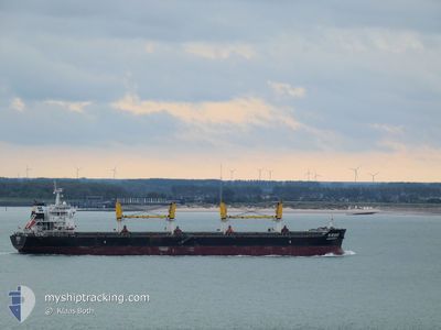
The vessel CHANG HANG RUN HAI (IMO: 9628726, MMSI: 414065000) is a Cargo It's sailing under the flag of [CN] China.
In this page you can find informations about the vessels current position, last detected port calls, and current voyage information. If the vessels is not in coverage by AIS you will find the latest position.
The current position of CHANG HANG RUN HAI is detected by our AIS receivers and we are not responsible for the reliability of the data. The last position was recorded while the vessel was in Coverage by the Ais receivers of our vessel tracking app.
The current draught of CHANG HANG RUN HAI as reported by AIS is 9.1 meters
Weather
| Temperature | 25.3°C / 77.54°F |
|---|---|
| Wind Speed | 5 knots |
| Direction | 59° ENE |
| Pressure | 1013.5 hPa |
| Humidity | 59.6 % |
| Cloud Coverage | 2 % |


Featured Company
Last Port Calls
| Port | Arrival | Departure | Time In Port |
|---|---|---|---|
| 2025-02-27 03:27 | 2025-03-03 11:16 | 4 d | |
| 2025-02-16 15:41 | 2025-02-23 19:23 | 7 d | |
| 2025-02-10 05:41 | 2025-02-14 23:51 | 4 d | |
| 2025-01-06 16:53 | 2025-01-13 11:17 | 6 d |
Most Visited Ports (Last year)
| Port | Arrivals | |
|---|---|---|
| 2 | ||
| 1 | ||
| 1 | ||
| 1 | ||
| 1 | ||
| 1 |
Last Trips
| Origin | Departure | Destination | Arrival | Distance | |
|---|---|---|---|---|---|
| 2025-02-23 19:23 | 2025-02-27 03:27 | 607.34 nm | |||
| 2025-02-14 23:51 | 2025-02-16 15:41 | 464.06 nm | |||
| 2025-01-13 11:17 | 2025-02-10 05:41 | 6415.94 nm | |||
| 2024-12-31 20:45 | 2025-01-06 16:53 | 525.81 nm |
Events
| Heure | Evenement | Détails | Position/ Destination | Info |
|---|---|---|---|---|
| 2025-03-06 04:33 | Etat Changé | Default Under way using engine |
24.83355 / 57.30909
DAR ES SALAAM
|
Vitesse: 12.3 kn Parcours: 123.7° |
| 2025-03-06 04:25 | Hors de la zone couverte |
24.84884 / 57.28381
Gulf of Oman
DAR ES SALAAM
|
Vitesse: 12.3 kn Parcours: 123.7° |
|
| 2025-03-06 04:03 | Etat Changé | Under way using engine Default |
24.89181 / 57.21380
DAR ES SALAAM
|
Vitesse: 12.1 kn Parcours: 126° |
| 2025-03-06 03:52 | Etat Changé | Default Under way using engine |
24.91352 / 57.18128
DAR ES SALAAM
|
Vitesse: 12.2 kn Parcours: 122.8° |
| 2025-03-06 03:43 | Etat Changé | Under way using engine Default |
24.92958 / 57.15407
DAR ES SALAAM
|
Vitesse: 12.4 kn Parcours: 125° |
| 2025-03-06 03:39 | Etat Changé | Default Under way using engine |
24.93645 / 57.14241
DAR ES SALAAM
|
Vitesse: 12.4 kn Parcours: 124.5° |
| 2025-03-06 02:34 | Changement de zone | Omani part of the Gulf of Oman United Arab Emirates part of the Gulf of Oman |
25.06840 / 56.93623
Gulf of Oman
DAR ES SALAAM
|
Vitesse: 12.8 kn Parcours: 124.4° |
| 2025-03-06 00:49 | Changement d'ETA | 2025/03/16 12:00 2025/03/15 16:00 |
25.23821 / 56.58756
DAR ES SALAAM
|
Vitesse: 8.2 kn Parcours: 115.8° |
| 2025-03-06 00:28 | Tirant d'eau modifié | 9.1 9 |
25.25297 / 56.55436
DAR ES SALAAM
|
Vitesse: 3.2 kn Parcours: 114° |
| 2025-03-06 00:27 | Démarrage | 12.05 nm, North East of FUJAIRAH |
25.25324 / 56.55376
DAR ES SALAAM
|
Vitesse: 3.1 kn Parcours: 113° |