
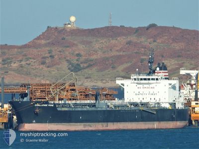
CHALLENGE PRIME
Tanker
Current Trip
| Time Travelled | 13 days |
|---|---|
| Remaining Time | --- |
| Distance Travelled | 3869.66 nm |
| Remaining Distance | --- |
| AVG Speed | 12.3 Noeuds |
| MAX Speed | 15.8 Noeuds |
| AVG Wind | 12.8 knots |
| MAX Wind | 26.3 knots |
| MIN Temp | 13.3°C / 55.94°F |
| MAX Temp | 30.4°C / 86.72°F |
| Tirant d eau | 12 m |
| Position reçue | 2 m depuis |
Current Position
| Longitude | 138.23640° |
|---|---|
| Latitude | -34.82744° |
| Etat | At anchor |
| Vitesse | |
| Parcours | 82° |
| Zone | Great Australian Bight |
| Station | T-AIS |
| Position reçue | 2 m depuis |
Info
Information
The current position of CHALLENGE PRIME is in Great Australian Bight with coordinates -34.82744° / 138.23640° as reported on 2024-05-07 10:02 by AIS to our vessel tracker app. The vessel's current speed is 0 Noeuds
The vessel CHALLENGE PRIME (IMO: 9793272, MMSI: 563026300) is a Tanker It's sailing under the flag of [SG] Singapore.
In this page you can find informations about the vessels current position, last detected port calls, and current voyage information. If the vessels is not in coverage by AIS you will find the latest position.
The current position of CHALLENGE PRIME is detected by our AIS receivers and we are not responsible for the reliability of the data. The last position was recorded while the vessel was in Coverage by the Ais receivers of our vessel tracking app.
The current draught of CHALLENGE PRIME as reported by AIS is 12 meters
Weather
| Temperature | 18.4°C / 65.12°F |
|---|---|
| Wind Speed | 13 knots |
| Direction | 124° SE |
| Pressure | 1027.9 hPa |
| Humidity | 62.3 % |
| Cloud Coverage | --- |
Featured Company
Last Port Calls
| Port | Arrival | Departure | Time In Port |
|---|---|---|---|
| 2024-04-22 03:00 | 2024-04-24 05:03 | 2 d | |
| 2024-04-20 03:49 | 2024-04-21 08:58 | 1 d | |
| 2024-03-28 11:44 | 2024-03-29 19:35 | 1 d | |
| 2024-03-18 21:53 | |||
| 2024-03-01 21:45 | 2024-03-05 15:24 | 3 d |
Last Trips
| Origin | Departure | Destination | Arrival | Distance | |
|---|---|---|---|---|---|
| 2024-04-21 16:58 | 2024-04-22 11:00 | 13.61 nm | |||
| 2024-03-30 07:35 | 2024-04-20 11:49 | 5085.12 nm | |||
| 2024-03-19 08:53 | 2024-03-28 23:44 | 1370.59 nm | |||
| 2024-02-12 06:15 | 2024-03-02 05:45 | 5637.40 nm |
Events
| Heure | Evenement | Détails | Position/ Destination | Info |
|---|---|---|---|---|
| 2024-05-07 05:44 | Etat Changé | At anchor Default |
-34.82507 / 138.23869
ADELAIDE
|
Vitesse: Parcours: -1° |
| 2024-05-07 05:42 | Etat Changé | Default At anchor |
-34.82500 / 138.23833
ADELAIDE
|
Vitesse: Parcours: 200° |
| 2024-05-06 17:26 | Etat Changé | At anchor Under way using engine |
-34.82772 / 138.23872
ADELAIDE
|
Vitesse: 0.6 kn Parcours: 9° |
| 2024-05-06 17:23 | Arret | 14.54 nm, West of ADELAIDE |
-34.82747 / 138.23892
ADELAIDE
|
Vitesse: 0.3 kn Parcours: 4° |
| 2024-05-06 14:37 | Tirant d'eau modifié | 12 12.1 |
-35.18676 / 138.03254
ADELAIDE
|
Vitesse: 12.5 kn Parcours: 43.2° |
| 2024-05-06 14:37 | Changement d'ETA | 2024/05/06 18:00 2024/05/06 21:00 |
-35.18676 / 138.03254
ADELAIDE
|
Vitesse: 12.5 kn Parcours: 43.2° |
| 2024-05-06 12:10 | Detecté en mer | Australian part of the Great Australian Bight |
-35.38271 / 137.48121
Great Australian Bight
ADELAIDE
|
Vitesse: 11.6 kn Parcours: 71.8° |
| 2024-05-06 12:08 | Etat Changé | Under way using engine Default |
-35.38522 / 137.47171
ADELAIDE
|
Vitesse: 11.6 kn Parcours: 72° |
| 2024-05-06 11:55 | Dans la zone couverte |
-35.38271 / 137.48121
Great Australian Bight
ADELAIDE
|
Vitesse: 11.6 kn Parcours: 71.8° |
|
| 2024-05-03 09:36 | Hors de la zone couverte |
-35.57817 / 118.52597
Indian Ocean
ADELAIDE
|
Vitesse: 12.9 kn Parcours: 86.2° |