
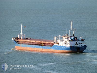
CELTIC NAVIGATOR
General Cargo
Current Trip
| Time Travelled | 7 h, 11 mins |
|---|---|
| Remaining Time | 1 day |
| Distance Travelled | 76.59 nm |
| Remaining Distance | 344.01 nm |
| AVG Speed | 11.1 Noeuds |
| MAX Speed | 11.8 Noeuds |
| AVG Wind | 11.2 knots |
| MAX Wind | 20.8 knots |
| MIN Temp | 10.3°C / 50.54°F |
| MAX Temp | 14.5°C / 58.1°F |
| Tirant d eau | 3.5 m |
| Position reçue | 1 m depuis |
Current Position
| Longitude | -1.42212° |
|---|---|
| Latitude | 55.59426° |
| Etat | Under way using engine |
| Vitesse | 11.1 Noeuds |
| Parcours | 144.5° |
| Zone | North Sea |
| Station | T-AIS |
| Position reçue | 1 m depuis |
Info
Information
The current position of CELTIC NAVIGATOR is in North Sea with coordinates 55.59426° / -1.42212° as reported on 2024-09-14 10:12 by AIS to our vessel tracker app. The vessel's current speed is 11.1 Noeuds and is heading at the port of TILBURY. The estimated time of arrival as calculated by MyShipTracking vessel tracking app is 2024-09-15 17:37 LT
The vessel CELTIC NAVIGATOR (IMO: 9256169, MMSI: 232020889) is a General Cargo that was built in 2003 ( 21 Age ). It's sailing under the flag of [GB] United Kingdom.
In this page you can find informations about the vessels current position, last detected port calls, and current voyage information. If the vessels is not in coverage by AIS you will find the latest position.
The current position of CELTIC NAVIGATOR is detected by our AIS receivers and we are not responsible for the reliability of the data. The last position was recorded while the vessel was in Coverage by the Ais receivers of our vessel tracking app.
The current draught of CELTIC NAVIGATOR as reported by AIS is 3.5 meters
Weather
| Temperature | 15.1°C / 59.18°F |
|---|---|
| Wind Speed | 17 knots |
| Direction | 225° SW |
| Pressure | 1023.2 hPa |
| Humidity | 80.8 % |
| Cloud Coverage | 97 % |
Featured Company
Last Port Calls
| Port | Arrival | Departure | Time In Port |
|---|---|---|---|
| 2024-09-11 20:30 | 2024-09-14 03:03 | 2 d | |
| 2024-09-02 15:48 | 2024-09-03 19:56 | 1 d | |
| 2024-08-30 06:21 | 2024-08-31 15:14 | 1 d | |
| 2024-08-22 20:52 | 2024-08-24 14:21 | 1 d | |
| 2024-08-18 17:47 | 2024-08-21 19:16 | 3 d | |
| 2024-08-08 02:22 | 2024-08-09 21:51 | 1 d | |
| 2024-08-06 14:21 | 2024-08-07 17:08 | 1 d | |
| 2024-07-28 13:32 | 2024-07-30 19:32 | 2 d | |
| 2024-07-26 19:55 | 2024-07-26 20:31 | 36 m | |
| 2024-07-25 20:23 | 2024-07-25 21:03 | 39 m |
Last Trips
| Origin | Departure | Destination | Arrival | Distance | |
|---|---|---|---|---|---|
| 2024-09-03 21:56 | 2024-09-11 21:30 | 1741.59 nm | |||
| 2024-08-31 16:14 | 2024-09-02 17:48 | 506.41 nm | |||
| 2024-08-24 15:21 | 2024-08-30 07:21 | 1284.97 nm | |||
| 2024-08-21 20:16 | 2024-08-22 21:52 | 261.62 nm | |||
| 2024-08-09 23:51 | 2024-08-18 18:47 | 2018.10 nm | |||
| 2024-08-07 19:08 | 2024-08-08 04:22 | 91.61 nm | |||
| 2024-07-30 20:32 | 2024-08-06 16:21 | 1619.18 nm | |||
| 2024-07-26 21:31 | 2024-07-28 14:32 | 341.14 nm | |||
| 2024-07-25 22:03 | 2024-07-26 20:55 | 0.44 nm | |||
| 2024-07-23 15:41 | 2024-07-25 21:23 | 484.57 nm |
Events
| Heure | Evenement | Détails | Position/ Destination | Info |
|---|---|---|---|---|
| 2024-09-14 07:06 | Dans la zone couverte |
55.97254 / -2.15169
North Sea
GBTIL
|
Vitesse: 10.4 kn Parcours: 120.9° |
|
| 2024-09-14 06:06 | Etat Changé | Default Under way using engine |
56.04975 / -2.45157
GBTIL
|
Vitesse: 10.9 kn Parcours: 113.6° |
| 2024-09-14 05:51 | Hors de la zone couverte |
56.06835 / -2.52244
North Sea
GBTIL
|
Vitesse: 10.9 kn Parcours: 113.6° |
|
| 2024-09-14 05:02 | Etat Changé | Under way using engine Default |
56.09787 / -2.78876
GBTIL
|
Vitesse: 11.3 kn Parcours: 69° |
| 2024-09-14 04:55 | Etat Changé | Default Under way using engine |
56.09207 / -2.82916
GBTIL
|
Vitesse: 11.6 kn Parcours: 69° |
| 2024-09-14 03:16 | Etat Changé | Under way using engine Moored |
56.00947 / -3.36550
GBTIL
|
Vitesse: 9.9 kn Parcours: 65.1° |
| 2024-09-14 03:03 | PORT DE DEPART |
|
56.01285 / -3.41710
GBTIL
|
Vitesse: 5.9 kn Parcours: 124° |
| 2024-09-14 02:57 | Etat Changé | Moored Default |
56.01855 / -3.43511
[GB] ROSYTH
|
Vitesse: 1.6 kn Parcours: 243° |
| 2024-09-14 02:57 | Démarrage |
56.01855 / -3.43511
[GB] ROSYTH
|
Vitesse: 5.9 kn Parcours: 124° |
|
| 2024-09-14 02:57 | Dans la zone couverte |
56.01855 / -3.43511
North Sea
[GB] ROSYTH
|
Vitesse: 5.9 kn Parcours: 128.8° |